Going to the Dogs
Dog Canyon, Texas, to Dog Canyon, New Mexico
February 5 - 11, 2026
Salt Basin Dunes
It's been just over eight years since I last set foot in Texas, haunted by my memory of Christmas Day, 2017, when I caught the toe of my boot on the camper steps in the parking lot at Guadalupe National Monument, spun around, smacked down on the pavement and broke my hip. I spent Christmas week in the hospital in Carlsbad, New Mexico. But west Texas is a good low elevation late winter destination, so we hatched a plan to return for a week of camping and hiking. My first priority was Dog Canyon on the west side of Guadalupe National Monument, since my accident meant we missed camping there in 2017. But while researching Dog Canyon, I ran across info about the Salt Basin Dunes, just west of the monument. Like White Sands, these dunes are composed of gypsum saturated by water from a nearby mountain range. When I learned it was possible to rough camp very close to the dunes, it was off to the races. Ken and Helena signed on, and I booked three nights at Dog Canyon.

A half hour east of sprawling El Paso, civilization skids to an abrupt halt. Habitations disappear, replaced by collages of abandoned RVs, junk cars and tumbledown sheds. The mountains are ancient seabeds, laid down in neat layers, and virtually devoid of vegetation. Even the few road signs are menacing: "No services for 120 miles," "Next passing zone 26 miles".

Then we turned north to Dell City, which shows up on Google Earth as a matrix of vivid green crop circles. It added to the "Twilight Zone" vibe when we noticed that our iPads gained or lost an hour depending on whether our truck was pointing south or north, even though the frontier between the Central and Mountain Time Zones is many miles to the east.

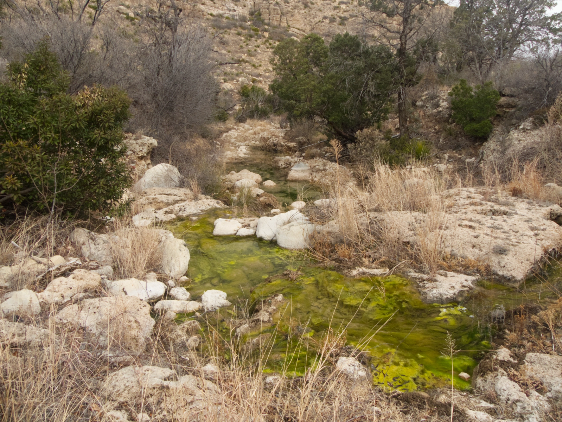
We met Ken and Helena at the Spanish Angels Café in Dell City and continued east toward the dunes, wandering down a two-rut track to a campsite near the edge of the basin. Salt Basin is a vast "dry" lake that is actually soaking wet, with curiously spongy soil. The gypsum is dazzling white, and quite striking against the sheer escarpment of the Guadalupe Mountains.
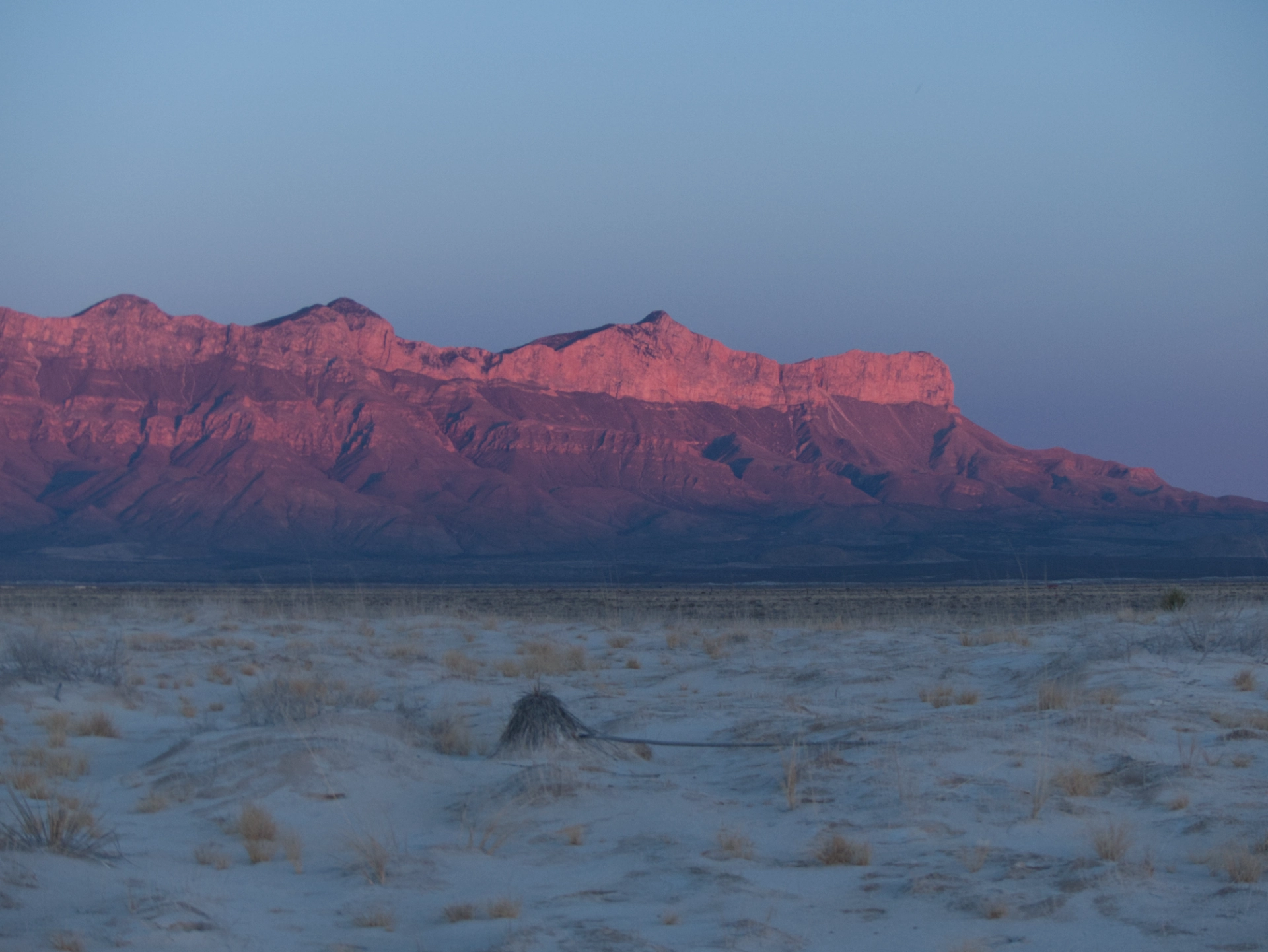
Rosy sunset over the Guadalupe Mountains.

Just one more. So spectacular!

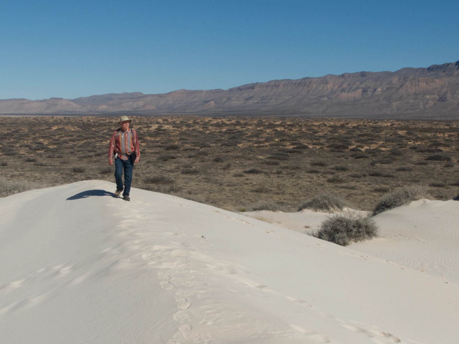
Tucked into a depression at the base of the Guadalupes, the dunes weren't visible until we were right next to them.
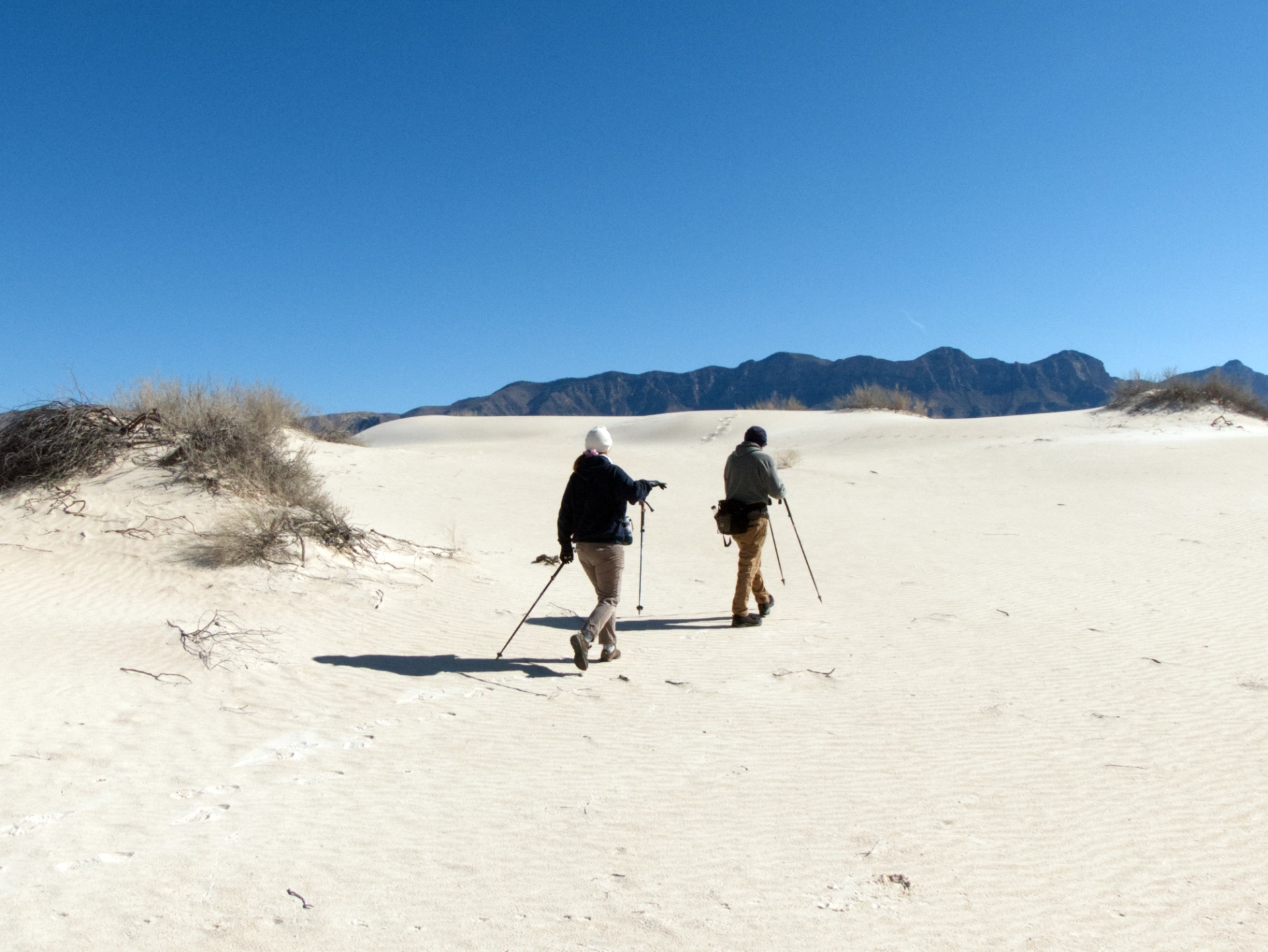
They began as gently rolling mounds dotted with sparse vegetation.
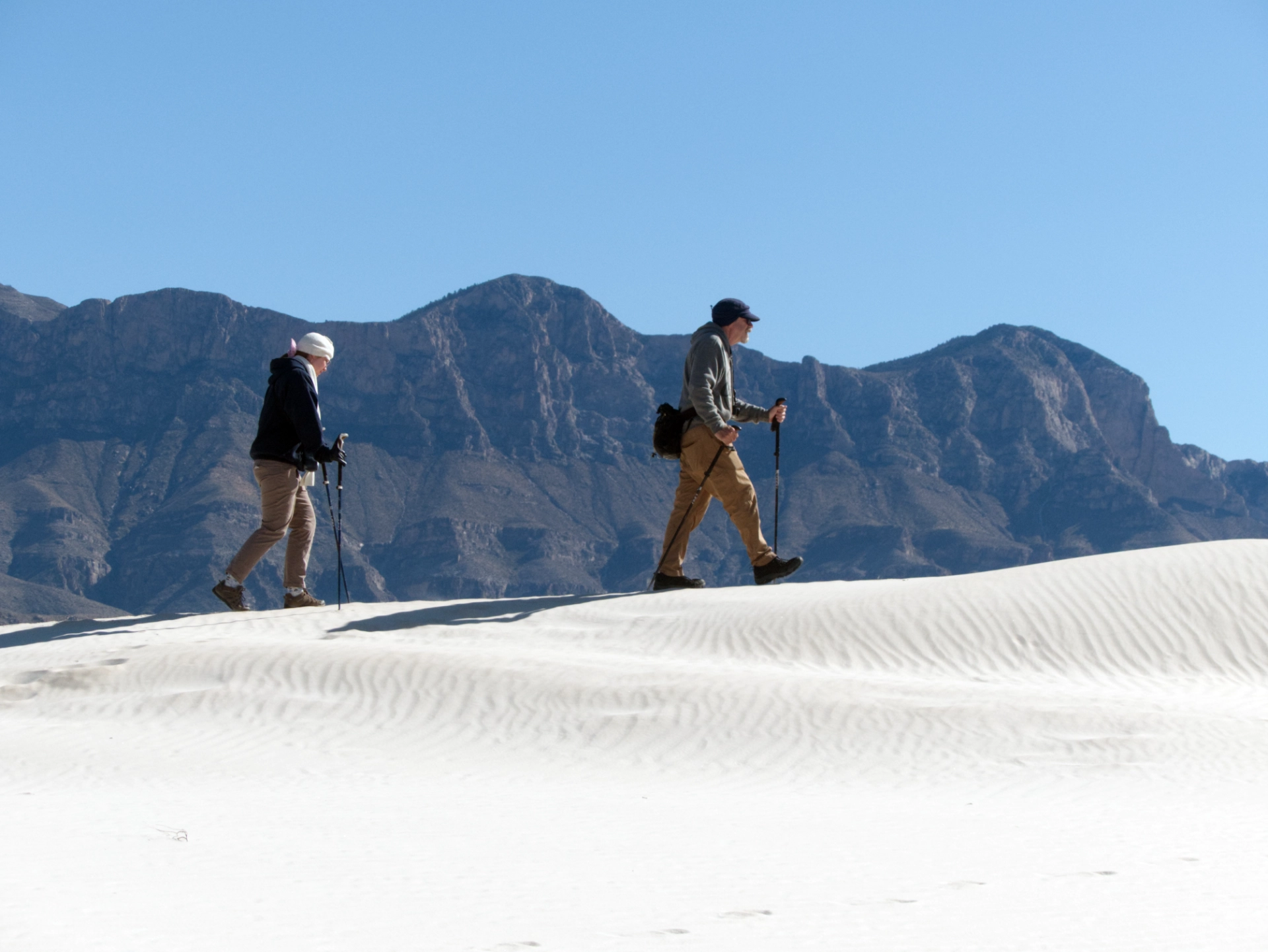
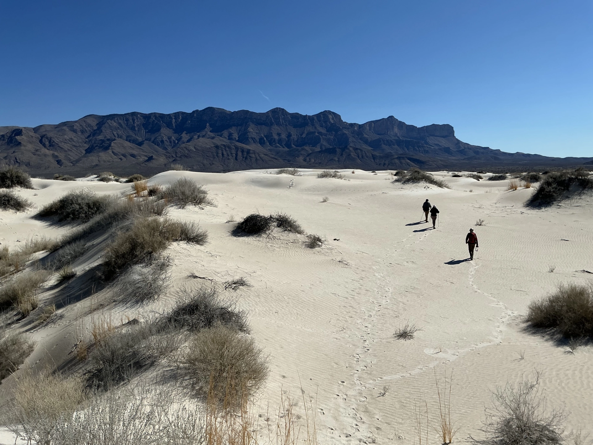
As we hiked closer to the Guads, the vegetation disappeared, and the dunes rose higher and transformed into giant pure white pillows.


Bare feet and the dance of desert grasses.

Waves and tracks of other tiny visitors.
We were stunned when the dunes suddenly stopped, and the white gypsum fell away steeply to ruddy sandstone.

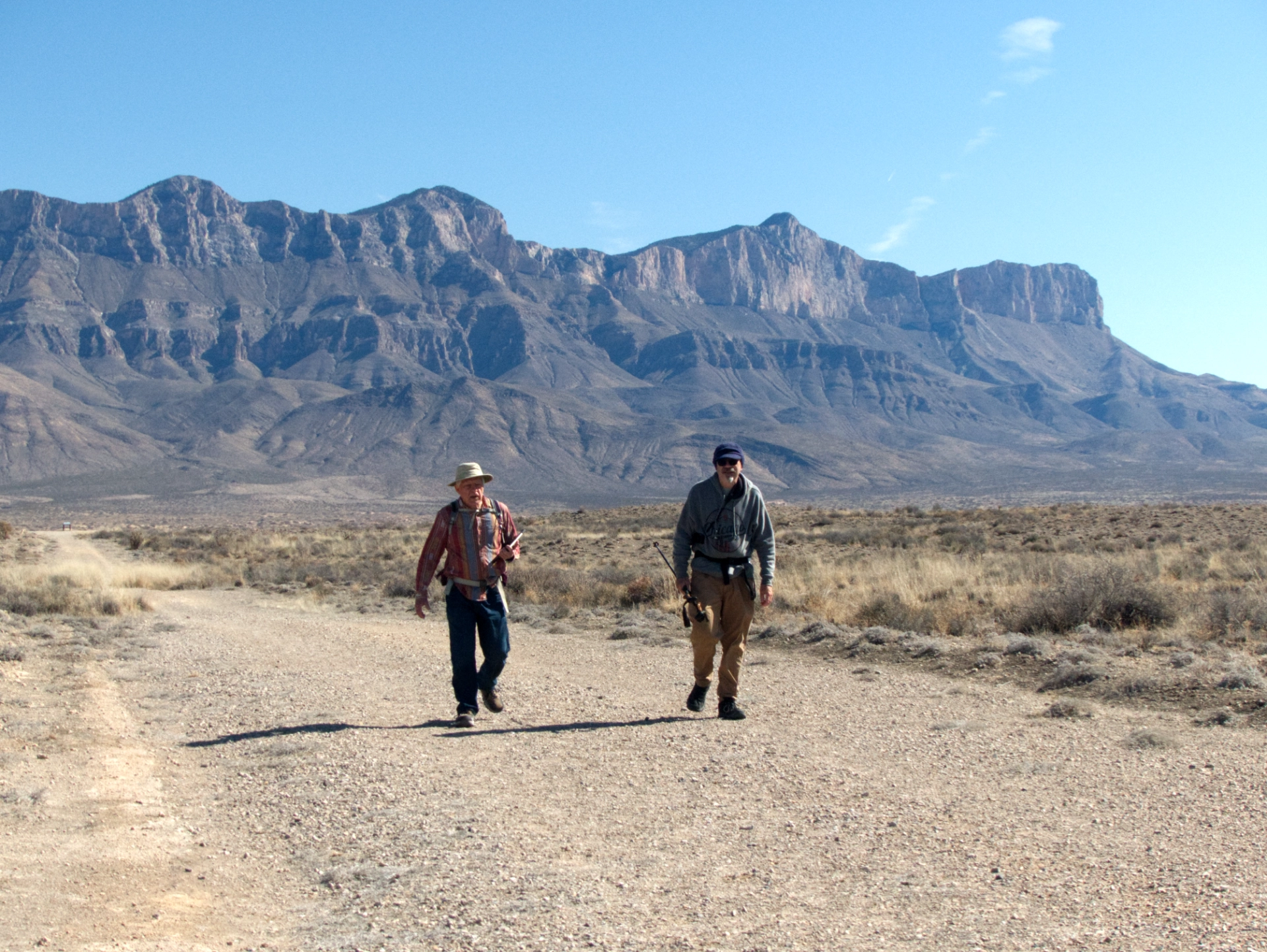
We ate our lunches at a ramada near the trailhead with a fine view of the Guadalupes. Then we packed up and prepared to grab a few provisions before heading to our next campsite But suddenly Ken's rig malfunctioned, displaying a "service required" error message, and then a warning not to put the van in gear. Dennis and Ken did everything they could to troubleshoot the problem. They tried jumpstarting, checking fluid levels and hoses, and examining all the fuses, but there was no response. It was time to call for help. Fortunately Ken and Helena — not us — had a cell signal, but it was well after dark when we finally saw the lights of the tow truck slowly creeping toward us. We reluctantly bid them farewell and followed them out, checking for other campsites closer to town along the way in the hope of catching a cell signal.
Salt Basin
We ended up wandering north until the road disappeared near the northern section of the salt basin, but there was a flat spot, so we pulled in. A few minutes later, there was a horrendous noise and a blinding beacon of light as an aging flatbed truck coughed and choked to a stop behind us. Thinking quickly, Dennis hopped out and introduced himself to an older gentleman who was initially suspicious, but ended up shaking Dennis' hand and telling him it was fine for us to camp where we were. So we did a quick setup and tucked in for the night.
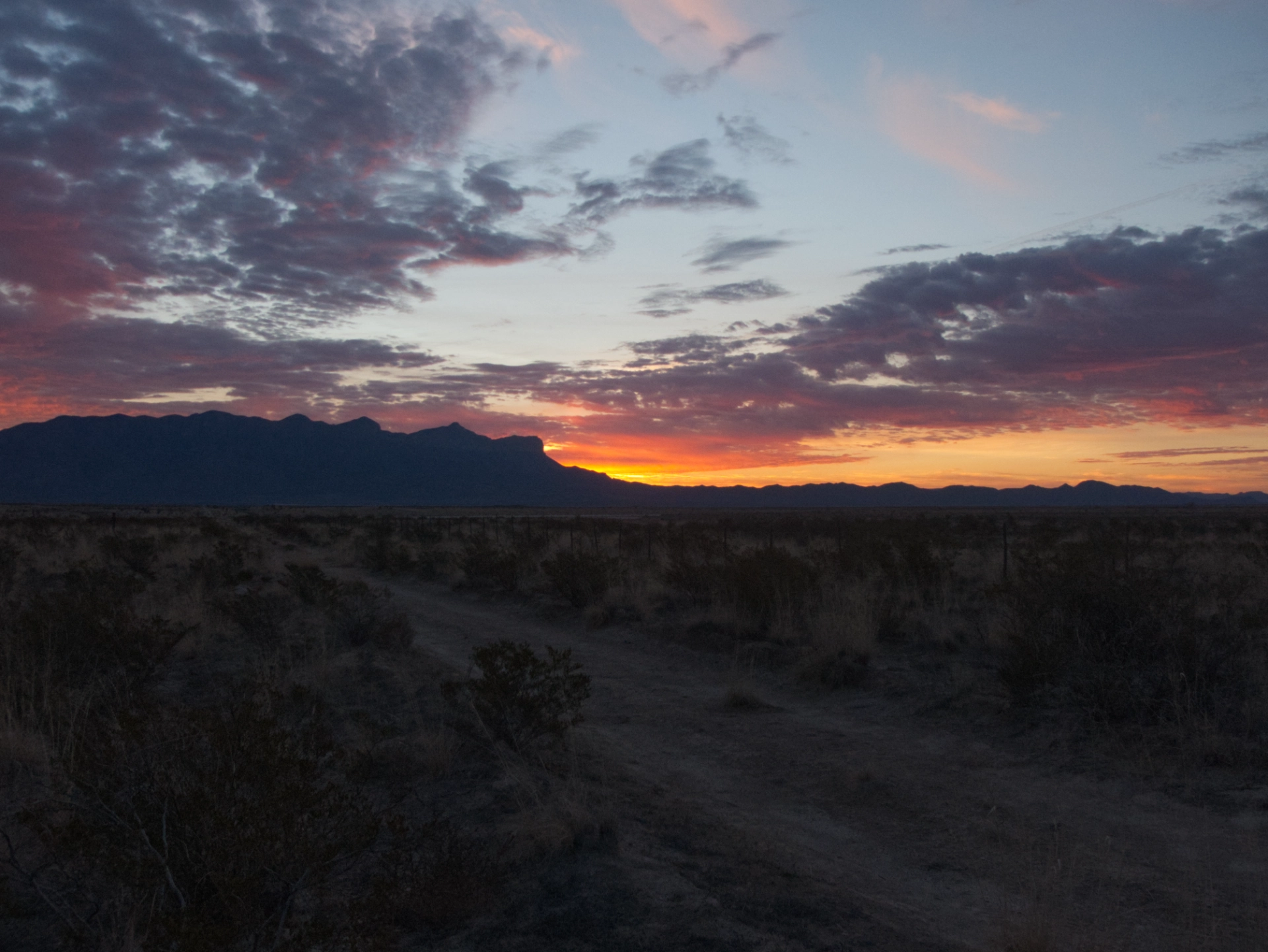
When the sun came up, we realized to our horror that we were basically camped in our new friend's front yard! We packed up quickly and headed out while a hot pink and periwinkle sunrise lit up the Guads.

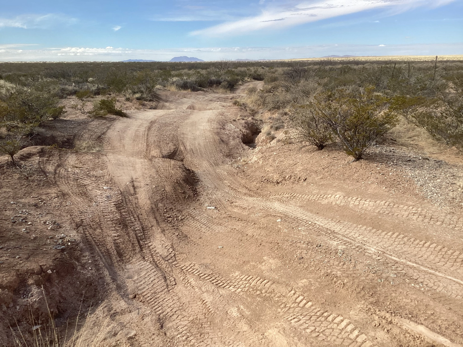
Passing through Dell City once again, we puzzled over the many empty homes, rusty well heads and countless agricultural implements abandoned in the fields. Of course, the huge irrigation rigs probably eliminated lots of jobs for agricultural workers, but it felt like more than simple depopulation. When Dell City fell, it must have fallen very hard. We rolled north on a barely-there paved road, one lane wide, with edges nibbled away by brush and washouts. Low hills with their eons of sediment laid down in neat layers gradually closed in, and there was almost no vegetation, except for cat claw, creosote and some ragged grasses. The pavement gave way to rough gravel, and we continued through the featureless landscape for three hours at an average speed of 20 mph until we finally we ascended El Paso Gap and rolled onto NM 137.
Sitting Bull Falls
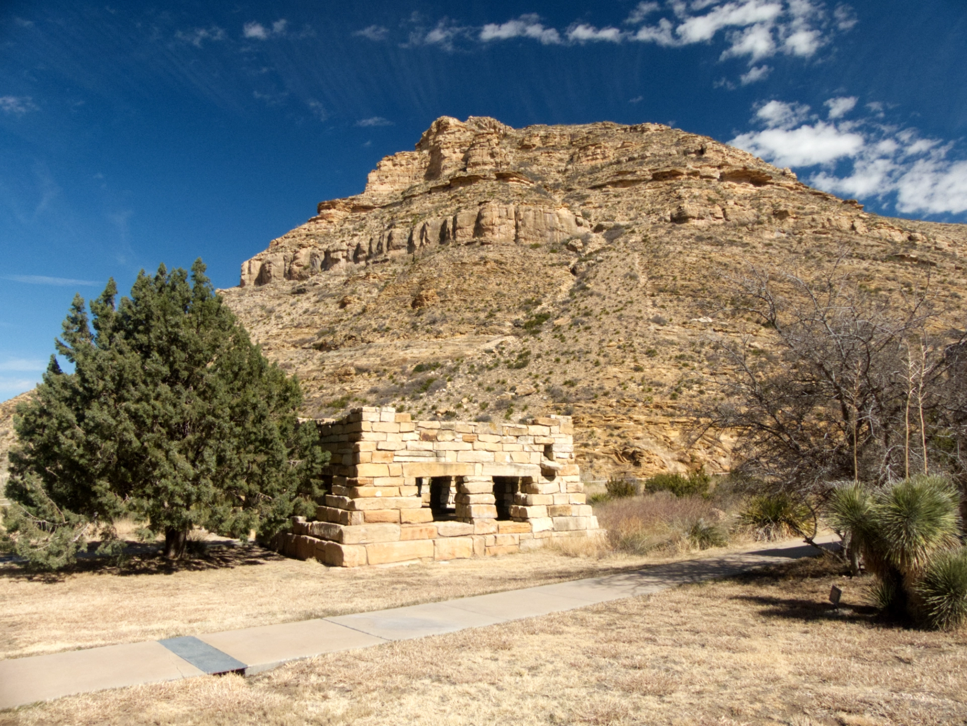
During the long drive, I had a couple of realizations. The first was that because of the six-hour wait for the tow truck, we were a day behind schedule. The second was a quick calculation of the length of our proposed itinerary, divided by the distance to the nearest gas station. So we decided to head to Carlsbad for gas, and compensate with a visit to Sitting Bull Falls along the way. There are some lovely CCC-era stone picnic shelters at Sitting Bull Falls.
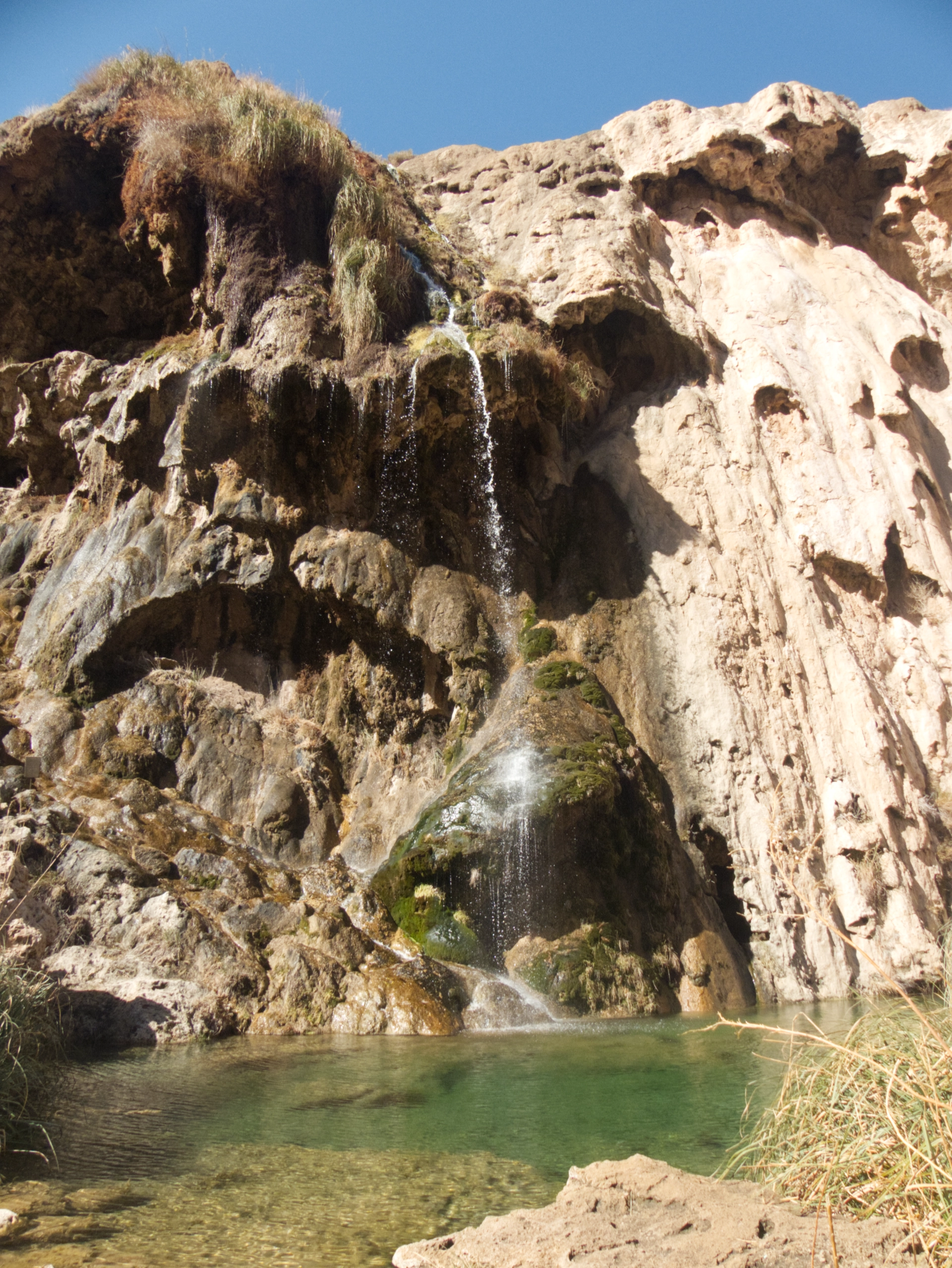

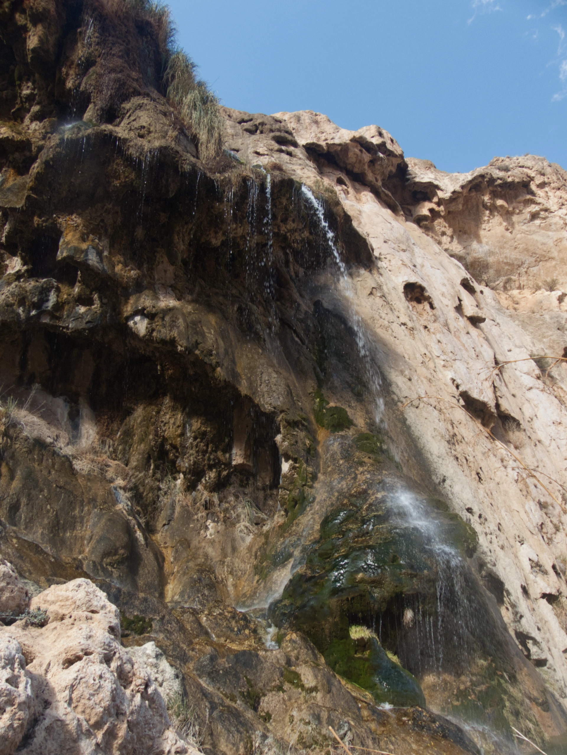
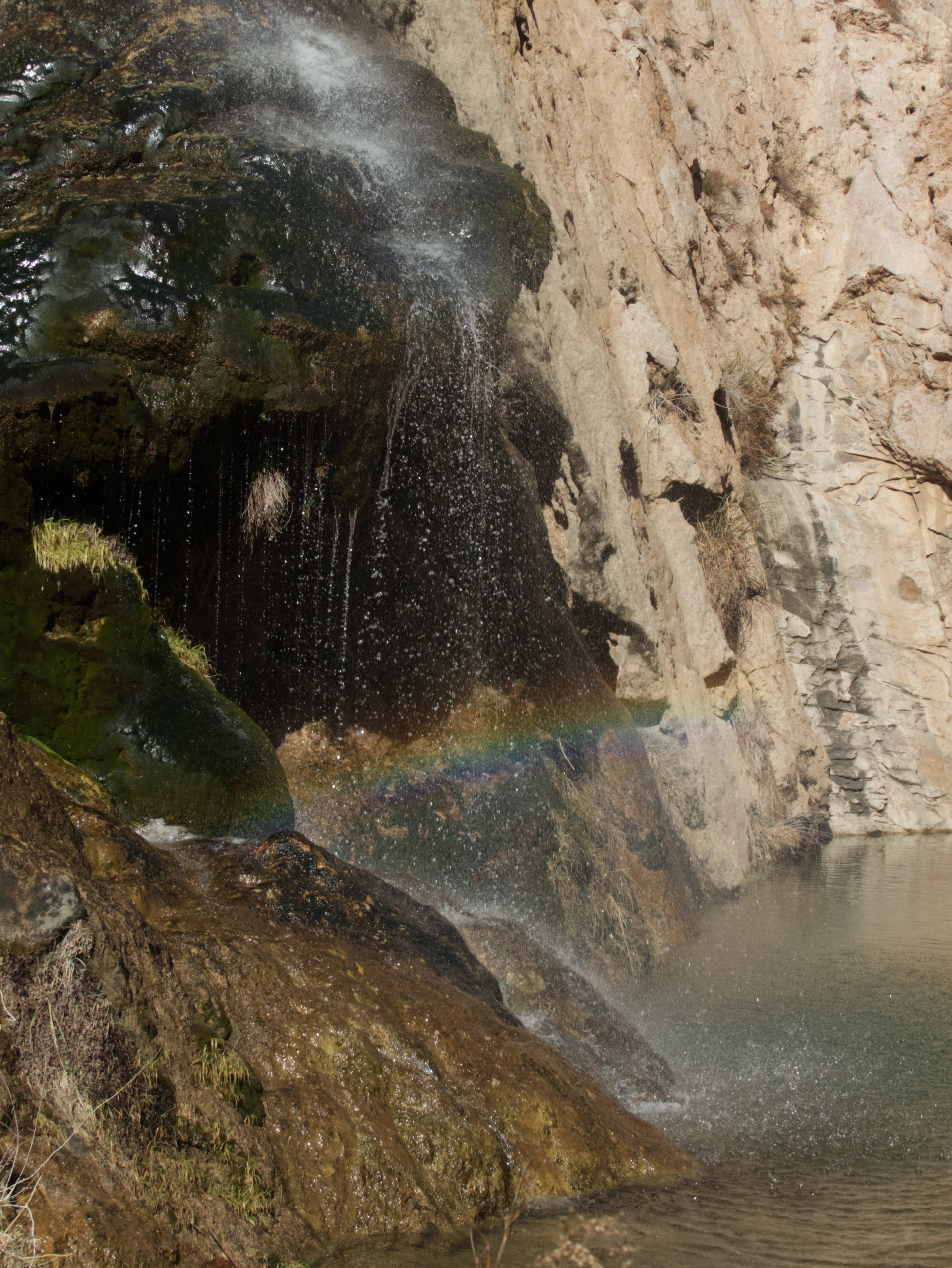
A side road took us into a canyon that looked so dry, it was hard to believe it sheltered a waterfall. But sure enough, a short hike from the parking lot, water tumbles about 150 feet down a rugged cliff composed of dark brown travertine into a creek flowing with clear bottle green water.
Unfortunately, the area was packed with screeching kids, and almost every one of them had a dog in tow, and I got charged by an off-leash pitbull. We had planned to leave the area around noon and continue on to Carlsbad, but somehow by the time we finished lunch, it was already 2:00 pm. Or was it? Back on NM 137, our iPads suddenly switched back to 12:30.
Gnarled travertine cliffs at Sitting Bull Falls.
Dog Canyon
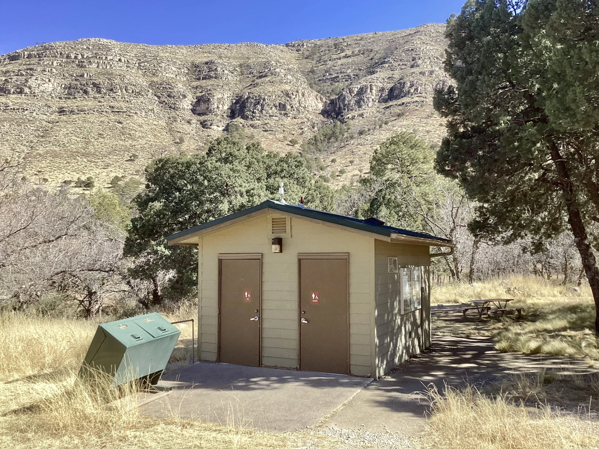
After filling up, grabbing a few items at the grocery store and unsuccessfully searching for an independent sit-down coffee shop, it was back down NM 137 to Dog Canyon. Although we had supposedly booked the last site at Dog Canyon, there was only one other vehicle in the campground, and we never saw the occupant. Several other cars drove through, took a look around, and sped away. It's a perfectly fine campground, but it feels a bit forlorn. As on the east side of the monument, the "campground" is just numbered spaces in a parking lot. The many fine homes and workshops look like they haven't seen any activity in decades. By far the best feature is a restroom that has HEAT, MOTION-ACTIVATED LIGHTS and RUNNING WATER! Unfortunately, it was a quarter mile away, although there was a corral right next to our campsite. Campers are presumed to have indoor plumbing and horses.
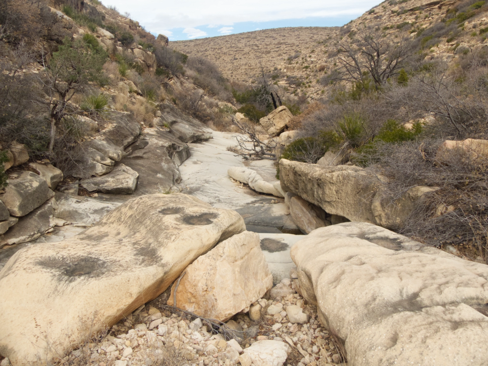
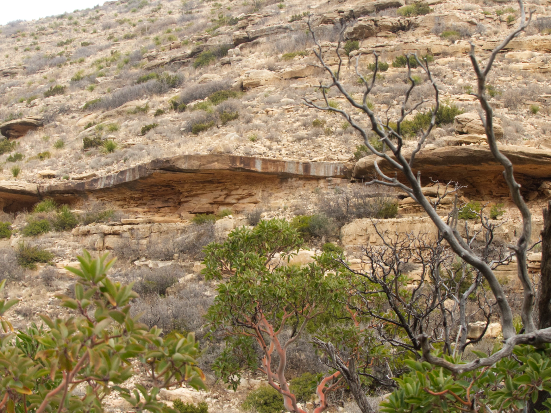
Dawn comes very late to Dog Canyon, with a 1600-foot escarpment directly to our east. It was 9:30 before the sun lit up the side of the camper. For our first hike we chose Upper Dog Canyon/Tejas Trail. The trail crosses a grassy field and then winds through a series of low hills, eventually scaling some layered limestone ridges. The environment was basically high desert vegetation — Colorado piñon, alligator juniper, some pondos in the canyon bottom, and lots of buckthorns and desert grasses higher up. It was nice, but I could rattle off a few hundred places in the Gila that are just as nice. The one spectacular plant was the Texas madrone, which grows to a height of about 20 feet, with bright green waxy leaves and shocking smooth red bark. We hiked to a high point at about 7000 feet where my old topo map shows a black blob that sometimes indicates a habitation, but while there were some interesting rock outcroppings, we didn't see any old walls or kitchen middens.

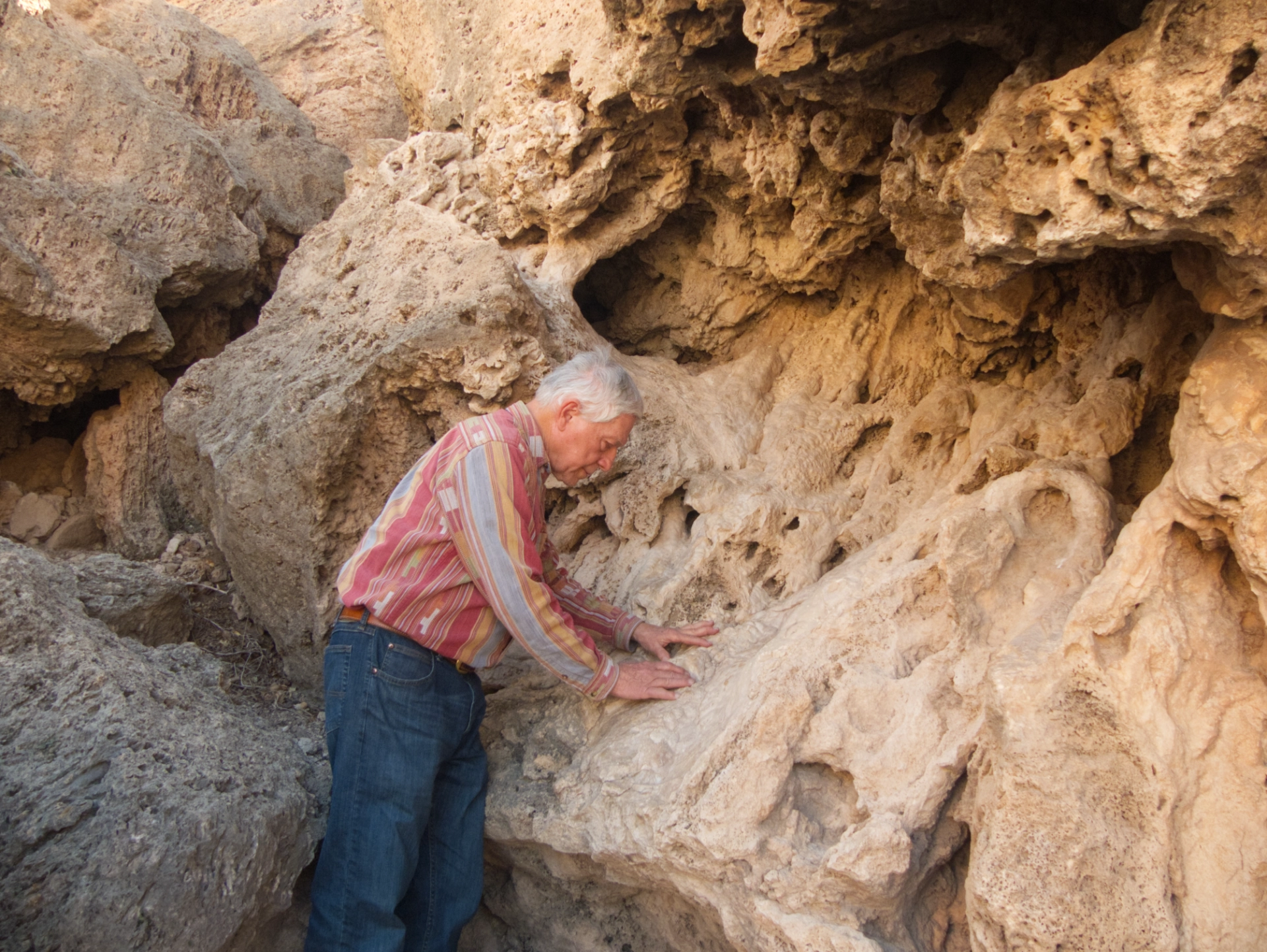
The limestone layers are shot with countless fine lines and fissures, all apparently the result of natural erosion.
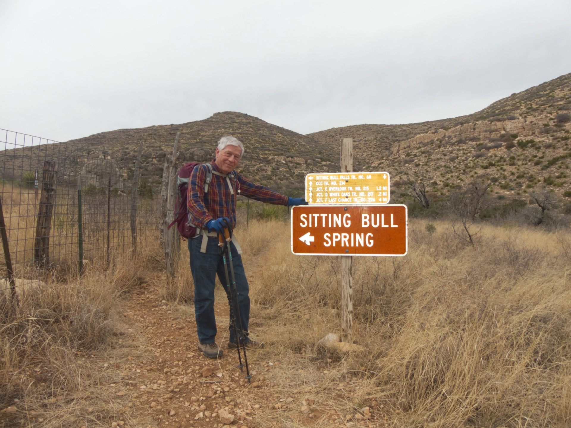
Sitting Bull Springs

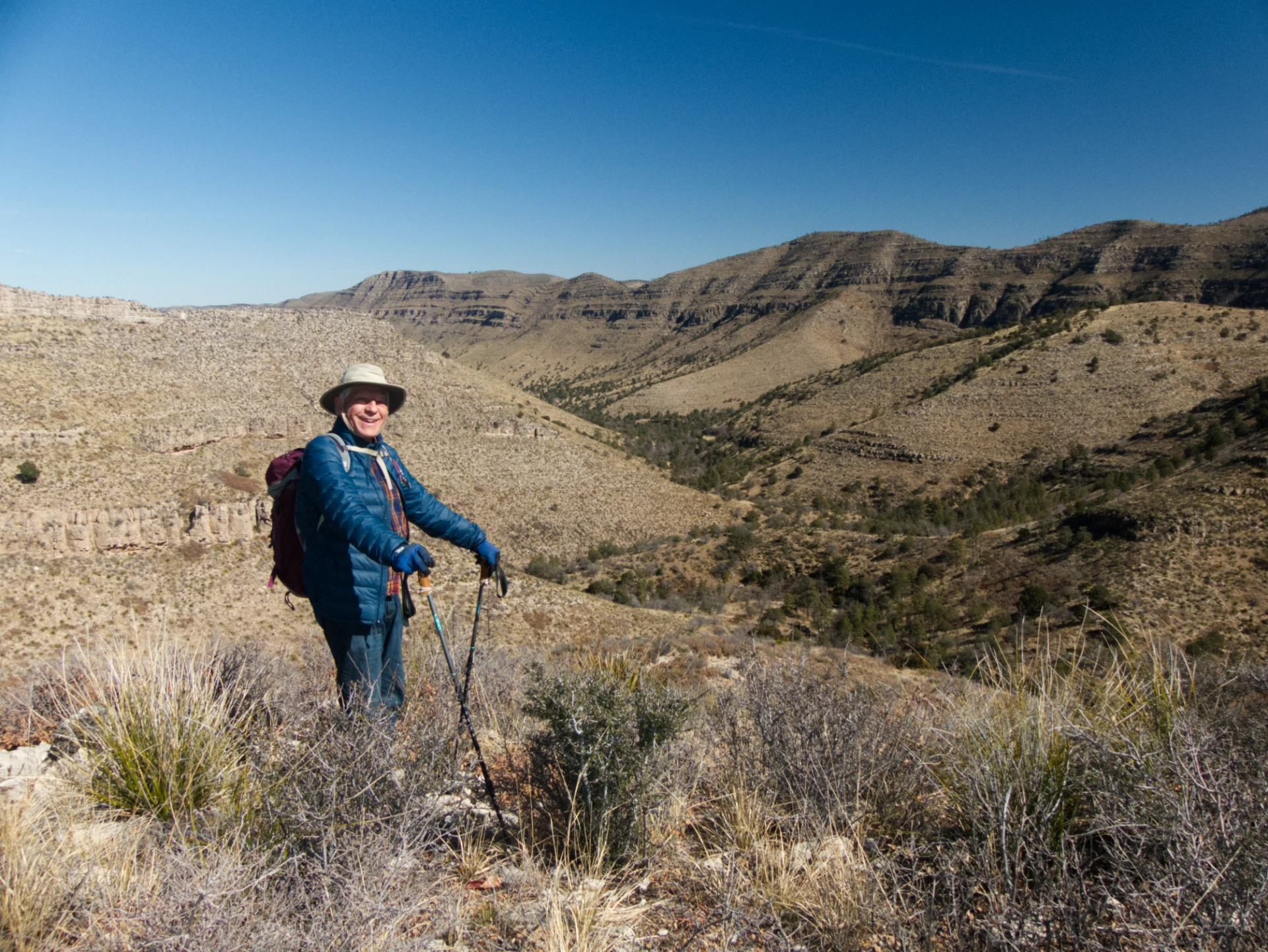
The next morning, instead of doing another hike at Dog Canyon, we packed up and headed for a trailhead we had noticed during our mad dash to Carlsbad. Just east of Queen, New Mexico, there's a trail that leads north about 2½ miles to Sitting Bull Falls.
It was cloudy, windy and bitterly cold, and we were bundled up in ski hats and gloves, with windbreakers over our down jackets. But the trail was intriguing. It starts on a limestone mesa that's flat as a pancake for the first mile. In the distance we could see the layered limestone walls of Sitting Bull Canyon, and beyond that, thousands of feet below, the shimmering Salt Basin.
The canyon walls are deformed into odd shapes or perilous overhangs. About 1½ miles in, we began to see puddles of water and bedrock mortars, and there were some possible rock shelters on the cliffs above us.
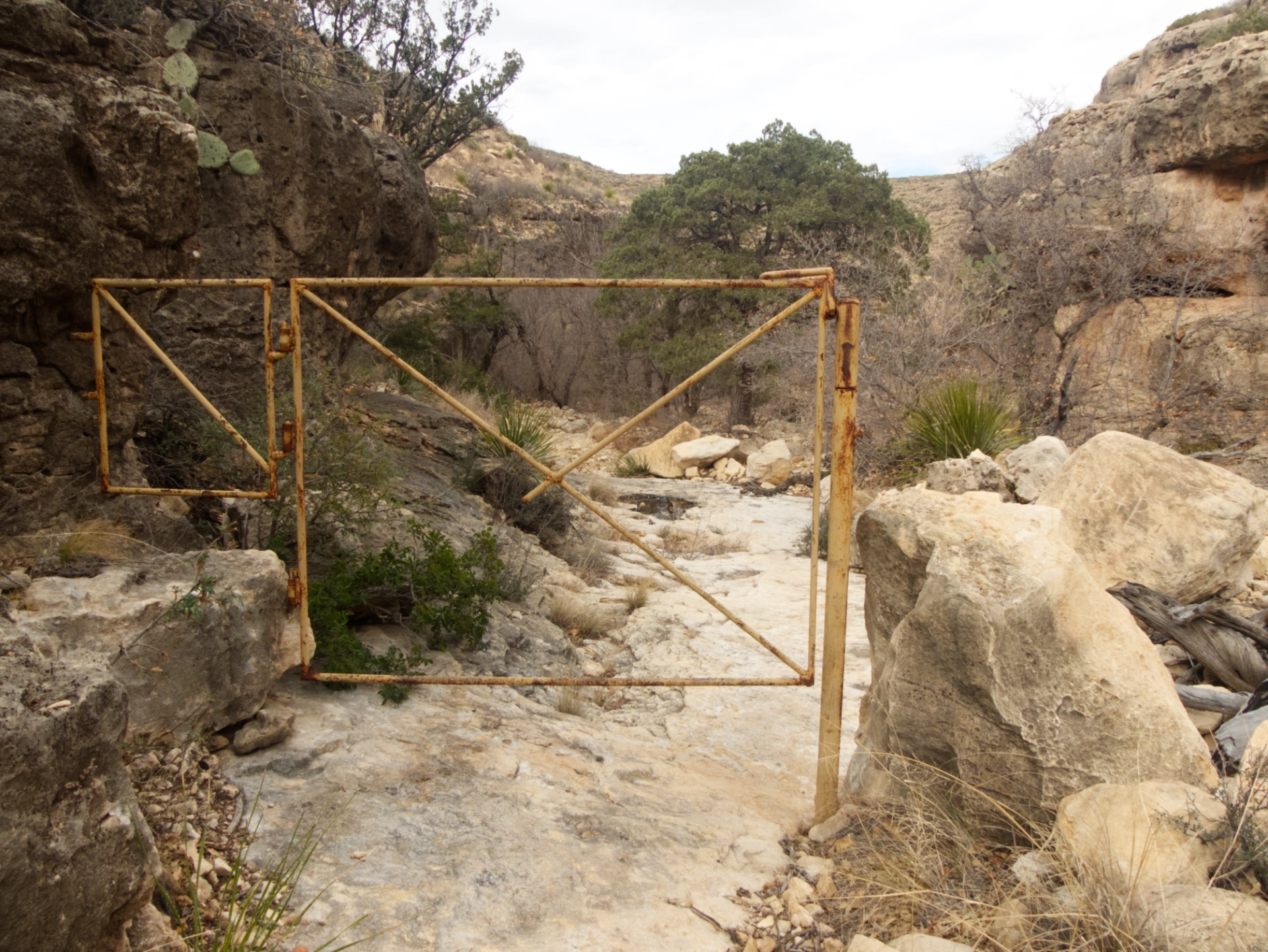
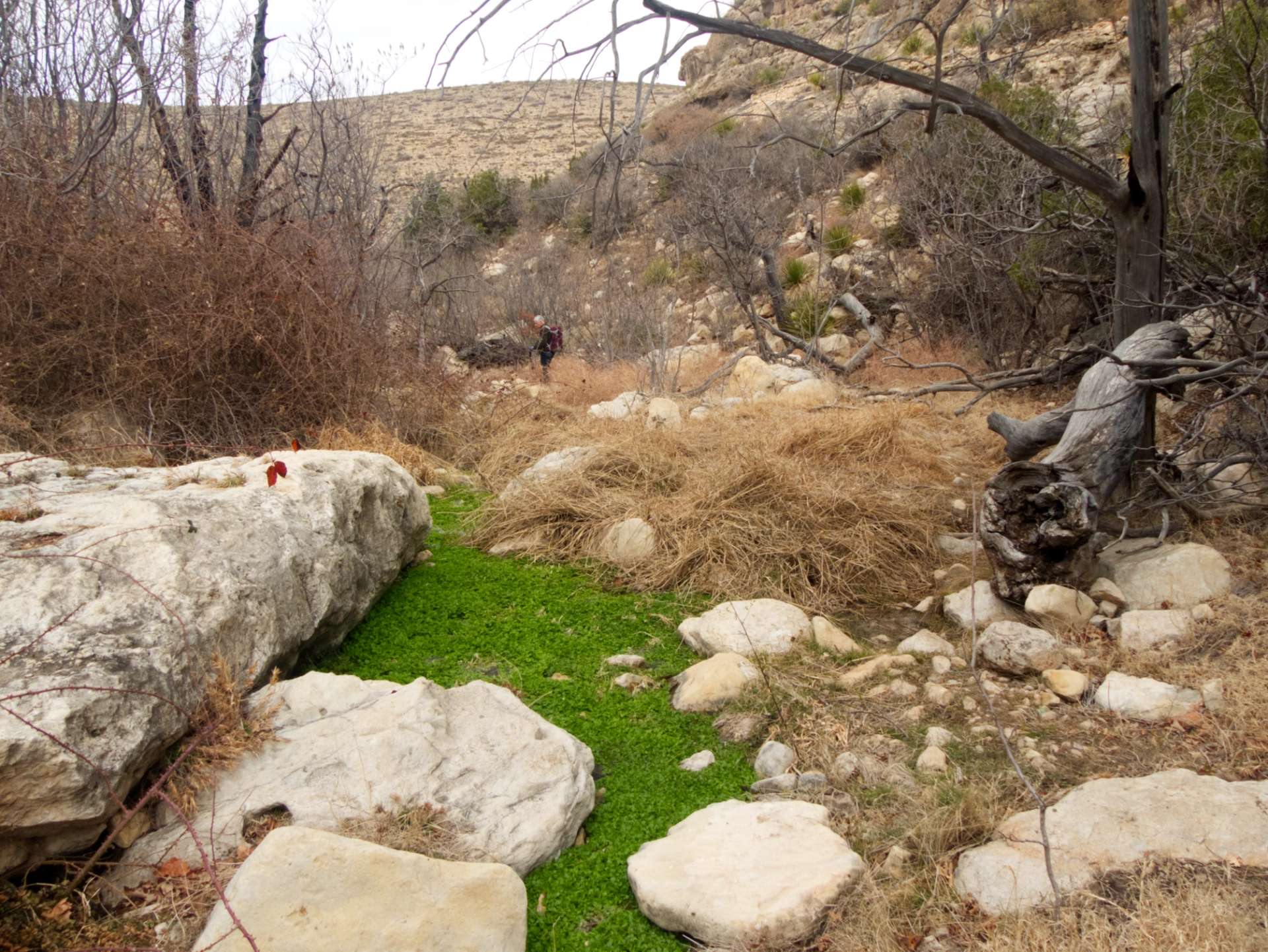
Suddenly there was an ancient iron gate (for cattle?) across the trail, and moments later, we were sitting next to the spring that is the source of Sitting Bull Falls.
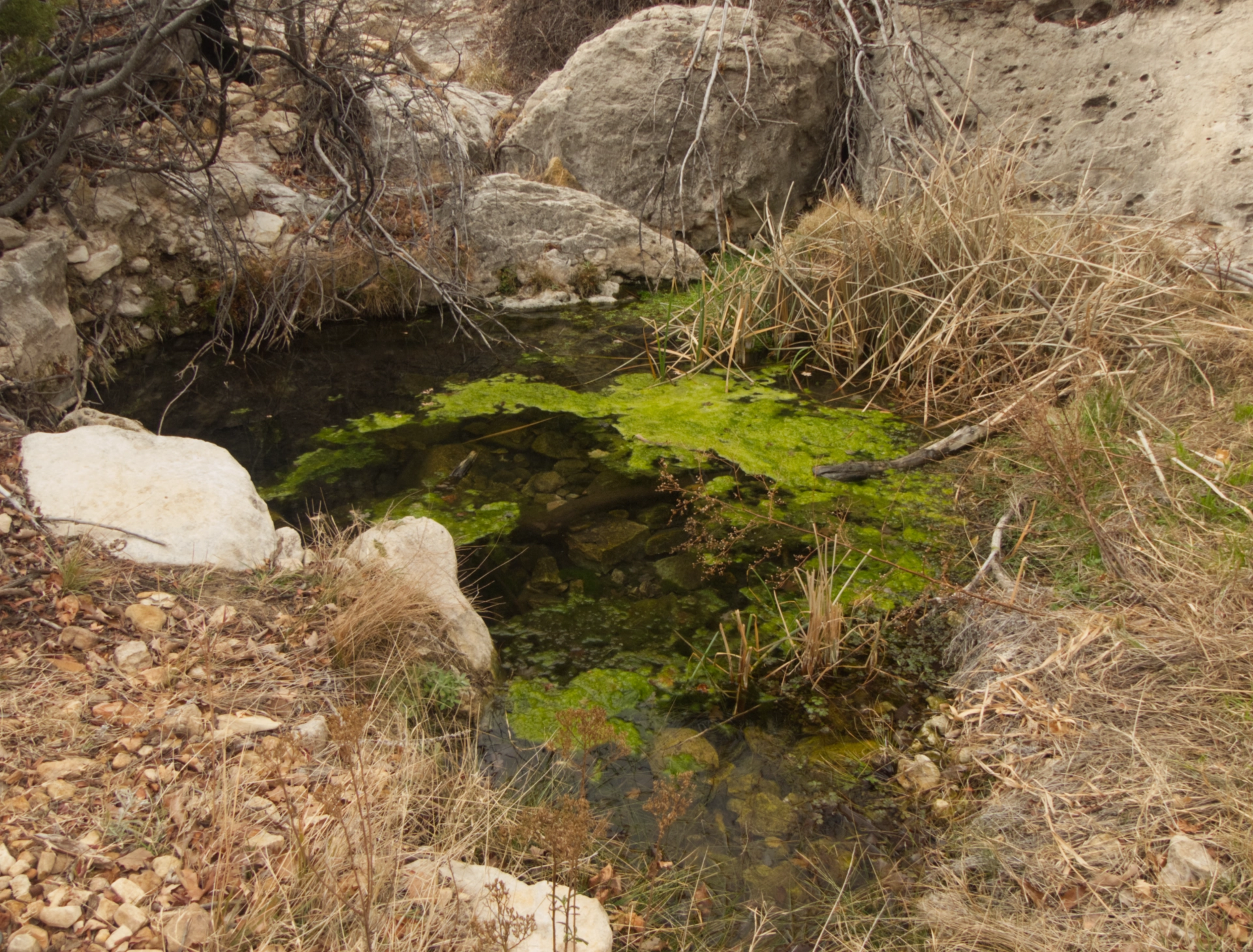
The pools were almost solid with a dazzling green aquatic plant that might have been watercress. It was quite a contrast next to the bare, buff-colored cliffs.
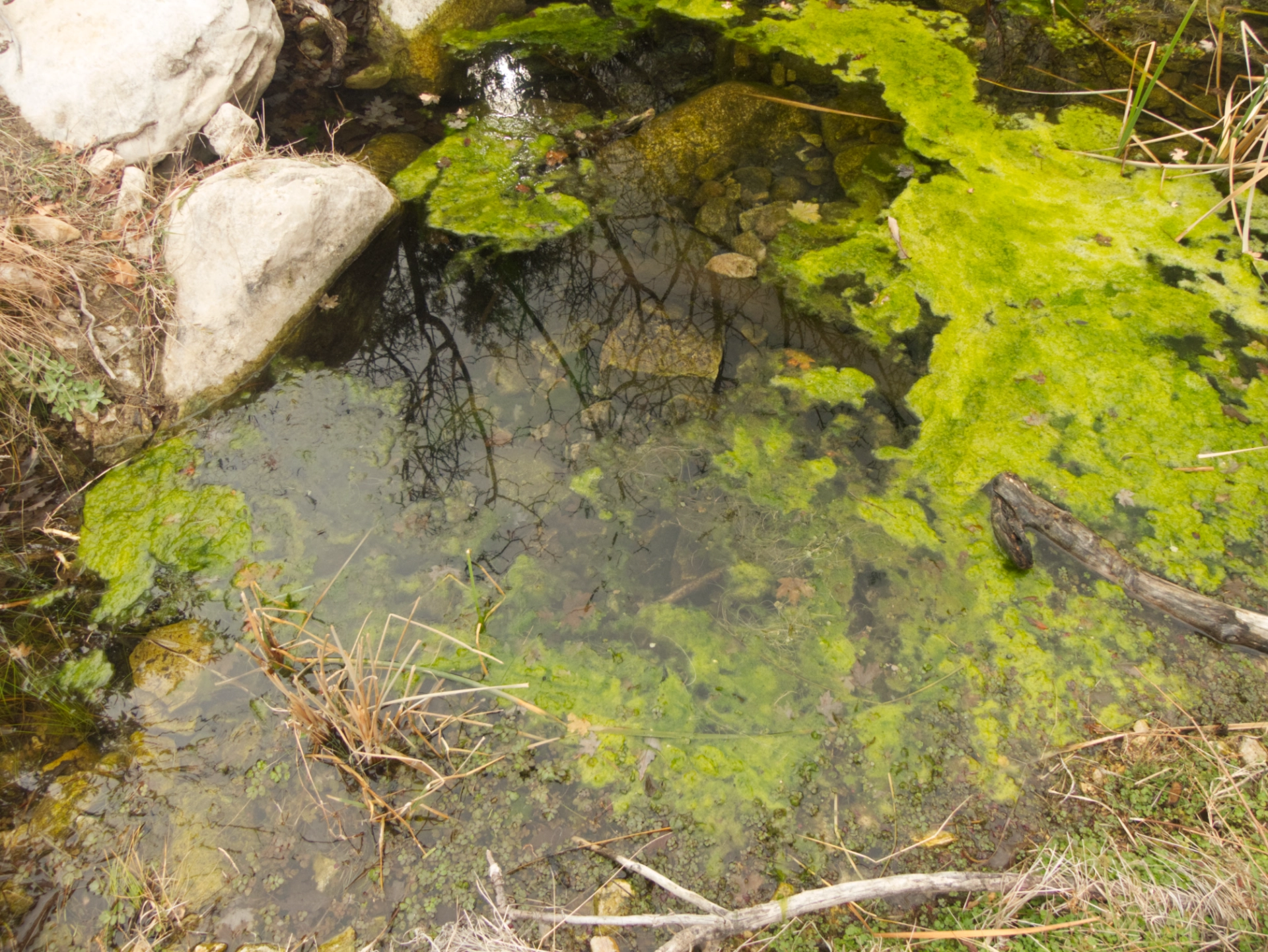

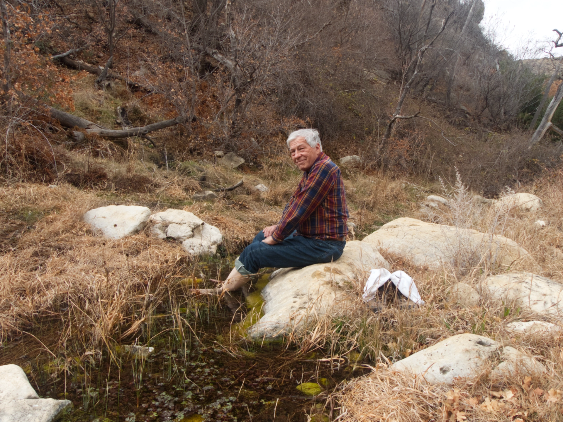
We sat by the pools, ate our lunches and soaked our feet.
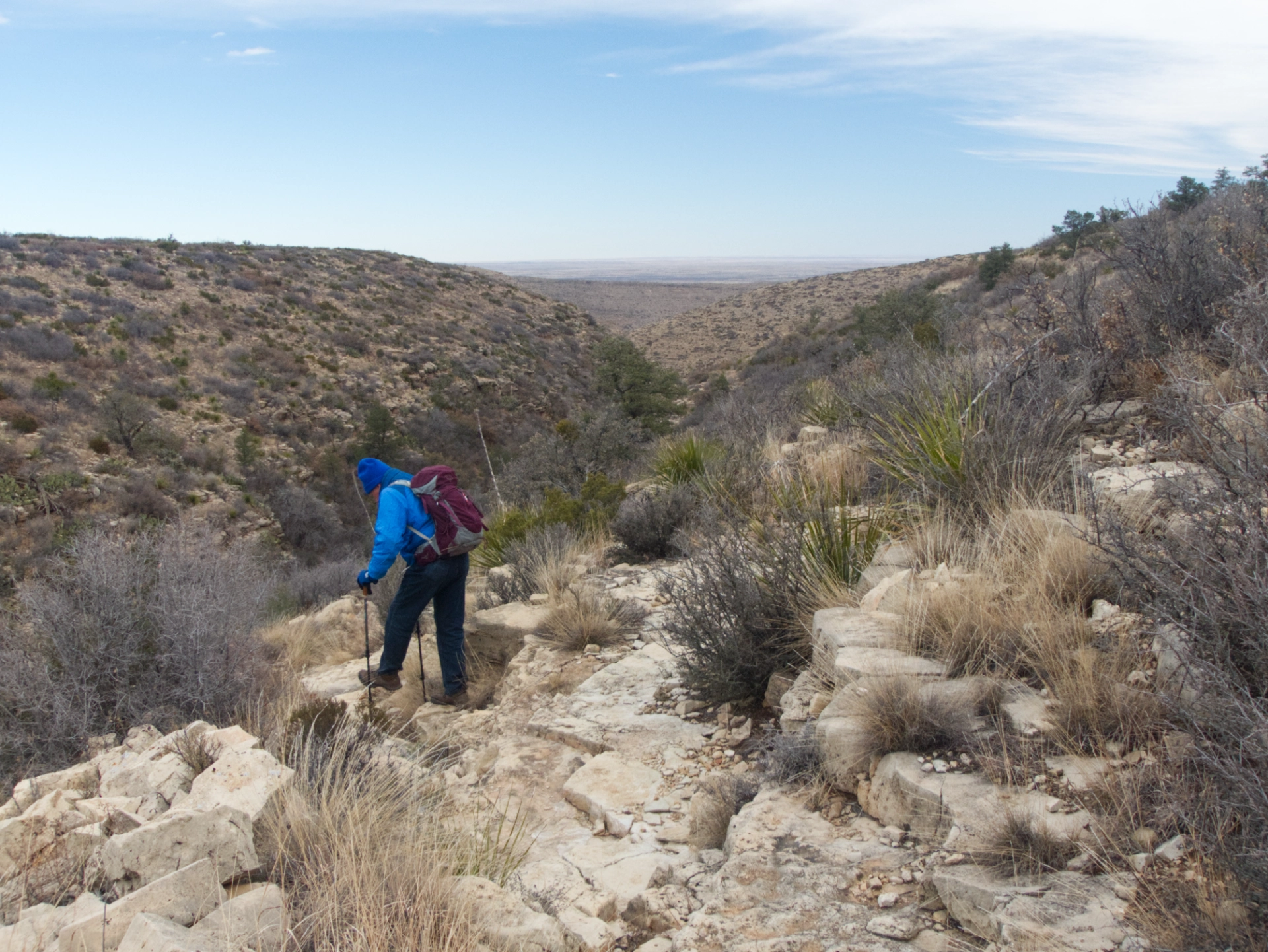
Since it was still early, we decided to continue down the canyon and take another slightly longer trail back. The trail dropped into a broad grassy plain, which had obviously been farmed at some point.
The trail crossed the creek, continued around the base of a ridge and then marched up the nose of the ridge via a series of switchbacks.
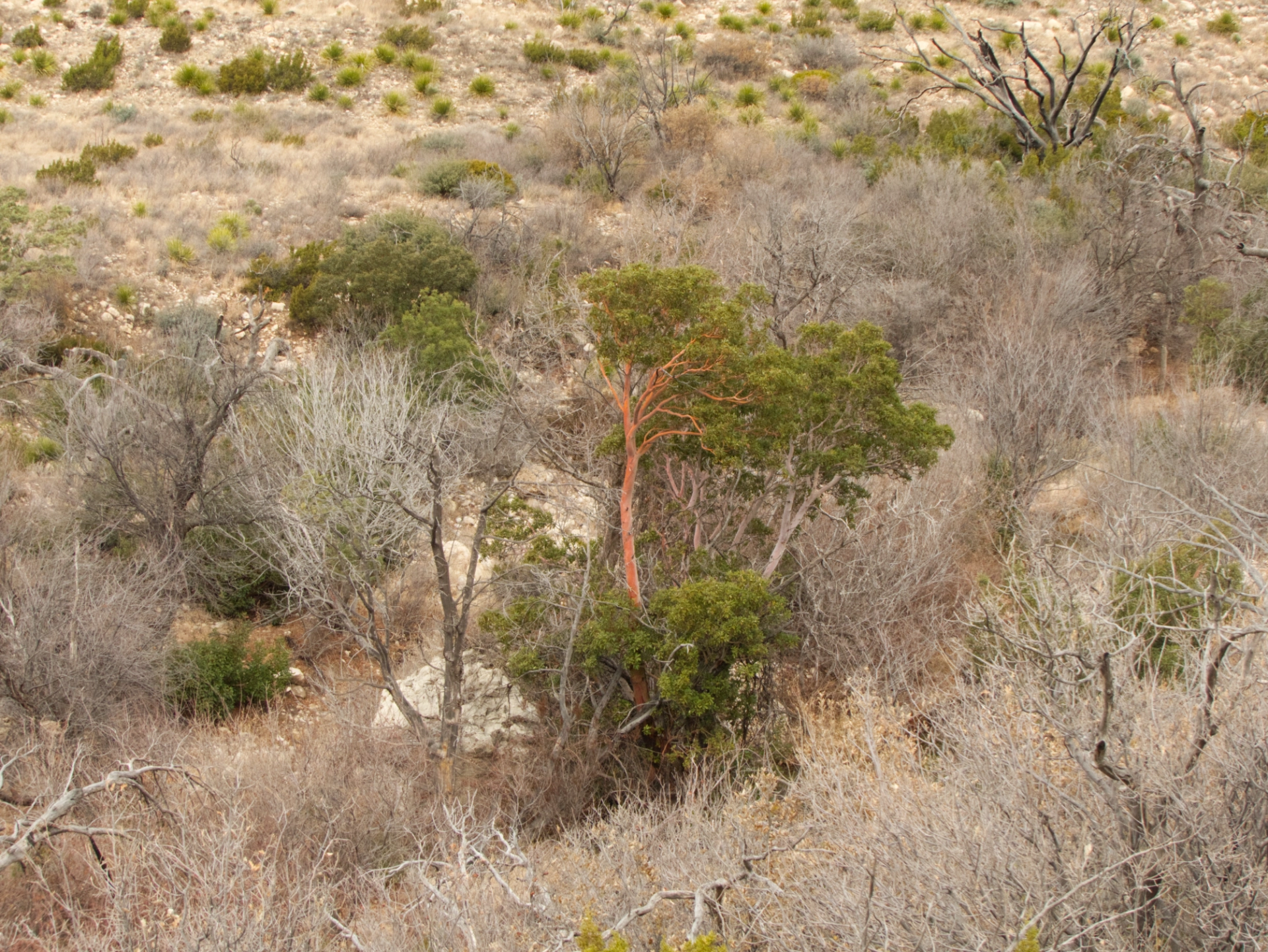
A Texas madrone with its distinctive smooth red bark.

We trudged across the treeless plateau until we rejoined the previous trail. The skies were still leaden, and the wind was howling. It reminded me of hiking across the tundra in Newfoundland.
The Cornudas
We moved quickly and were back at the truck by noon. We took turns driving, and somehow the 65 miles of gravel back to Dell City wasn't as bleak as we remembered. We filled up with gas, had a snack, checked the weather at Spanish Angels Café, and decided to make a run for the Cornudas.
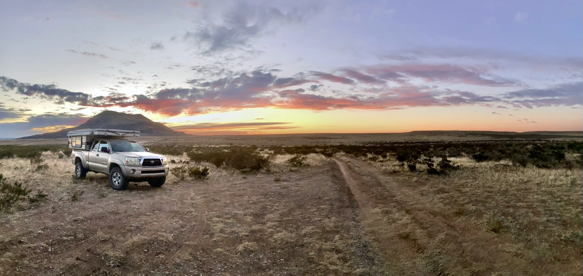
And now for a note about navigating in Otero Mesa. Maps of the area show a spider's web of numbered county roads, but a county road may be an impassible washout, a two-rut track, a decent gravel road, or a public thoroughfare gated and locked by a local rancher. But navigating by instinct or maybe sense of smell, we made it to the Cornudas and they are gorgeous! Alamo and Flat Top are classic old volcanoes, composed of a speckled dark gray rock that we couldn't identify, but Cornudas Mountain is an incredible twisted sculpture of reddish rock that looks like a death star from a distance. It was almost dark when we finally found a place to camp on a spur road near Flat Top Mountain. The sunset was epic, and later the lights of El Paso made a stunning silhouette of Alamo Mountain.

The next day started out as planned, with packing up and driving to the north side of Alamo Mountain in search of the petroglyphs my friend John W. had told us about. We found a parking spot, some likely looking rocks and eventually a few small glyphs. But despite spending a couple of hours scouring the area, we never found the mother lode.
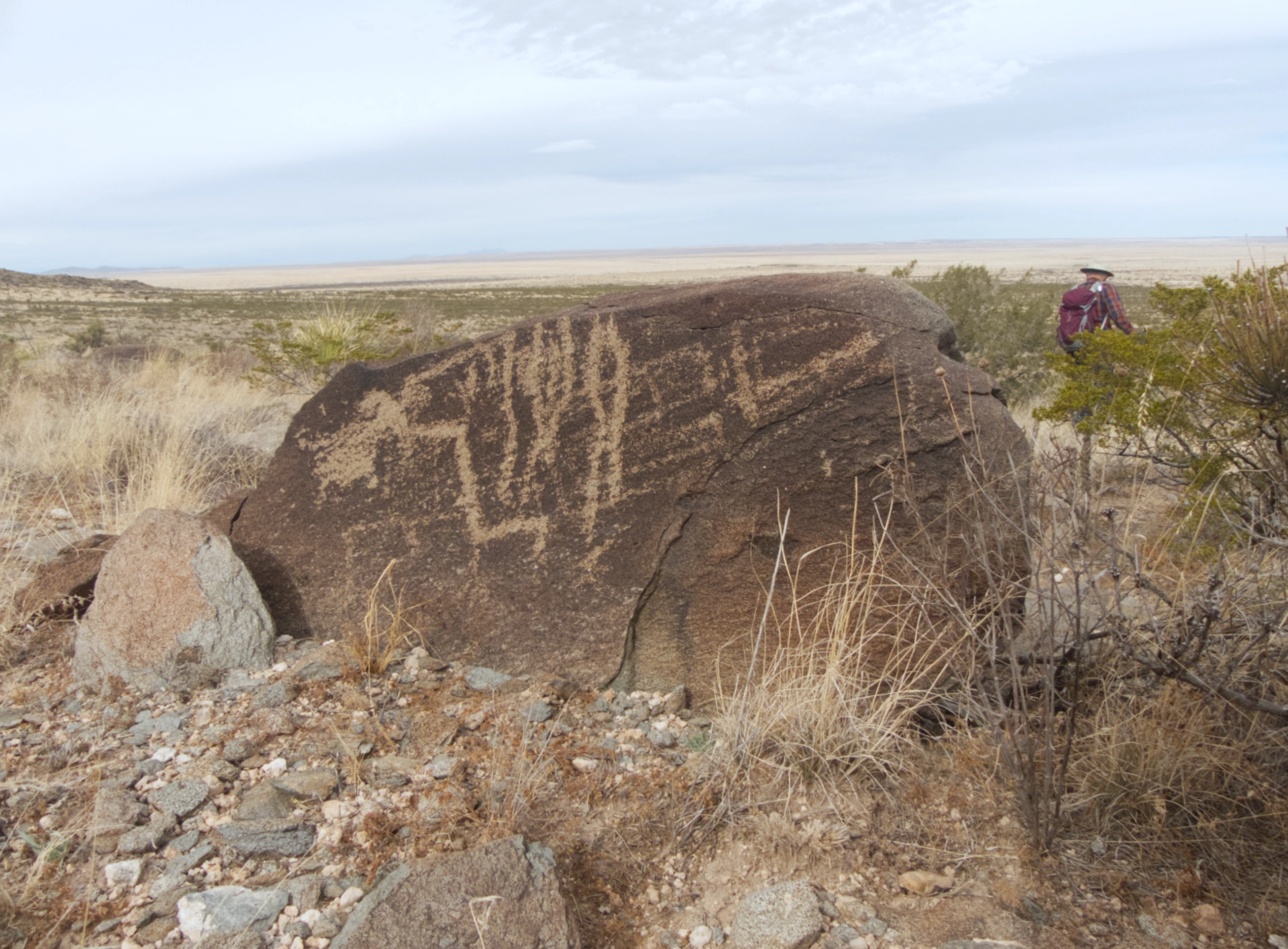
Ironically, on the hike down we did find a few larger glyphs near where we had parked the truck.
We thought we'd check out the site of the old Butterfield stage station and then look for the best route west toward El Paso. But the road, which was already pretty bad, got much worse, devolving into a quarter mile of deep rolling swales. We crept along, analyzing every washout to reduce the tilt, but we were eventually forced to retrace the mile or two of impossible road that we had worked so hard to put behind us. But what now? We couldn't continue west, and we weren't keen on backtracking to Dell City. We began wondering if there was ANY tow truck that would come to our rescue in this location should we need it, and calculating how long our food and water would last.
Otero Mesa

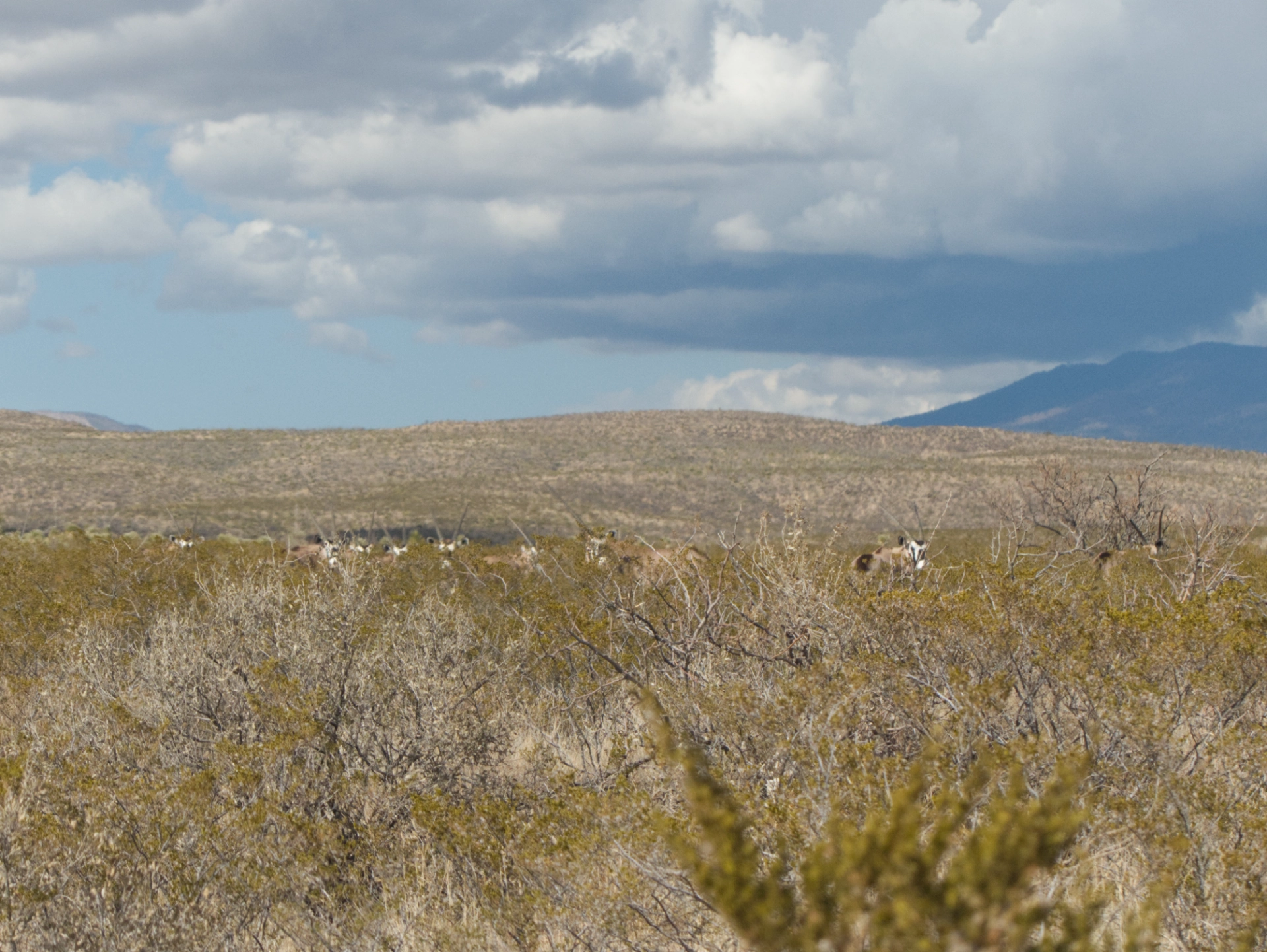
We'd spend the rest of the day feeling our way north, from intersection to intersection. We breathed a sigh of relief when we finally bumped onto F001, a broad, well-graded gravel road heading north. Now there was time to admire the astounding beauty of our surroundings. So this was the famous Otero Mesa, that I'd heard so much about! Except for the Cornudas Mountains, it's an endless sea of yellow grass, bounded by the deep blue Sacramento Mountains to the north. The expected rain never materialized, replaced by bright sunshine and puffy Georgia-O'Keeffe-style clouds.
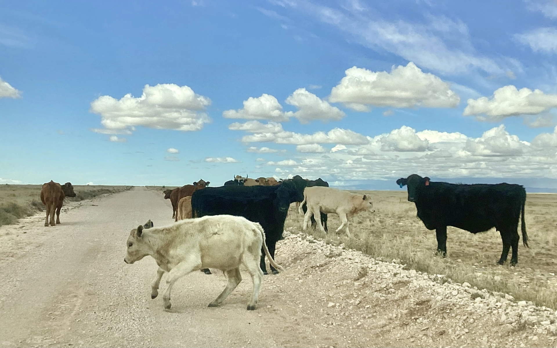
We saw one ranch and two distant pickup trucks, but no other buildings or people all day. But we did see lots of very curious cows who consistently approached us rather than running away. I don't think they see very many people!
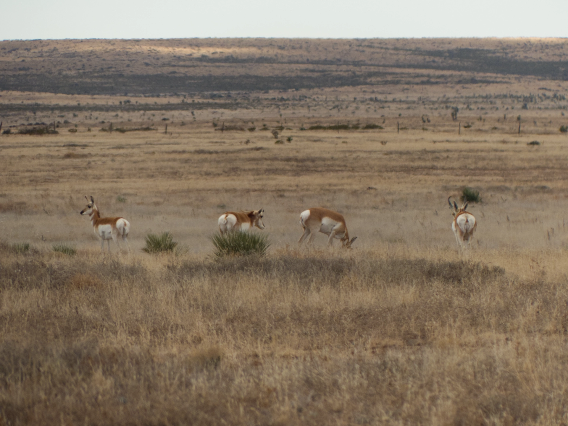
We were also delighted to see several groups of pronghorns dashing across the prairie.
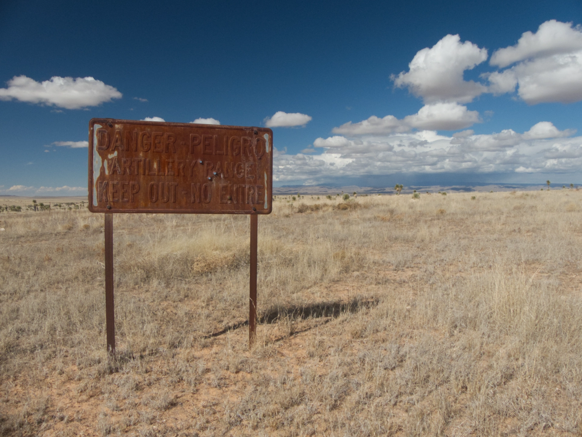
We stopped to eat lunch overlooking El Paso Draw next to a rusty bullet-riddled sign warning us that we were entering an artillery range for Fort Bliss.
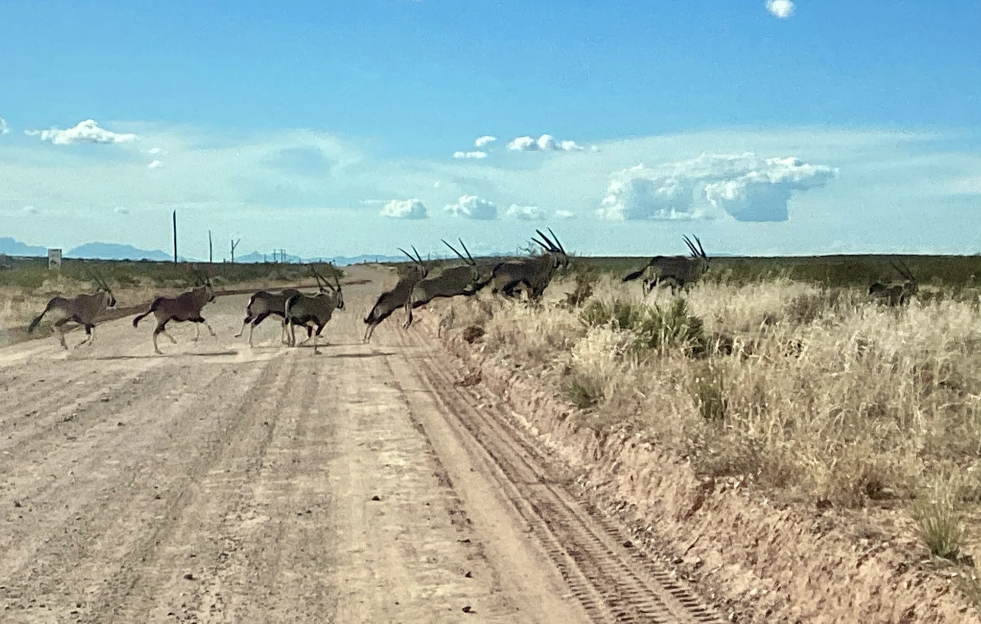
We had just turned west on NM 506 when suddenly a herd of about a dozen oryx came barreling across the road in front of us. What a thrill! We've traveled over their range from the Florida to Lake Lucero, but had never seen a single one until now.
They ran about 20 yards away, then turned and watched us, much more curious than fearful.

We found a spot at Oliver Lee State Park at the foot of Dog Canyon, watched the sunset over the Tularosa Valley, and enjoyed much-need hot showers. We felt quite lucky to have arrived safely. Except for Ken's Sprinter seizure, the only mishaps were a broken bottle of port, a busted running light and a frozen drain hose that snapped when I tried to coil it. What an amazing place! I'm so glad we got to see it, and, as always, I'm dazzled by New Mexico's incredible beauty and variety.
Epilogue
It was a $300 electronic component that took out Ken's Sprinter. Since he suffered a similar incident last year, he says, "No West Texas for me ever again. The place is cursed! Wise people should never drive past El Paso airport!"
A Border Patrol vehicle tailed ... um ... escorted us all the way across Fort Bliss. Only later would we learn of "Balloongate," when a pissing match between the FAA and the Pentagon resulted in a brief closure of the El Paso Airport supposedly due to a "cartel drone incursion" that turned out to be a party balloon.
We sent our accidental host in Dell City and thank you note and a $20 bill. What's fair is fair.
Don't drive across Otero Mesa with raw eggs in the fridge. They were very, very well scrambled!
