Beyond the Bat Cave
April 26-29, 2026
My fascination with the Plains of San Agustin goes back to at least 2017. While researching a trip to the Trinity Nuclear Site and the VLA, I learned that this high-altitude basin was created by a Pleistocene lake that occupied the area between 11,000 and 23,000 years ago. At the height of the Ice Age, the lake was more than 250 feet deep. As the ice melted, the lake level dropped precipitously. By the time humans occupied the area 13,000 years ago, the lake had been replaced by several seasonal playas.
Today, the scientific community is abuzz with the discovery of fossilized tracks in the sediment of Lake Otero in White Sands National Monument, indicating that humans have been living in the Americas for at least 23,000 years. But 70-some years ago, the big news — once again in New Mexico — was the discovery of ancient maize cobs at "Bat Cave", a series of rock shelters on the shores of the former lake in the San Agustin basin. It was the very first application of radiocarbon dating, which allowed researchers to assess the age of organic material, and it indicated that Southwestern agriculture was several thousand years older than expected.
Maize is not a native crop. It was developed by humans, possibly by manipulating native grasses. The 1950s excavations at Bat Cave pulled back the covers on the history of maize, with the size of the maize cobs increasing dramatically from the lowest to the uppermost layers.
There has been a pin for the possible location of "Bat Cave" on my Gaia GPS app for years. Several times we tried and failed to make our way to the site, but most roads in the area either end at locked gates, or simply disappear into the dust at old corrals and water tanks. Finally, a clue in one of the scholarly articles pointed me in right direction.
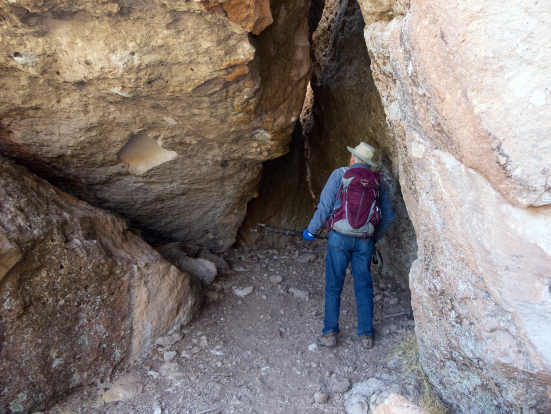
The Bat Cave
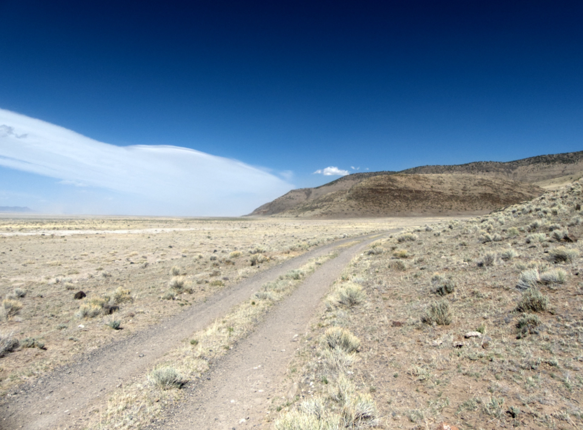
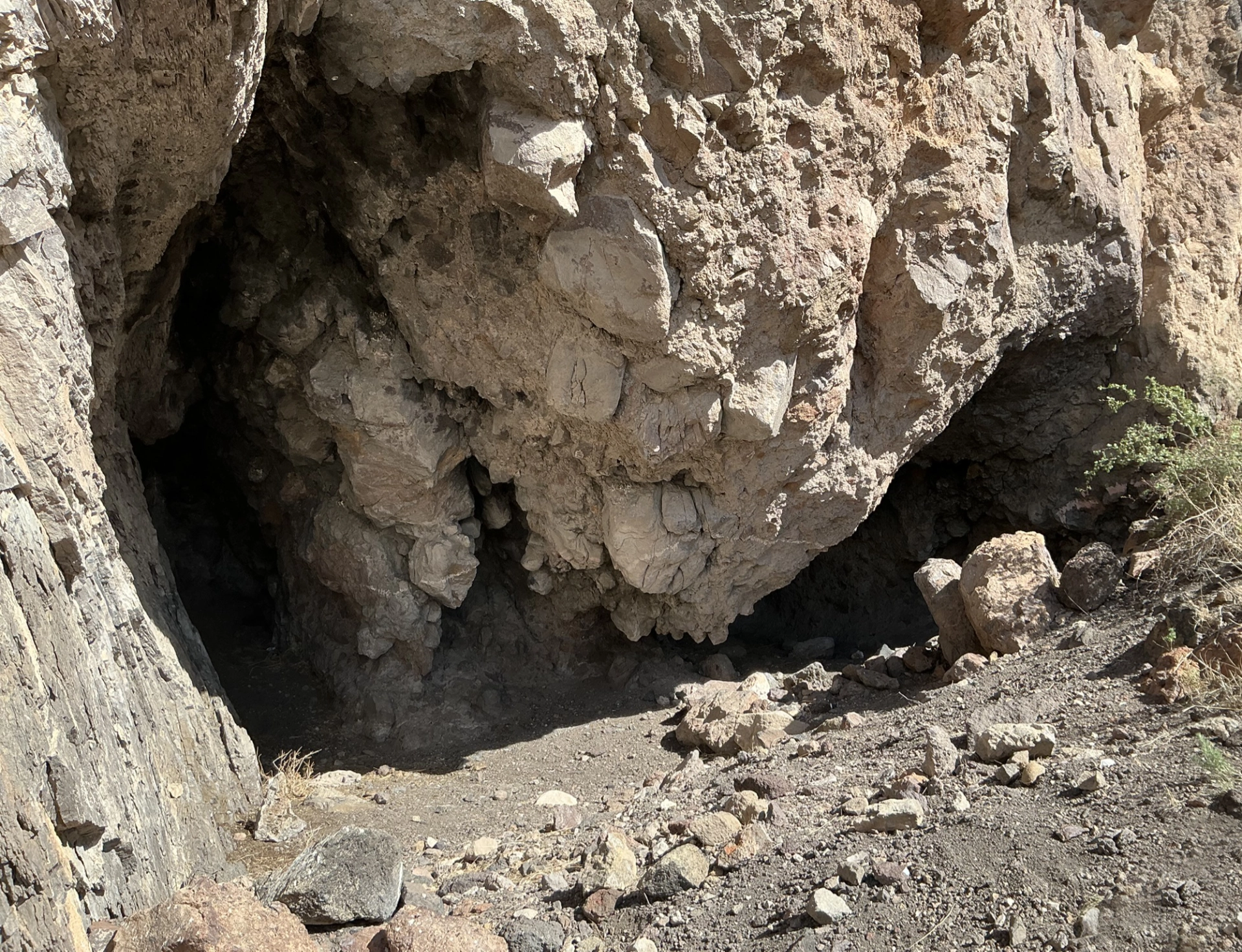
Dennis and I were scouting locations for a summer camping trip when we decided to make one more attempt to reach the Bat Cave. It was day six of the Hummingbird Fire, which had blown up to nearly 4000 acres after several days of 25-35 mph winds. For hours, we inched along two-rut tracks in a brownout, struggling mightily to open and close creaking ranch gates while the wind did its best to separate me from my eyeglasses, earrings and camera.
But finally there it was, exactly where it was supposed to be, in the jagged volcanic rock on the southwestern edge of the Plains of San Agustin.
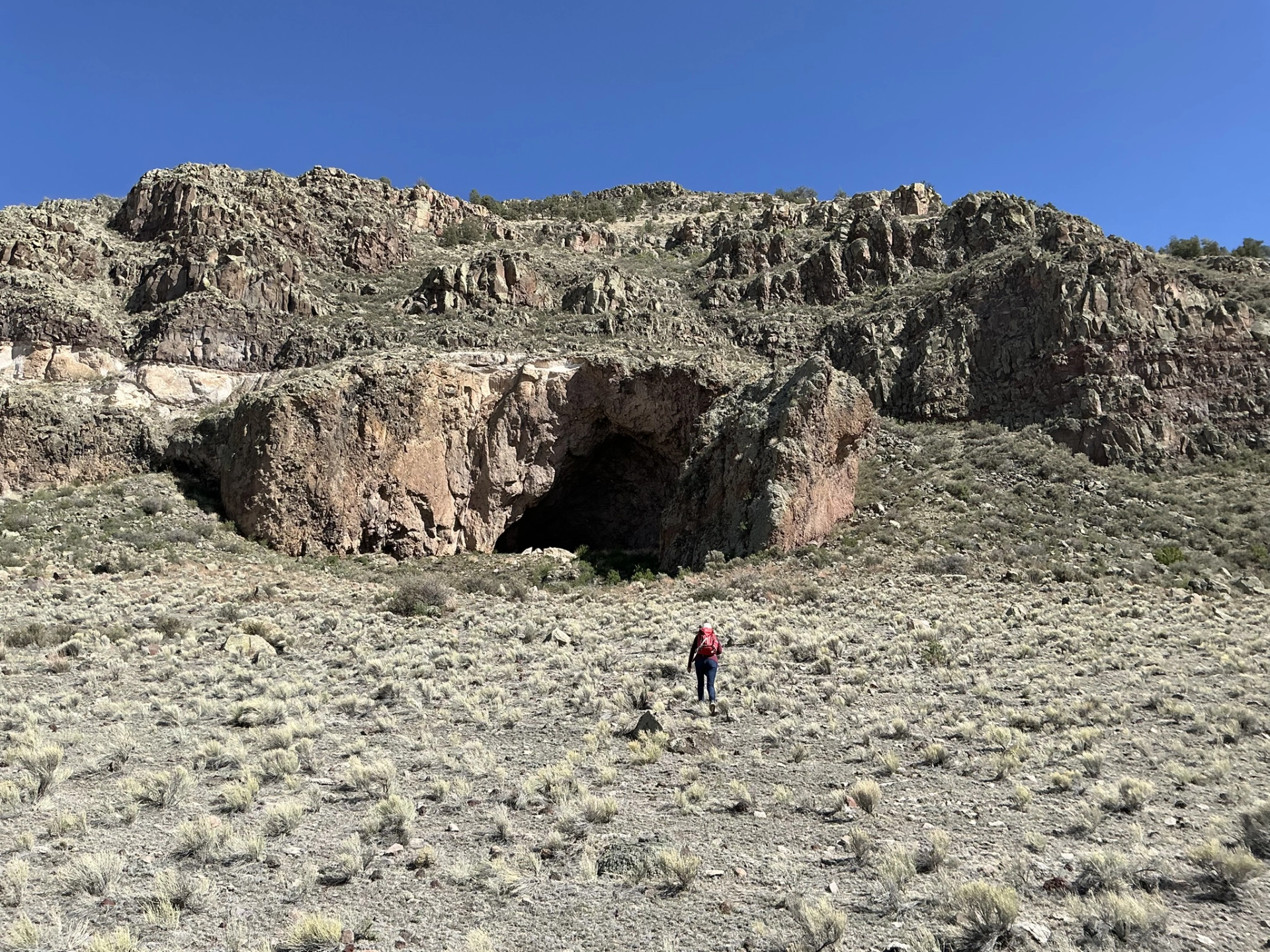
We were nearly blown over by the wind on our way to the alcove.
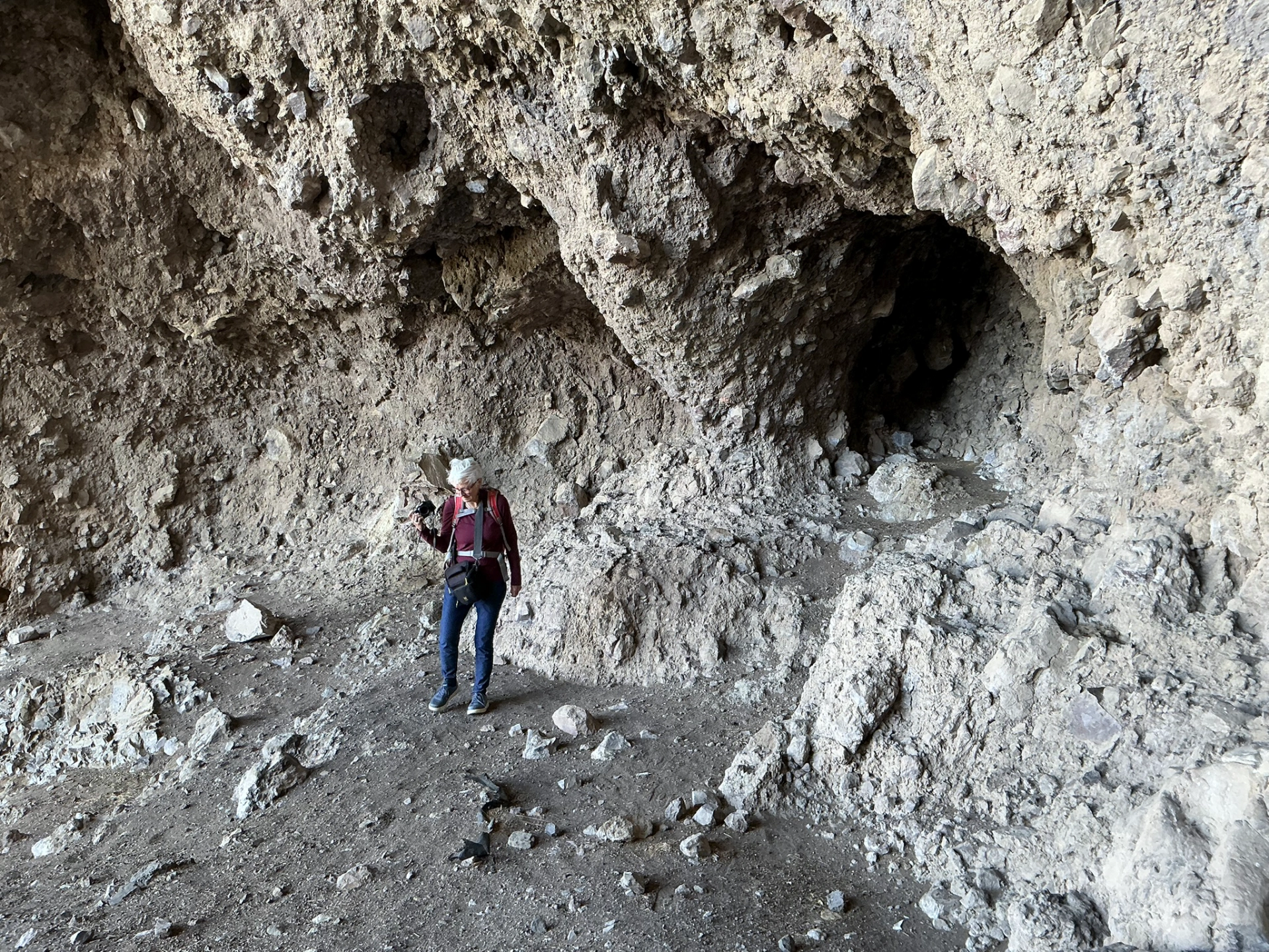
Once inside, we found a register, mostly signed by hunters visiting the area.
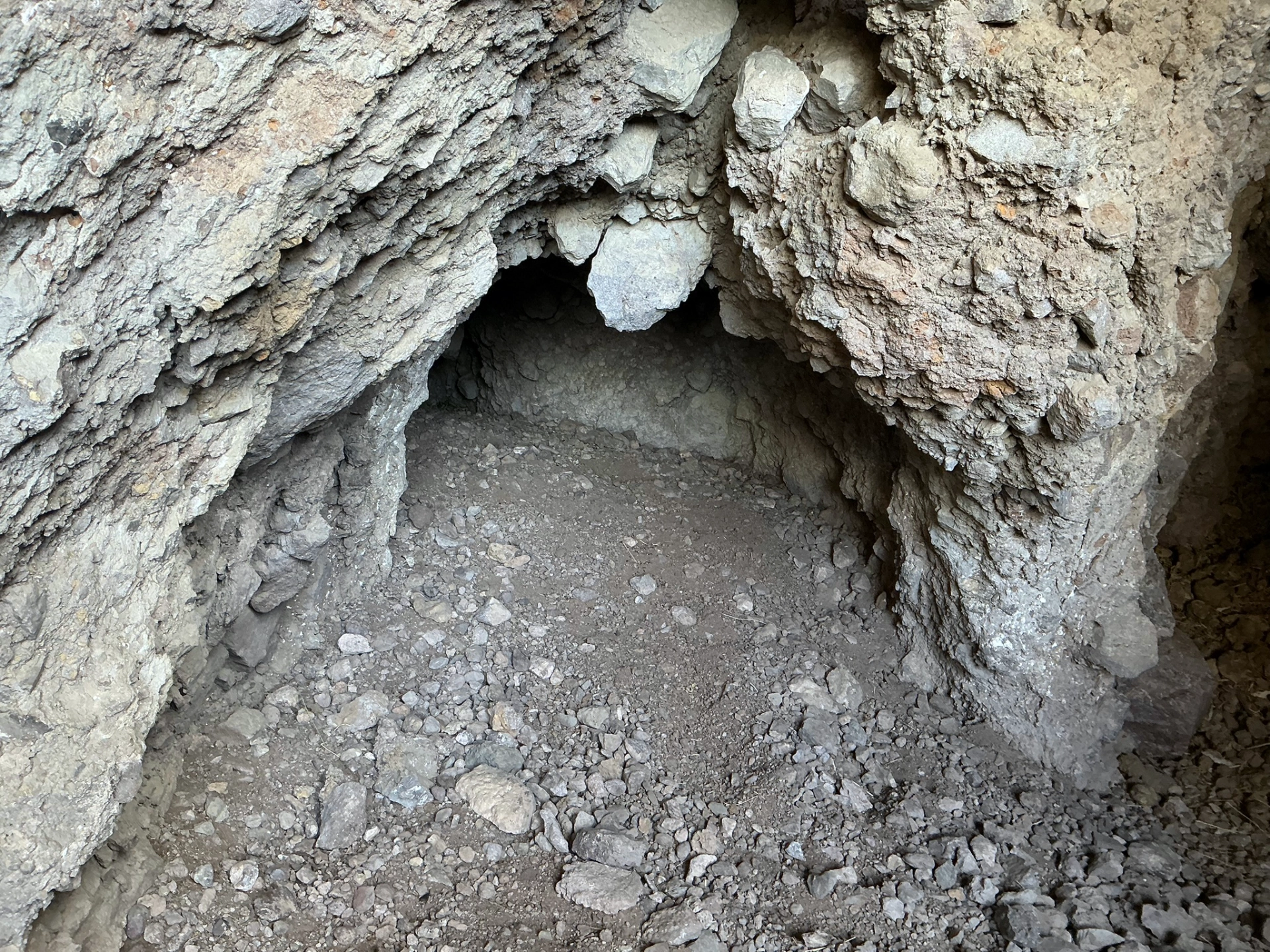
Blackened ceilings made it clear that the caves were used for habitation as well as storage.
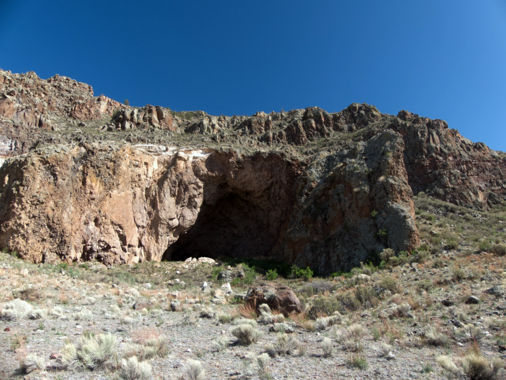
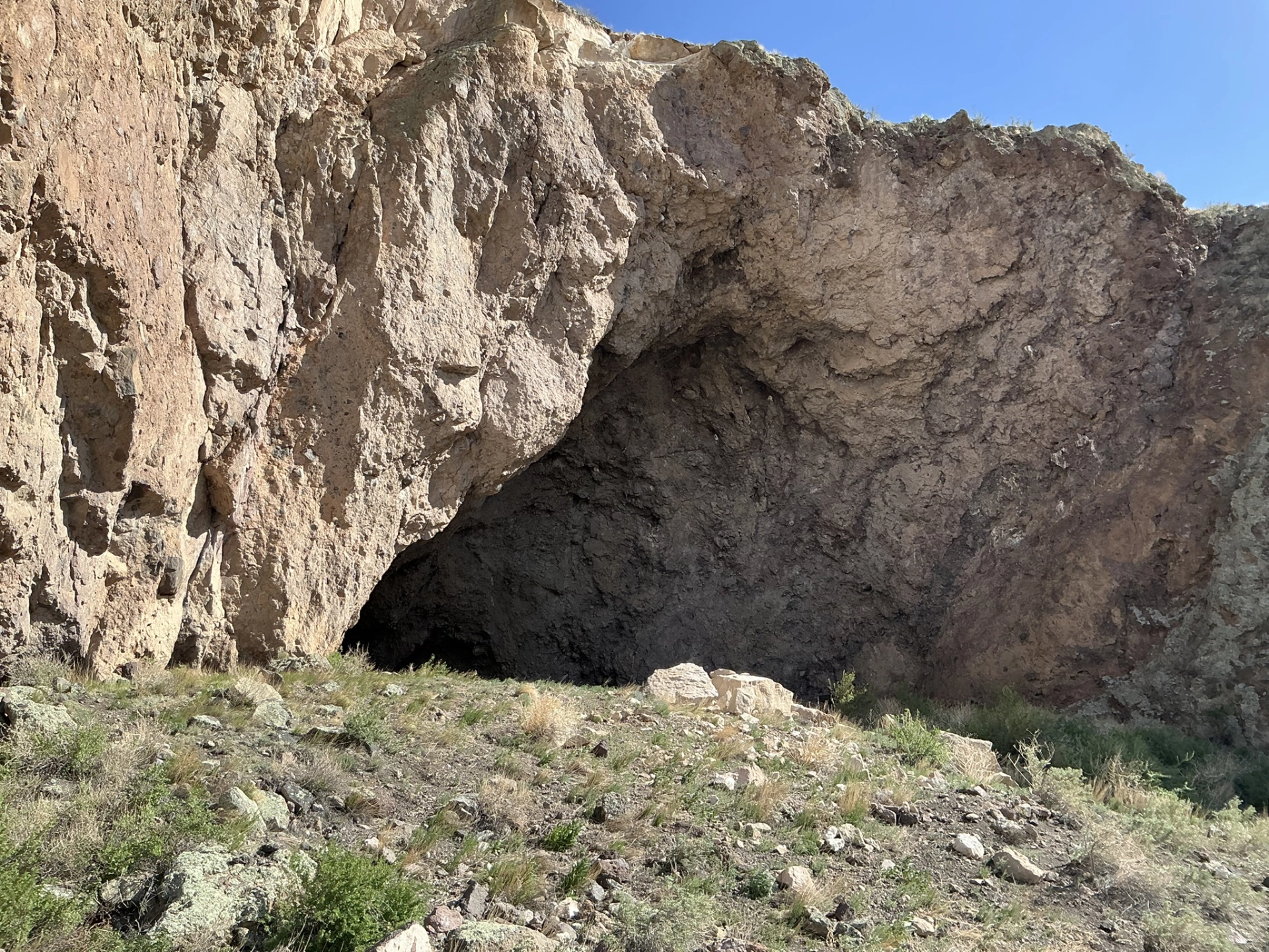
Truth be told, there is not much to see at the Bat Cave site. Whether intentionally or simply by natural weathering, the rock shelters have been filled in over time.
But just to stand there, on the edge of the ancient lake, trying to imagine that for nearly 4000 years, humans lived here, and grew maize, squash and beans and other edible plants ... it was absolutely worth it!
Mangas Mountains
On to our primary destination, the Valle Tio Vinces Campground. Well off the beaten path at 8120', the National Forest Campground seemed like a good prospect for hot-weather camping. But the campground was underwhelming — rather dark and forlorn, with a pit toilet, but no actual campsites (any that might have existed had been pulverized by stock).
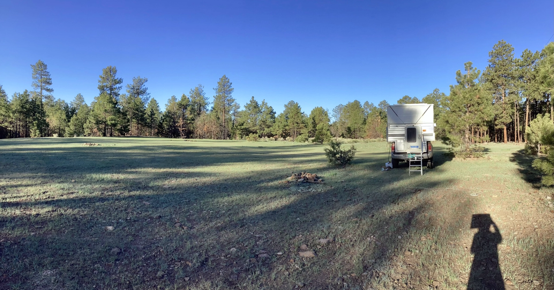
With the daylight fading, we probed various side roads, and quite by accident stumbled onto a primo site at 9000'. It was a chilly night. I measured 30° at dawn!
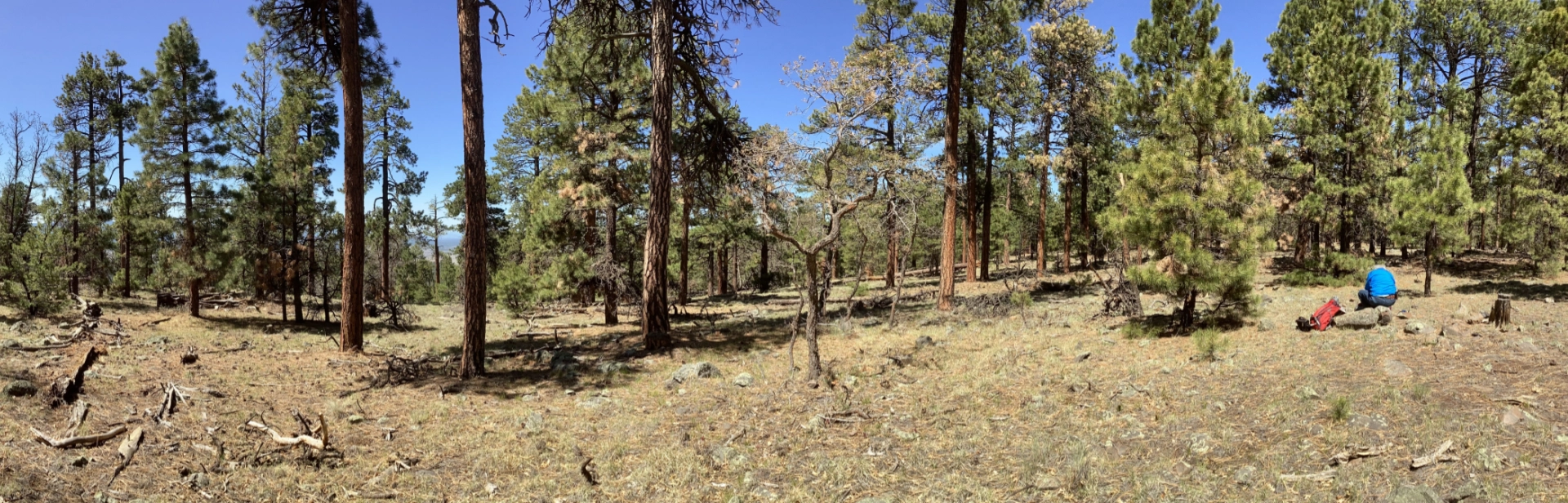
Given our elevation, we figured there must be good views nearby, so the next morning we hiked up an old forest road to an unnamed summit at over 9100'. There were glimpses of epic landscapes through the trees, but no real panoramas. Just a lush and lovely Doug Fir and Ponderosa Pine forest!
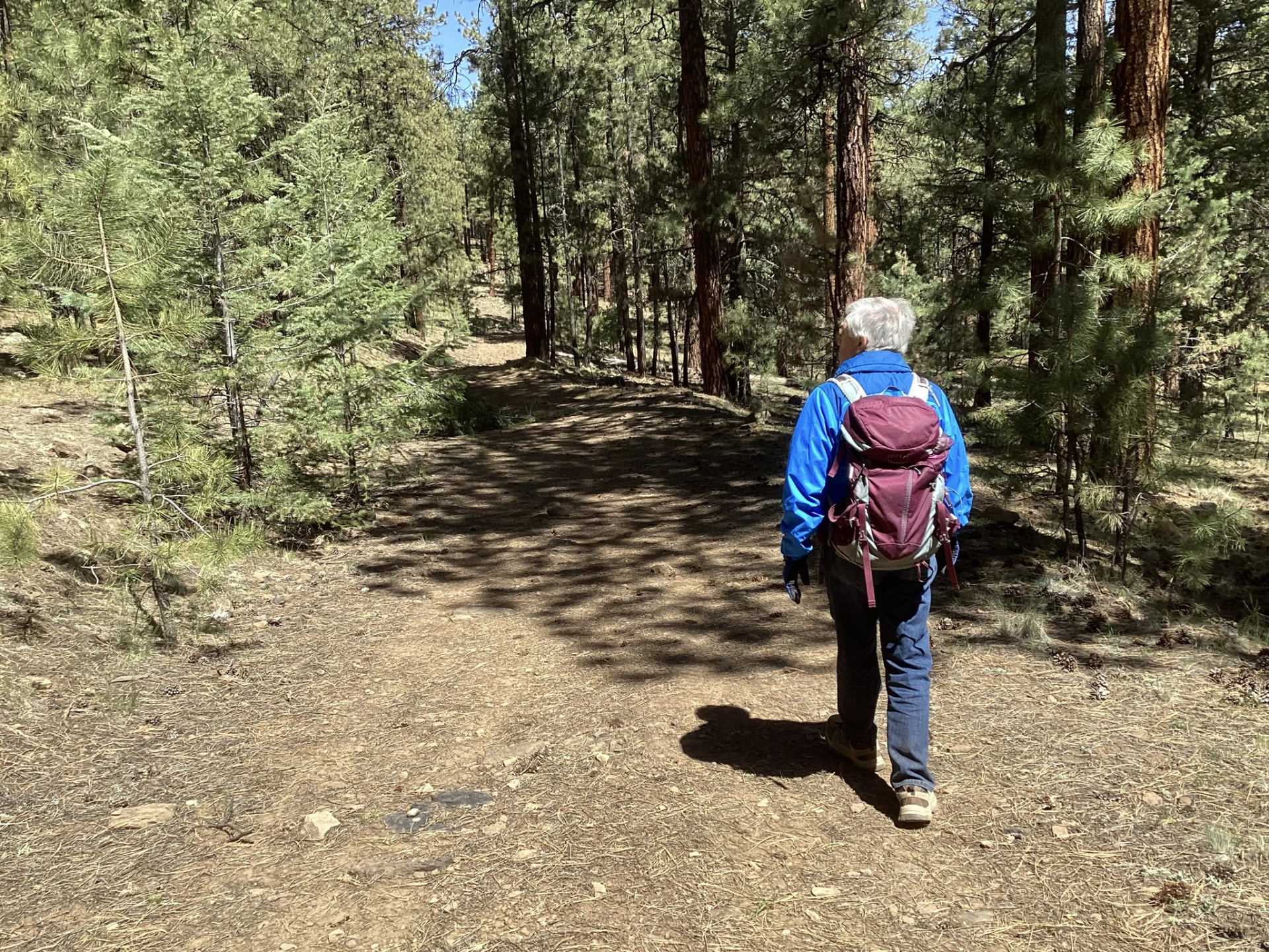
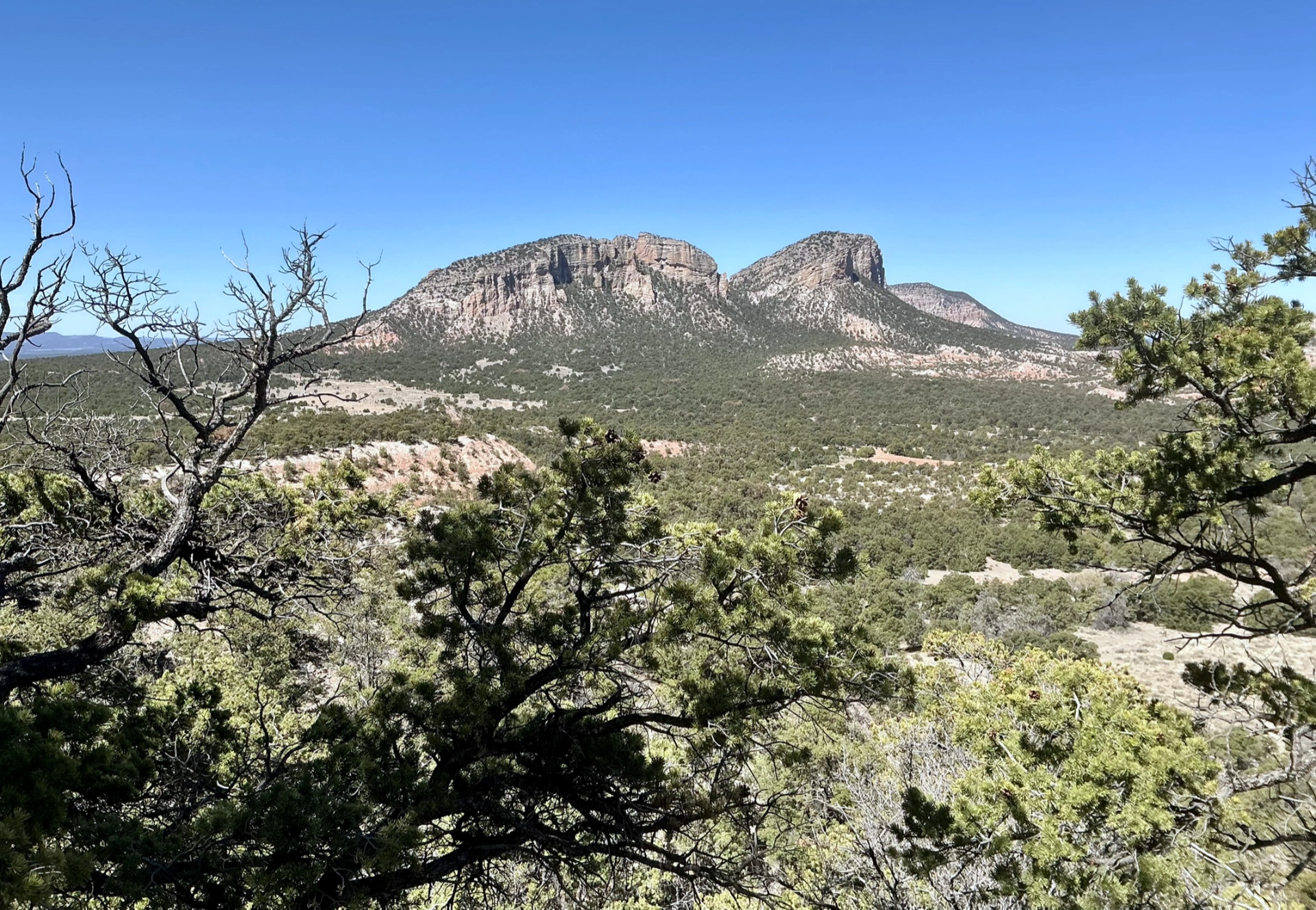
After a quick exploration of Slaughter Mesa, we retraced our steps to see if we might drive or hike — or some combination thereof — to the lookout on Mangas Mountain.
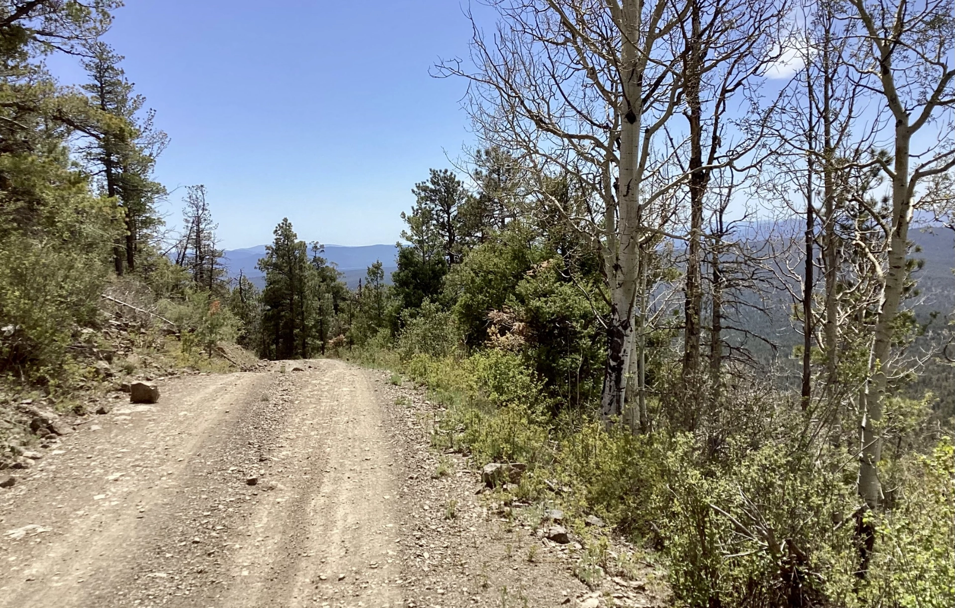
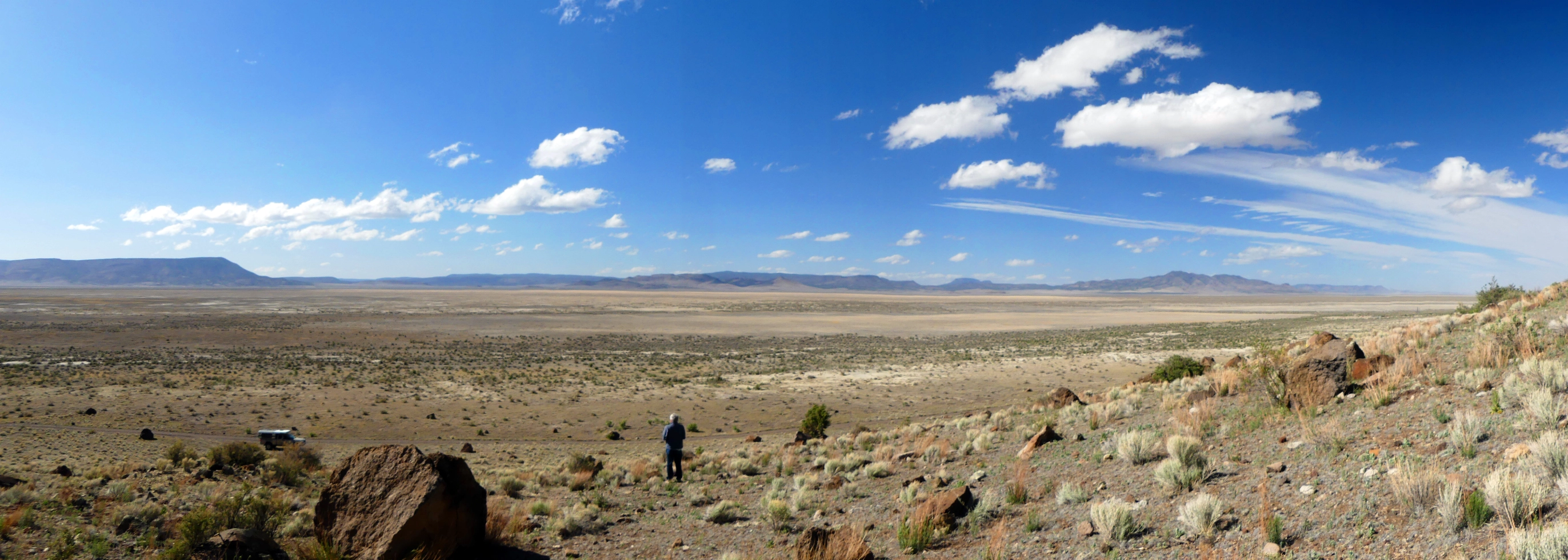
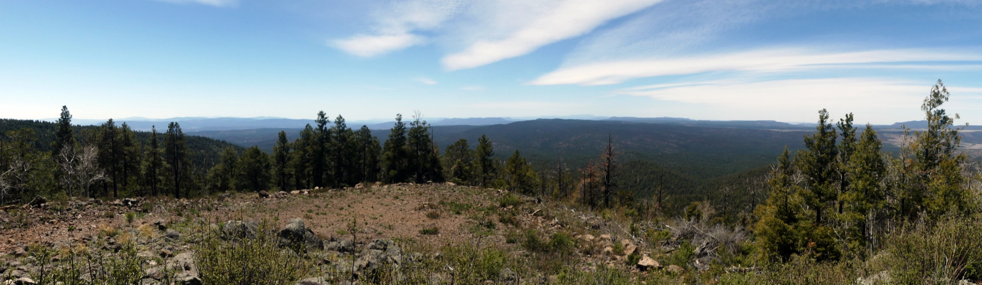
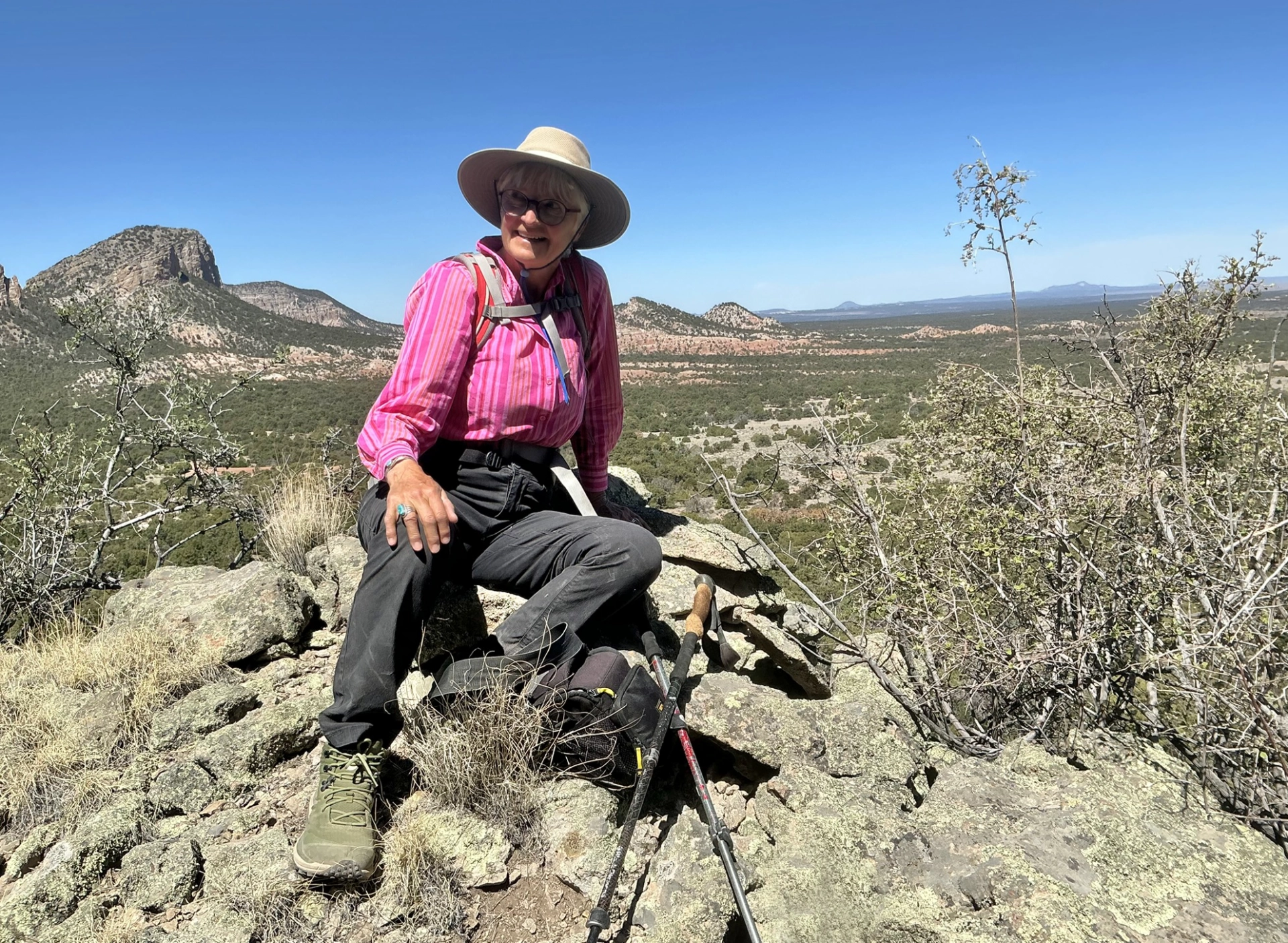
The road was in great shape and the views across Slaughter Mesa and the Plains of San Agustin were stupefying!
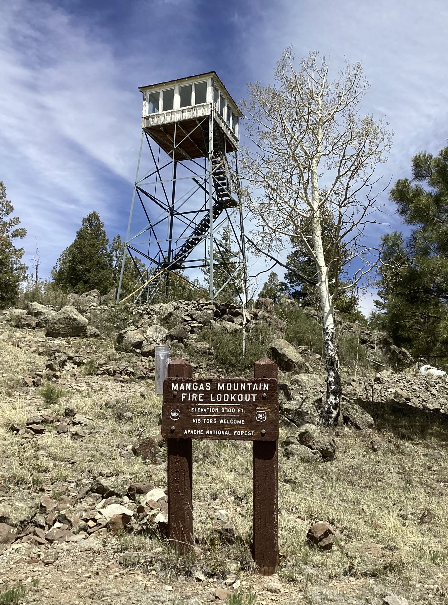
These days most lookouts don't welcome visitors, so we were delighted when Patrick, the lookout, motioned us to come on up. I made it to the last flight of steps when a powerful gust of wind knocked me flat. I eyed the tiny hatch overhead and nope, nope, not going up there! But Dennis made it to the cabin and had a great conversation with Patrick. This lookout was built in 1934 by the Civilian Conservation Corps. Both the wood cabin and the steel tower are original equipment, and looked like they could use a little TLC — a coat of paint and a new roof, for starters!
We huddled in the sun, made a picnic lunch and enjoyed the view.
Ghost Town
As always, when traveling in remote areas, it's important to get gas wherever you find it. We forgot to gas up in Reserve, so it was time for a mad dash to the nearest gas station in Quemado. We headed north on Mangas Road, which unrolled a dramatic transition from alpine forest to high desert and finally a vast, arid grassland.
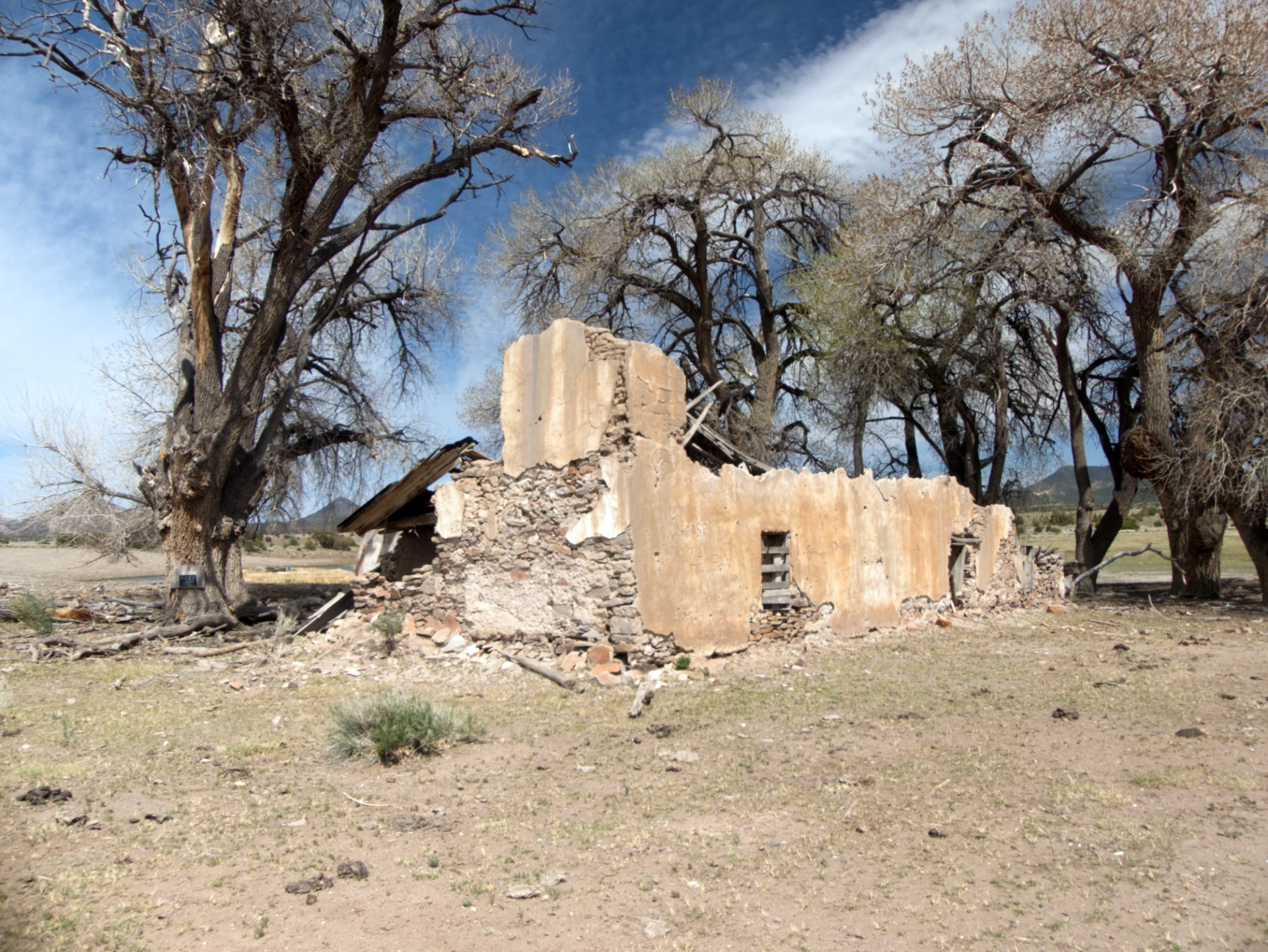
Along the way we passed by some fascinating ruins — several adobe homes and an old stone schoolhouse.
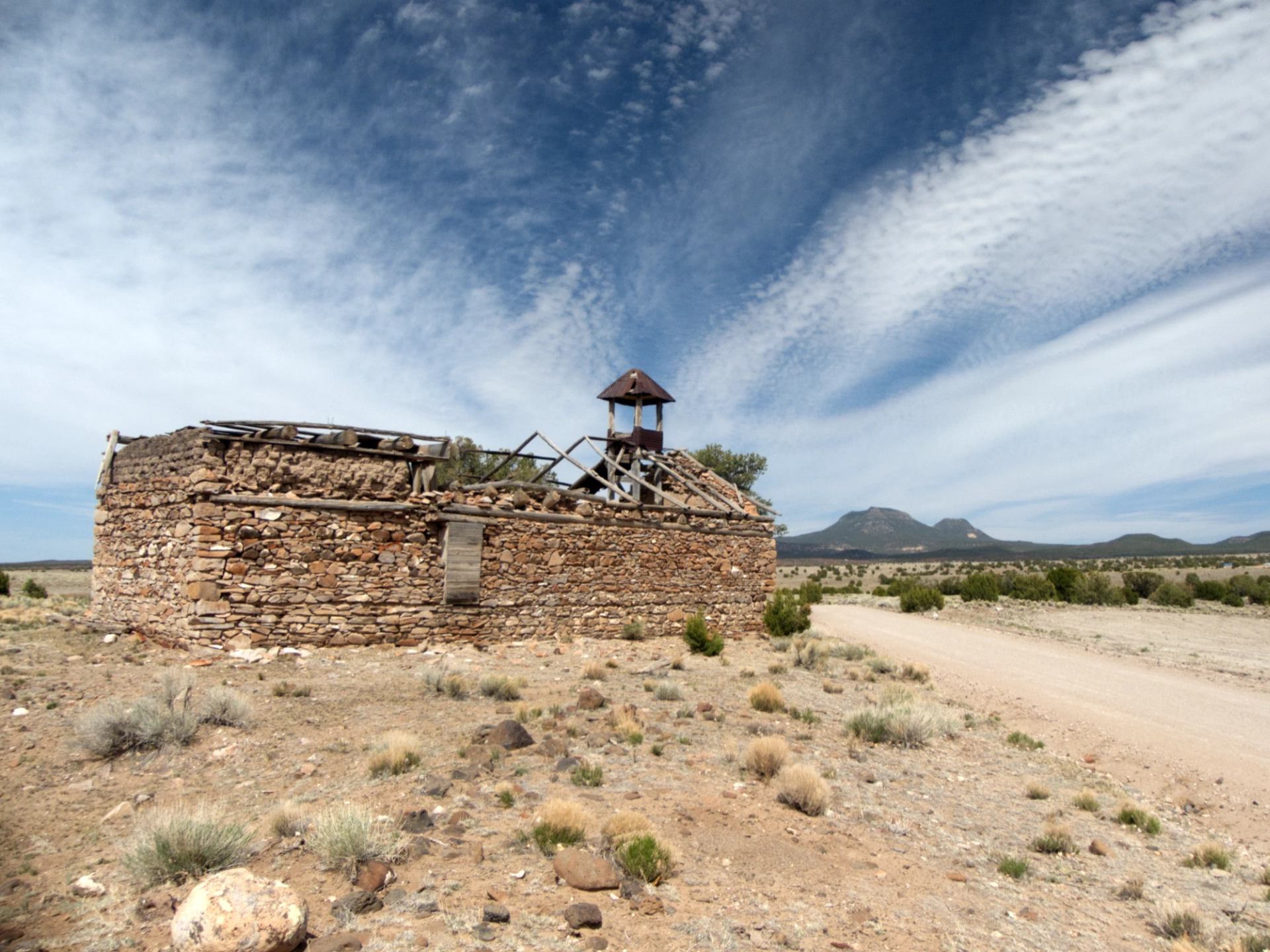
I haven't been able to find any mention of this settlement online. It sits aside a large spring, and with all those cottonwoods it must have been a lovely oasis it its day.
The Sawtooths
The gas run to Quemado put us within striking distance of the Sawtooth Mountains, so that was our next destination. Since our goal was identifying new camping spots, we decided to branch out. We drove. And drove. And drove. Not a single pullout!
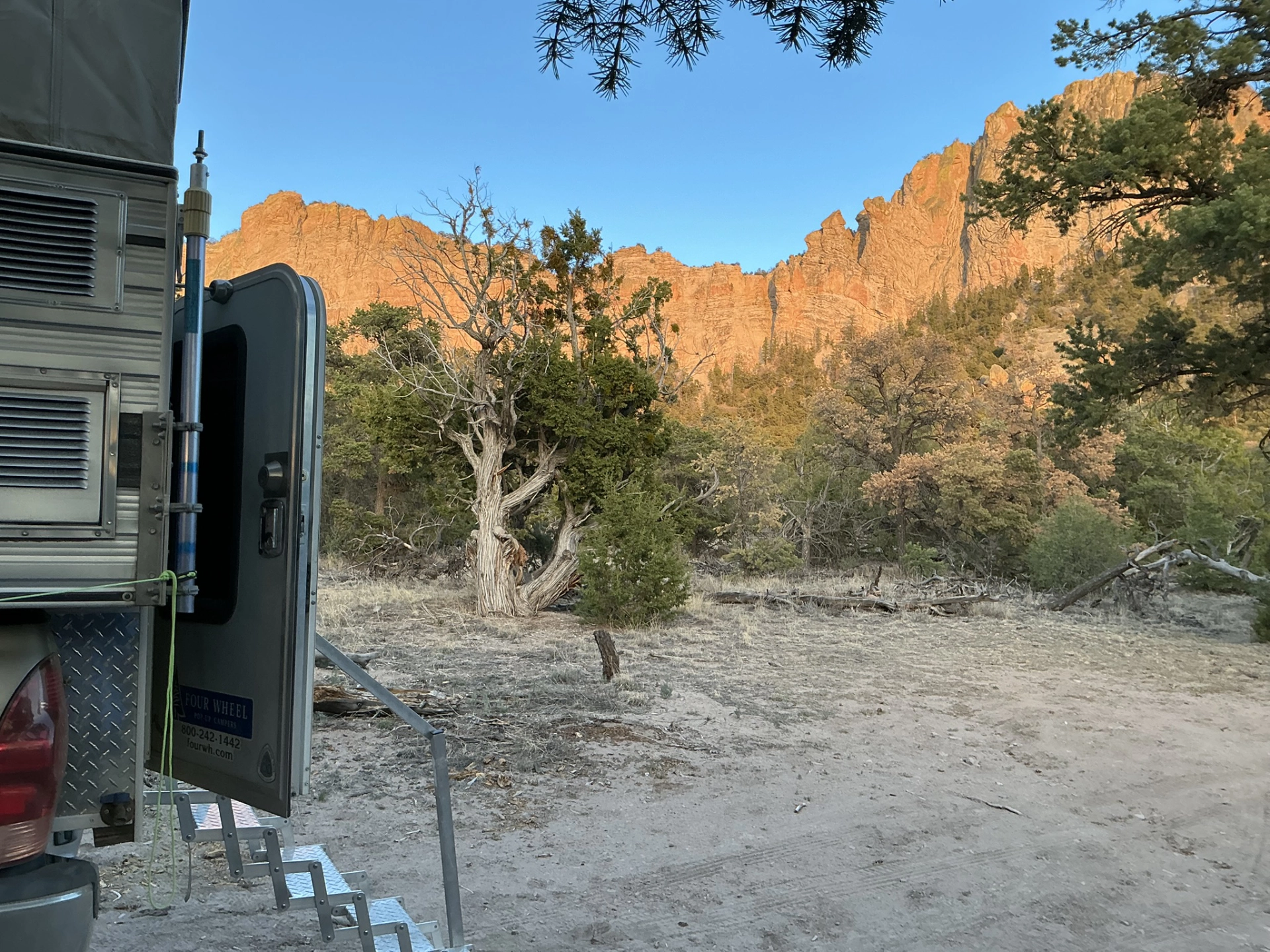
The sun was setting when we finally nabbed a spot at the end of a track close to the base of a cockscomb ridge.
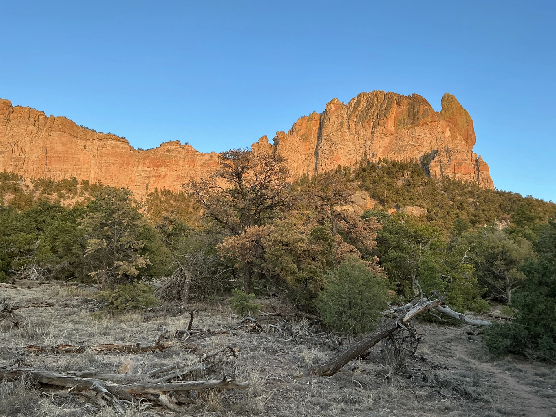
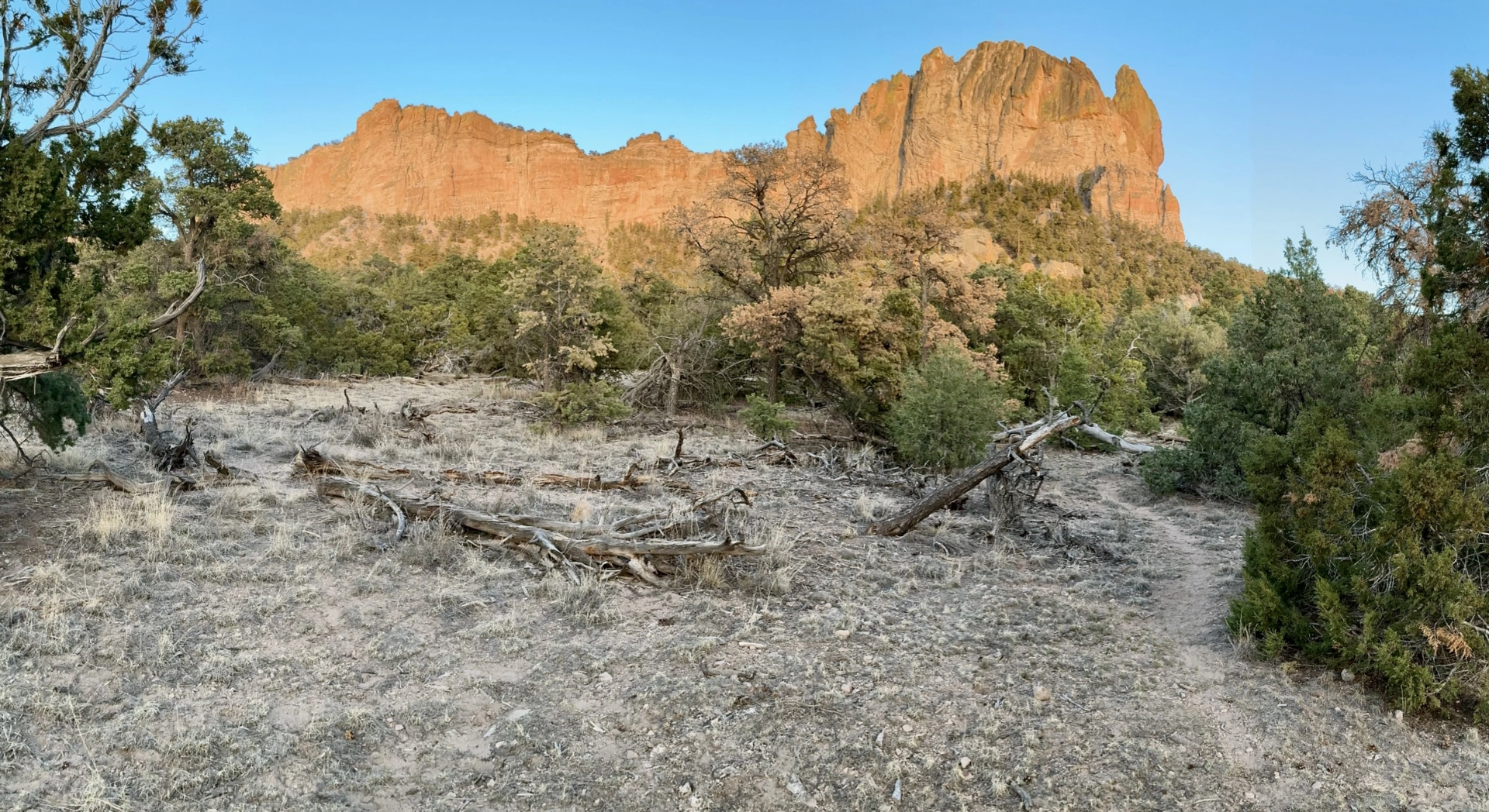
In the morning we discovered that we were camped at the head of a trail leading to a jumble of house-sized boulders along the cliff face.
Chalk marks in the handholds confirmed that these boulders are a popular spot for rock climbers.
The trail spidered out to various promontories with wonderful views of the Sawtooths.
Datil Well
After our hike, we treated ourselves to a late lunch at the Gathering Place in Pie Town. There I surprised two hikers from Montréal by greeting them with "J'aimerais vous souhaiter un bon voyage". They said they were among the last hikers to pass Snow Lake before the trail was closed, and the smoke from the Hummingbird Fire was so bad they had to wear masks.
After trying several approaches to the Enchanted Tower, which were either blocked by local ranchers with tiny inholdings, or possibly accessible via a long drive on a sketchy road, we ended up camping at Datil Well.
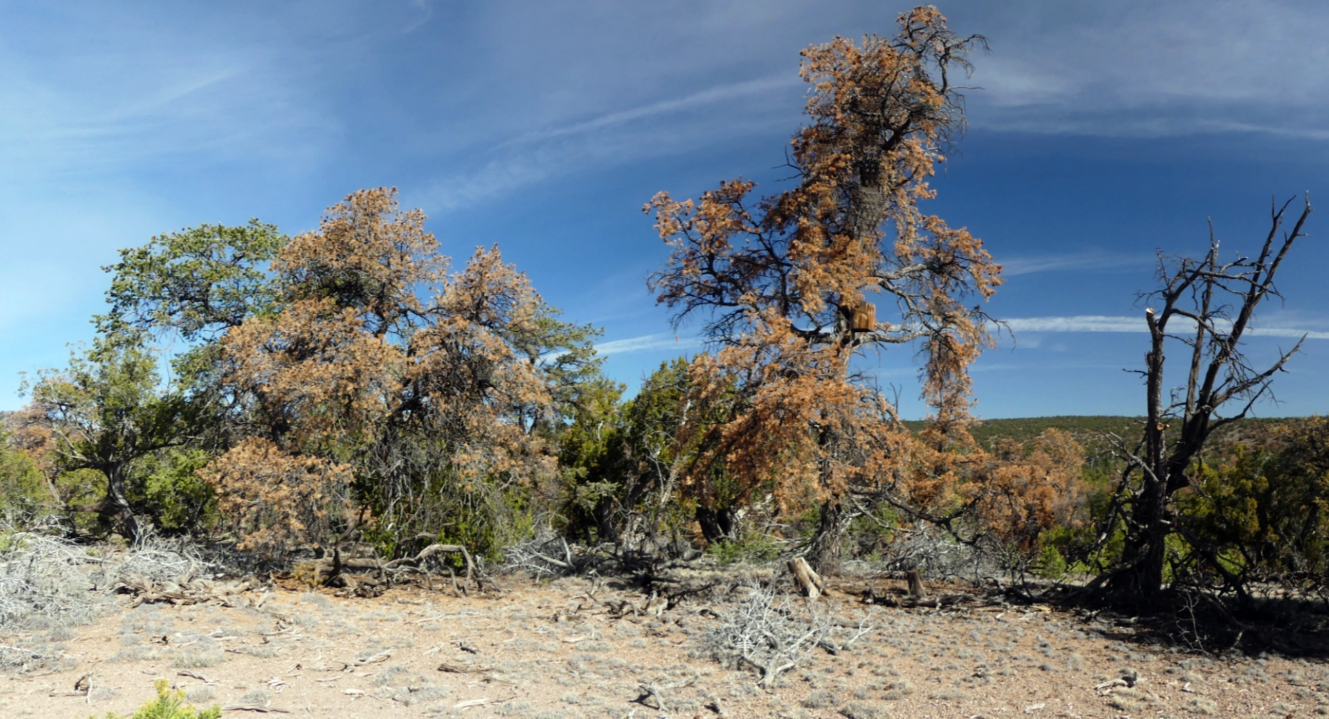
No matter where we travel, we always seem to end up at Datil Well. Such a peaceful place! But since our last visit less than a year ago, the forest has suffered an alarming amount of bark beetle damage.
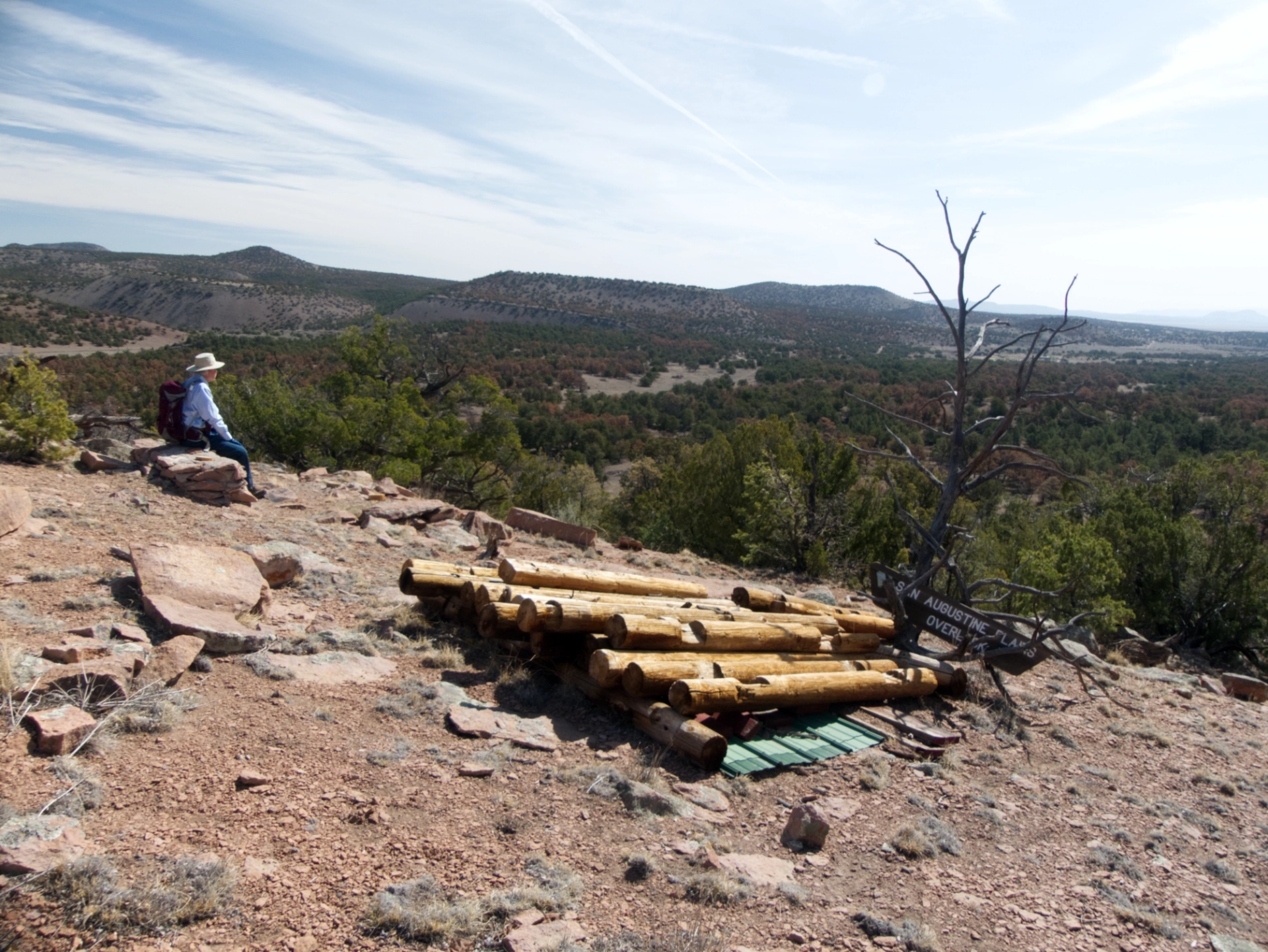
Even the San Agustin Overlook has been taken down.
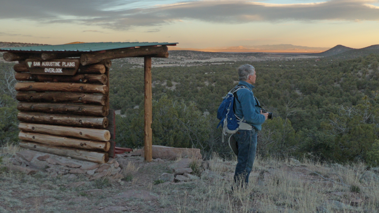
Compare with this photo at the same spot from 2017. The rusty cast in the present-day forest and even the dearth of desert grasses tells a tale that does not have a happy ending.
