Horseshoe Pass
October 24-25, 2004
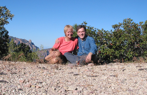
This was my first attempt to organize a two-day trek since I resumed backpacking one year ago, at the age of 50. The trip began with a day of frantic packing and four trips to Summit Hut to replace missing and hopelessly outdated equipment including my cushy but seriously overweight sleeping bag and my trusty but rusty MSR stove. The next challenge was finding a trail that would be interesting but not too difficult for two old duffers. We were focusing on the Chiricahuas to sample a bit of fall color, but many of the trails in the Crest area have been scarred by seven years of drought and attendant forest fires. So we fixed our sights on the South Fork Cave Creek area south of Portal instead. The fastest route is I-10 into New Mexico and than returning southwest via Route 80 to Portal. It took us about four hours with the required stop at the Claim Jumper Cafe in Wilcox.
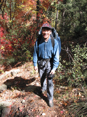
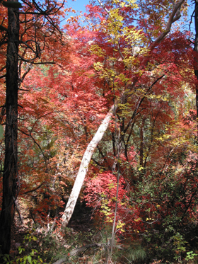
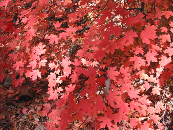
We hit the trailhead about 10:30 and worked out the kinks on a gentle 1-1/2 mile stroll along the South Fork River which was full of water from a recent rainstorm. The trail is lined with colorful red maple and yellow cottonwood and sycamores as well as some truly imposing Arizona Cypress.
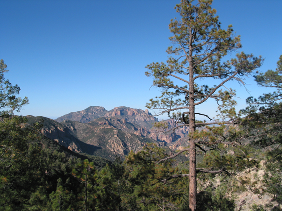
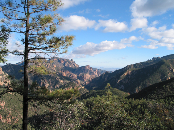
At Maple Camp, a smaller trail crosses the river and heads rather steeply up the side of the canyon. There is no water above this point -- contrary to the Forest Service web site, Log Spring below Horseshoe Saddle is bone dry. Pinon, manzanita, alligator juniper and yuccas decorate the brilliant orange-red rhyolite cliffs, and a half-mile takes you to a promontory with spectacular views in all directions. The lunch rocks overlook an extremely steep-walled canyon that is certainly a lush riparian area, and we were entertained by a golden eagle dive-bombing a gang of ravens who had encroached on his territory.
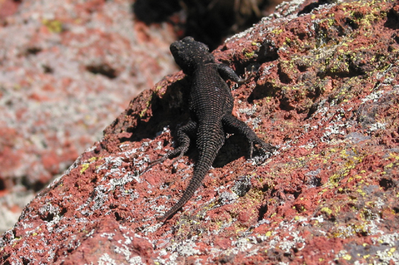
Now who is this fine-looking fellow? Jet black and as long as my hand, it's not a lizard I've seen anywhere else in Arizona.

Above the lunch rocks the trail becomes rather difficult to follow. It is seriously overgrown on the uphill side and seriously eroded on the downhill slope. We hacked our way through Manzanita jungles and scampered over downed trees and across rock slides.
Fortunately, the trail eventually opened up and distant views more than made up for the difficult trail conditions. Past Maple Camp, we encountered no other hikers and very few signs of previous visitors. Just mountains of well-seeded bear scat!
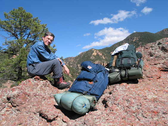
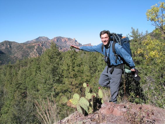
At about 3:30, with five miles of heavy slogging behind us, we emerged in a wonderfully open saddle at the top of Horseshoe Pass. To the north, we were looking down into Cave Creek and over the Peloncillo Mountains into New Mexico. To the south, another canyon falls away toward the Mexican border. Although it was quite windy, we pitched the tent in the open to enjoy the scenery.
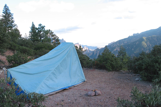
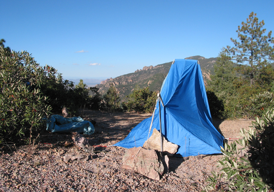
We chose Dennis' tent because it weighs three pounds less than mine. That's because, unlike my tent, it has no actual frame, and is supposed to remain erect through sheer force of will. During the night, the wind became even stronger and the tent spun around like a luffing topsail, releasing a shower of condensation with every contortion. Oh well, sleep is overrated ...
Thanks to the front, the temperature only dipped into the 30s, although we were camped out at 7200 feet.
The return trip was considerably easier, although once again we lost the trail several times. This is a challenging but very rewarding hike, and is probably one of the easiest trails in the Chiricahuas, with a vertical rise of only 2500 feet over a distance of five miles. Highly recommended!
