Chiricahua Crest
November 4-6, 2005
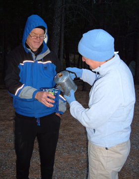
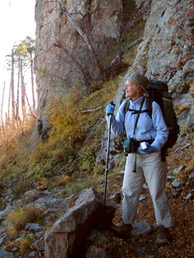
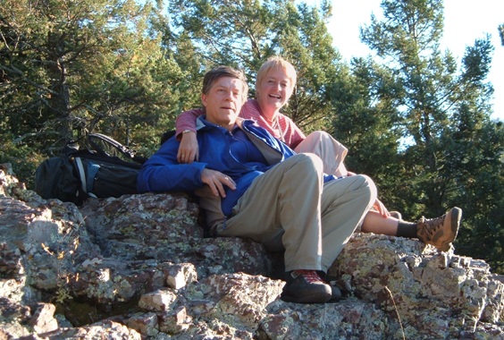
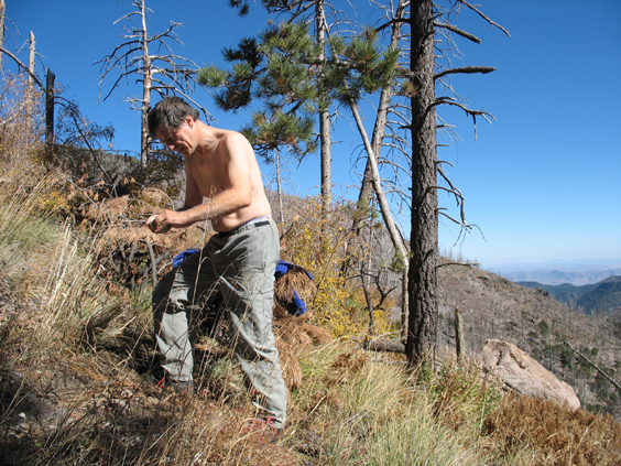
In honor of my 52nd birthday, six friends gathered high in the Chiricahua Mountains. Patrick came all the way from Chicago. He and David met us for dinner Friday night at the Desert Rose Cafe in Safford. It takes more than an hour to cover the 30-odd miles of serpentine gravel road in Pinery Canyon, and it was nearly 10 pm before we pulled into Rustler Park. The park is officially closed for the season, so we pitched our tents in the parking lot. David rousted us while it was still dark of course. I made a pot of coffee in the morning, but since Patrick has converted to ultra lightweight backpacking, I had to served it to him in a used tuna fish envelope (yup, that's what he had for breakfast). Here he is enjoying his "Café Bon Thon."
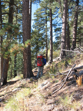
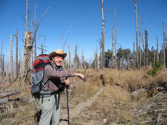
After jettisoning his tent, David and Patrick disappeared up the trail at a jog. During the next three days, they would log nearly 24 miles -- all of it above 8000 feet. Dennis and I lingered over a decadent breakfast of seared ham and cheddar cheese on grilled onion bagels. Then we trundled off with 37 pounds of dead weight apiece.
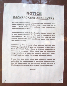
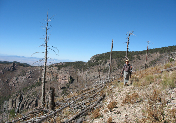
Our only other backpack in the Chiricahuas was Horseshoe Pass in October, 2004. A fire devastated the Crest Trail in 1994 and there are many reports on HIKEAZ and elsewhere of downed trees, poor trail conditions and marauding bears.
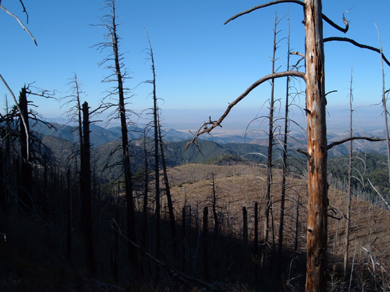
We did not see any evidence of bears on the main trail -- the deposits were obviously horse pucky and not bear scat. And while there were plenty of downed trees, the trade-off was stupefying views in all directions. About one mile out, we sensed the possibility of an overlook and scrambled a short distance up Bootlegger Trail. On the ridge we were literally blown away -- both by gale-force winds and by a sea of large mountains 2000 feet below us glimpsed through a holocaust of burnt Ponderosa Pine.
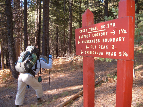
The Crest Trail takes off from 8300 feet and never drops below 8000. Although there was minimal climbing compared to most of our hikes, we were keenly aware of the +6000-foot difference in elevation.
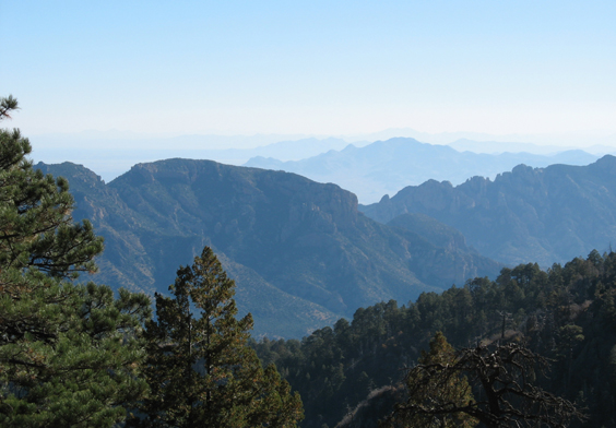
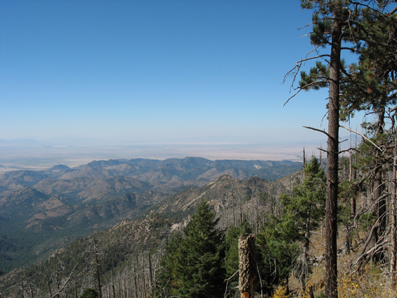
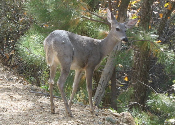
The first unobstructed view, looking northeast towards Cave Creek.
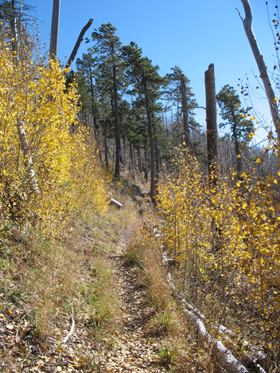
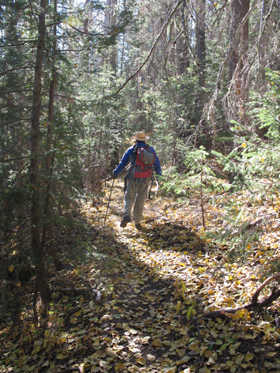
At 1-1/2 miles, there's an unnamed park with a lovely meadow, a big fire ring and a rocky knoll with great views to the west. Above this point, the trail alternates between patches of dense pine forest and naked ridges littered with the bleached bones of burnt timber. But aspen have taken hold in the burnt areas, and on this bright and windy day their leaves were dancing a jig.
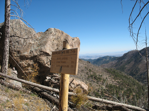
We stopped for lunch at Round Park, 3.4 miles out. The trails to Bear Wallow and Booger Spring take off from this park but are barely visible from the main trail.
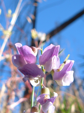
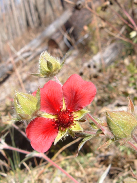
I underestimated the temperatures by about 10 degrees. I was figuring on 30s at night and 60s during the day. In fact the nights were well below freezing and daytime temps tottered around 50 degrees. Nevertheless there were some splendid flowers along the trail (desert lupine on the left).
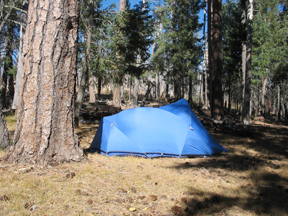
We reached Anita Park about 1:30. Although we'd only hiked 4-1/2 miles, we decided to make it a day. My tent in all its +7 pounds of wonderfully weatherproof glory.
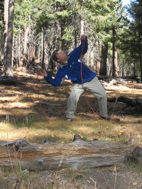
The sun was warm and I wrote in my journal while Dennis practised for the Bear Rope Toss Olympics.
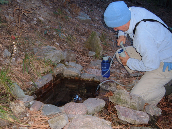
We were carrying nine liters of water but since we weren't sure the springs were running, we topped off our tanks at Anita Spring, a steep 1/8 mile below Anita Park.
Just before sunset we scrambled up the hill to watch the sun set. Although there's no sign of it today, Dennis remembers that 30 years ago the flat spot at the top of the hill was a helipad. Do you remember when there fire towers and forest rangers, and when you could actually call the Forest Service and get information on the latest trail conditions? Then you must be older than dirt!
Looking west toward the Willcox Playa and the Dragoon Mountains. From the ridge, we were able to contact Patrick and David by radio. They were making their way back to Juniper Spring, having hiked all the way to Sentinel Peak. They reported that Price Trail is in good condition, but Sentinel Peak is "dismal." They bushwhacked back down the mountain with night falling and more than 12 miles behind them.
Anita Park is at 9500 feet, so there was a hard frost overnight, the wind continued to howl, and the naked trees cried out for their long needles and their warm sap.
Early the next morning, liberated from our backpacks, we sauntered over to Chiracahua Peak and then took a side trip to Ojo Agua Fria. This trail was quite steep and in very bad condition. There was a trickle of water in the stream but the spring itself was totally obscured by downed timber. There was bear and big cat scat near the stream. The only thing to recommend this trail is the geode "factory" that litters both sides of the saddle between Chiricahua Peak and Snowshead Peak with peculiar egg-shaped stones.
The sun was warm, the winds were finally calmed, and the views were superb from the exposed ridge. We followed it around all the way to Juniper Spring -- the perfect spot for lunch and a bird bath.
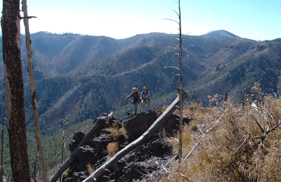
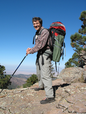
A few minutes later we encountered the only other hikers we would see this weekend -- a group of five sturdy souls our age or older halfway through a 13-mile day hike from Herb Martyr Dam to the Crest and back via the Greenhouse Trail. One of them took this photo of us from the ridge looking south toward Monte Vista Peak. A controlled burn is visible in the distance.
Smoke and all, David and Patrick followed the Raspberry Ridge Trail to Monte Vista Peak.
For David, this was the highlight of their trip.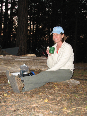
We circled around the south side of Chiricahua Peak toward Chiricahua Saddle, but turned back when the trail began switchbacking steeply toward the southwest. David and Patrick navigated past this point with the aid of a GPS. Back at Anita Park, we were joined by Ruth who had driven up that afternoon from Phoenix, and later by Nick and Christie, returning from Chiricahua Peak. Ruth had backpacked in three boxes of wine, but we were almost was too cold to drink it! That night there were five tents -- at Anita (aka "Singing Zippers") Park. At left, Ruth with her morning cup of tea.
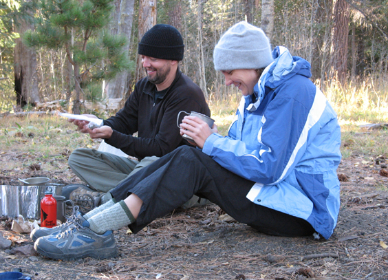
Nick and Christie making breakfast.
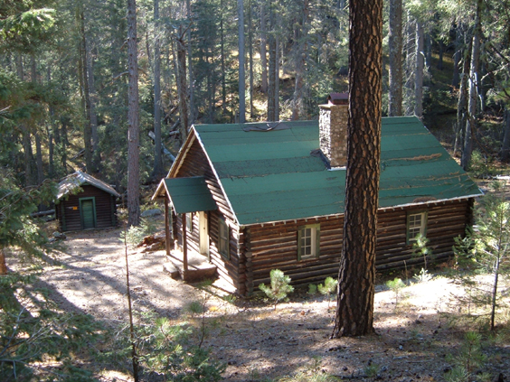
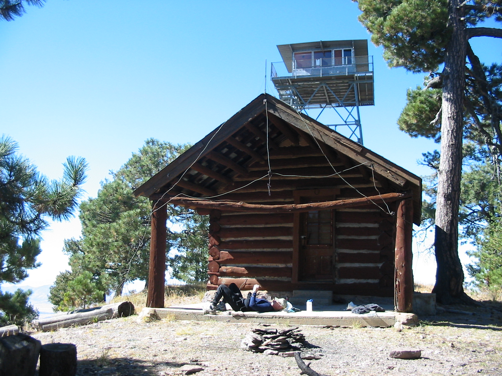
Awakened at an unseemly hour by some homeless guy with the bivvy sack and a tarp, we slowly made our way back to Rustler Park, with a side trip to Cima Cabin.
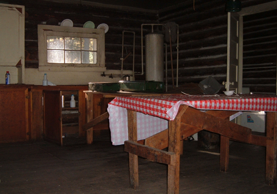
Some 30 years ago, Dennis and Tom and Kit and a lost dog named "Beauregard" took shelter in this cabin from a violent thunderstorm. The wooden chair where Dennis spent the night is still in the same corner.
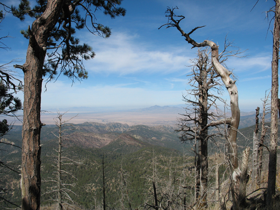
One last view, looking northwest toward Dos Cabezas and Mount Graham.
The Crest Trail -- fire damage and all -- is still one of the best long-distance treks in southern Arizona.