The Far Side of the San Franciscos
White Horse Hills and Hart Prairie
July 10 - 23, 2020
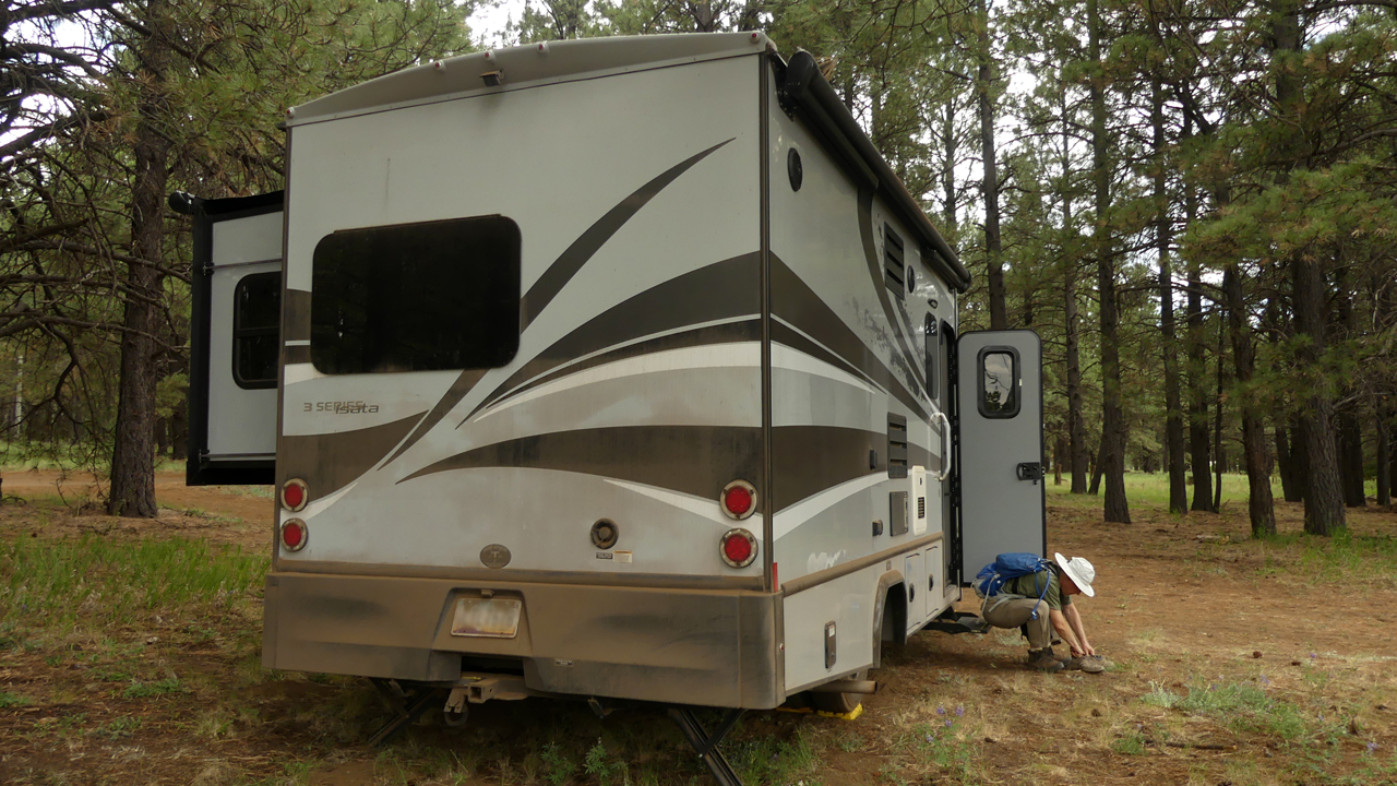
Instead of purchasing a summer home, which we briefly considered, we bought a small RV, with the intention of using it to spend most of the summer camping and hiking in northern New Mexico. After months of preparation, we packed Dyna with a 21-day supply of everything we needed, aiming to leave town on July 10. But a few days before our scheduled departure, I stumbled across the news that in order to protect itself from the COVID-19 surge in neighboring Texas and Arizona, New Mexico was requiring a 14-day quarantine for out-of-state visitors. I spent a couple of days thrashing around for an alternative destination, but none of them had the same cachet as the Pecos Wilderness. Meanwhile, Tucson's 10-day forecast called for temperatures of 108 to 113° with not a drop of rain in sight. The extraordinary heat wave meant there would be no comfortable place to camp below 8000 feet. Finally, Dennis suggested we just head north, aiming for the high country on the back side of the San Francisco Mountains, and while initially I wasn't keen on the idea, it met the criteria for elevation, dispersed camping and close-in hiking options.
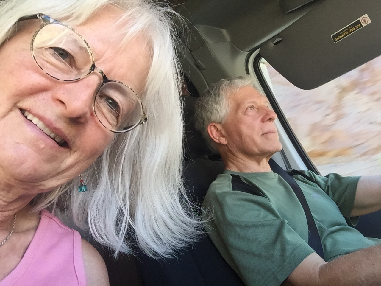
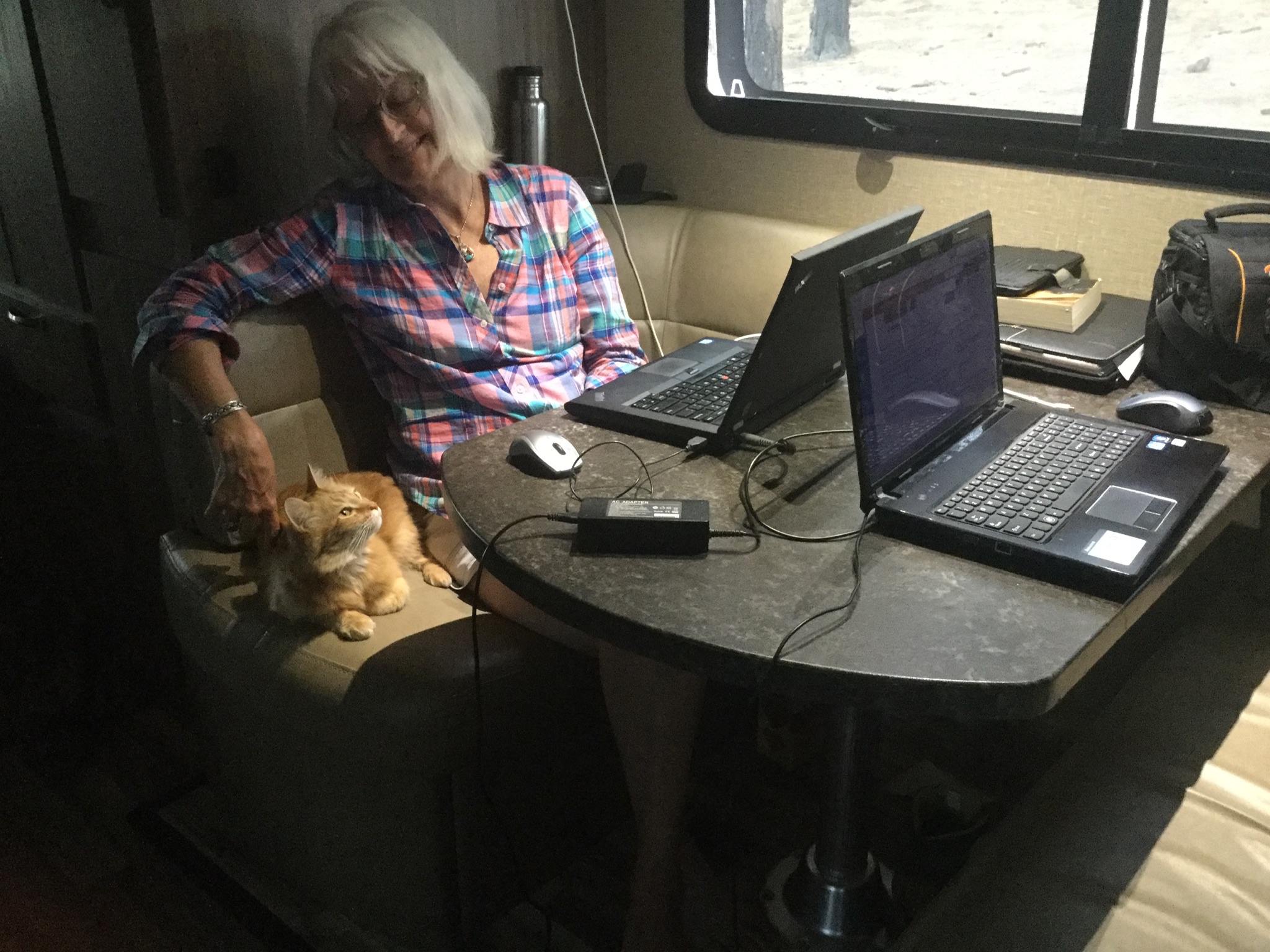
In the escape pod. Take her to Warp 5, Captain!
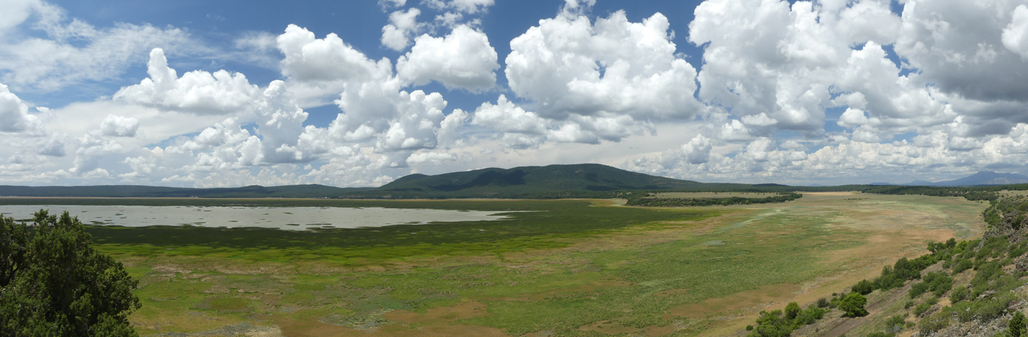
Near Mormon Lake. Some news stories are calling 2020 "the summer of the RV", as Americans look for safe ways to get away during the Covid-19 pandemic. In the campgrounds near Clint's Well and Happy Jack, we saw hundreds of RV and tent campers packed tightly in every available spot. We kept going, foolishly aiming for dispersed camping near Marshall Lake, only to find every possible site occupied. We ended up in a boulder field north of the lake, feeling just a bit out of place among the converted school buses and pop-up tents flying giant "Trump 2020" flags. But it was fine for one night, and we were on our way early the next morning.
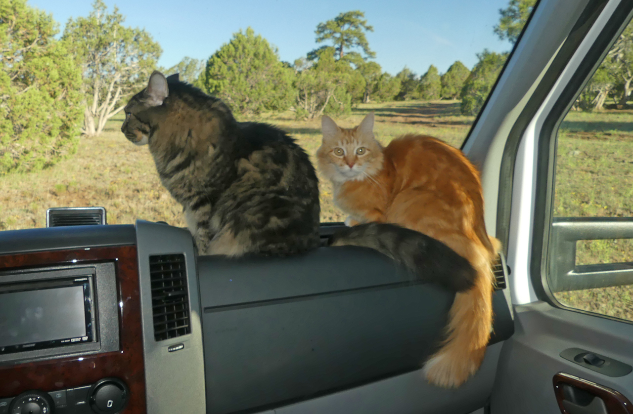
"Can someone please explain why the view from our living room window keeps changing?"
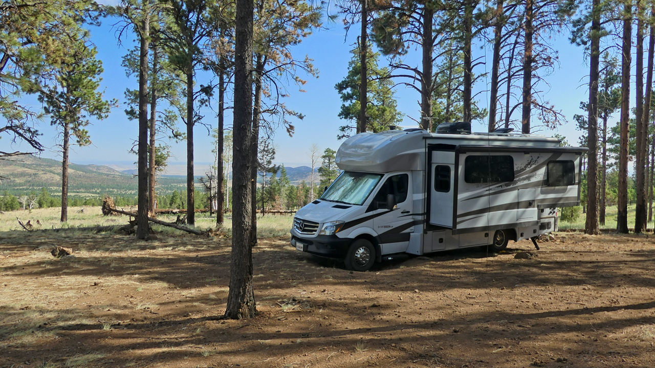
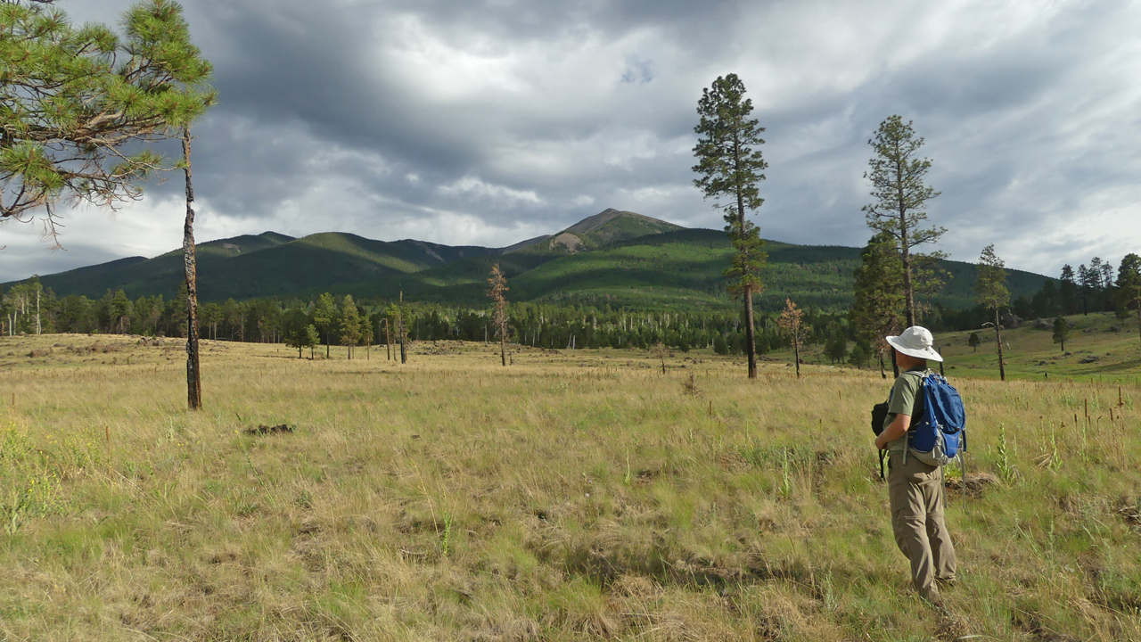
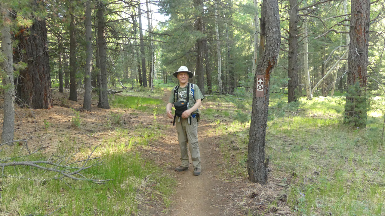
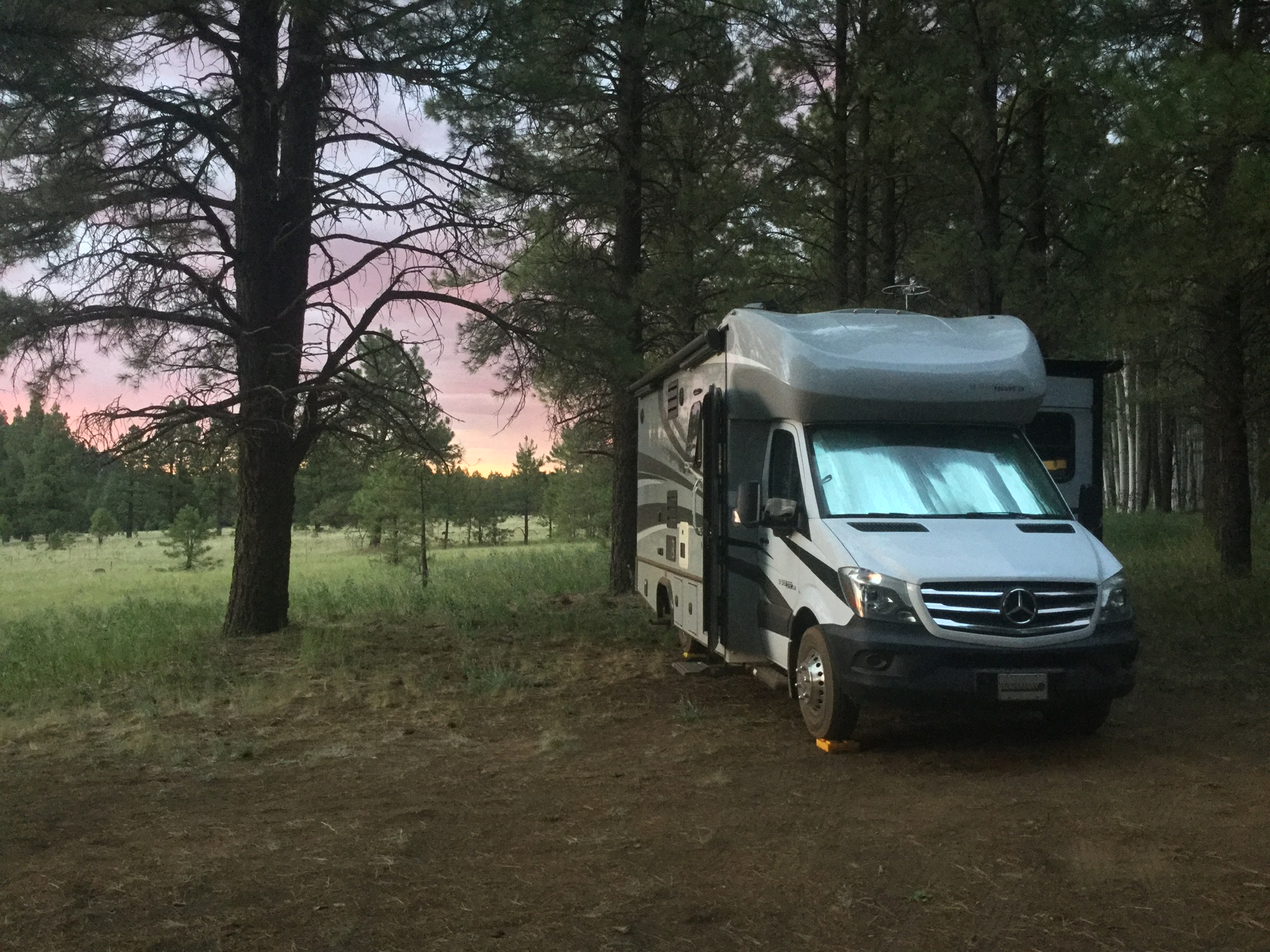
Well north of Flagstaff, we headed west on a forest road, and were immediately cheered to see an abundance of fine campsites with a steady three bars of internet. Above 8000 feet, most sites were occupied, but the views were astonishing. Dennis noticed that one couple in a prime spot might be packing up, and by the time we got turned around and came back, they were gone! We managed to level up by jamming one front tire into an old fire pit and using blocks and stones to jack up the rear end. It was truly a five-star campsite! Below us, a yellow grass meadow rolled down to a dense pine forest and a long green valley, with the cinder cones north of Sunset Crater in the distance. Behind us loomed mighty Humphreys Peak, Arizona's tallest mountain (12,635').

"Are we there yet? Is it safe to come out now?"
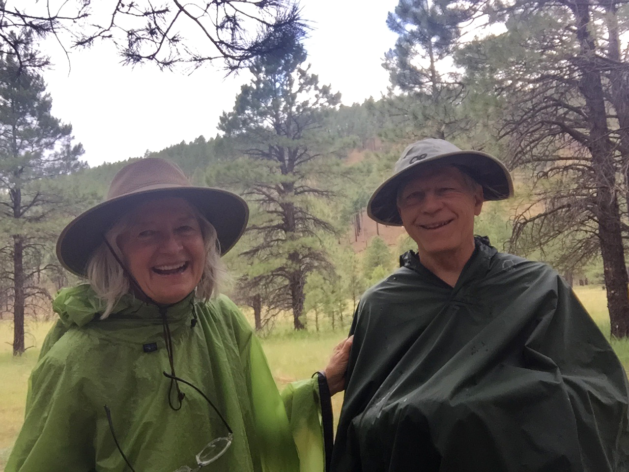
The first drenching rain rolled in that afternoon, but by 4:00 pm the sun was out and hiked cross-country toward the nearest cinder cone.
We quickly stumbled across a fine trail that wraps around the cones, scarred by wildfire but now sprouting lush grass and young aspens.
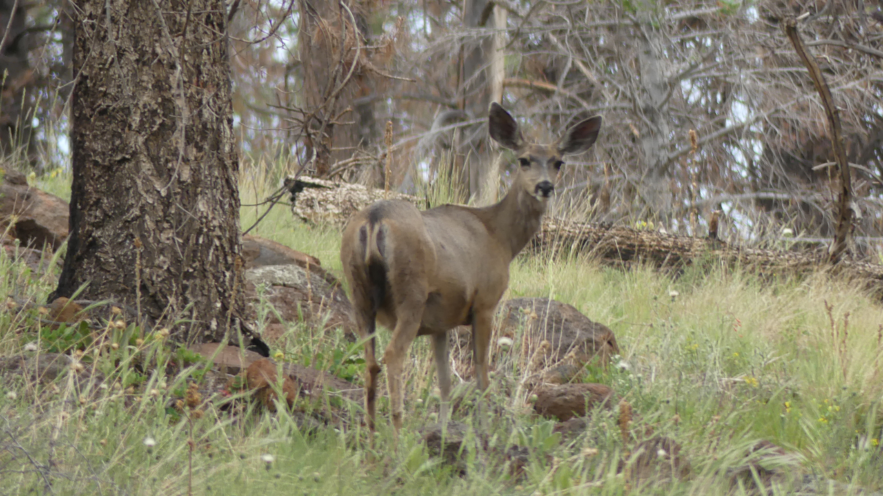
A family of mule deer calmly regarded our approach, posing for many photos.
An unforgettable view of Humphreys Peak.
Charred Ponderosa pines, glowing burnt orange in the setting sun.
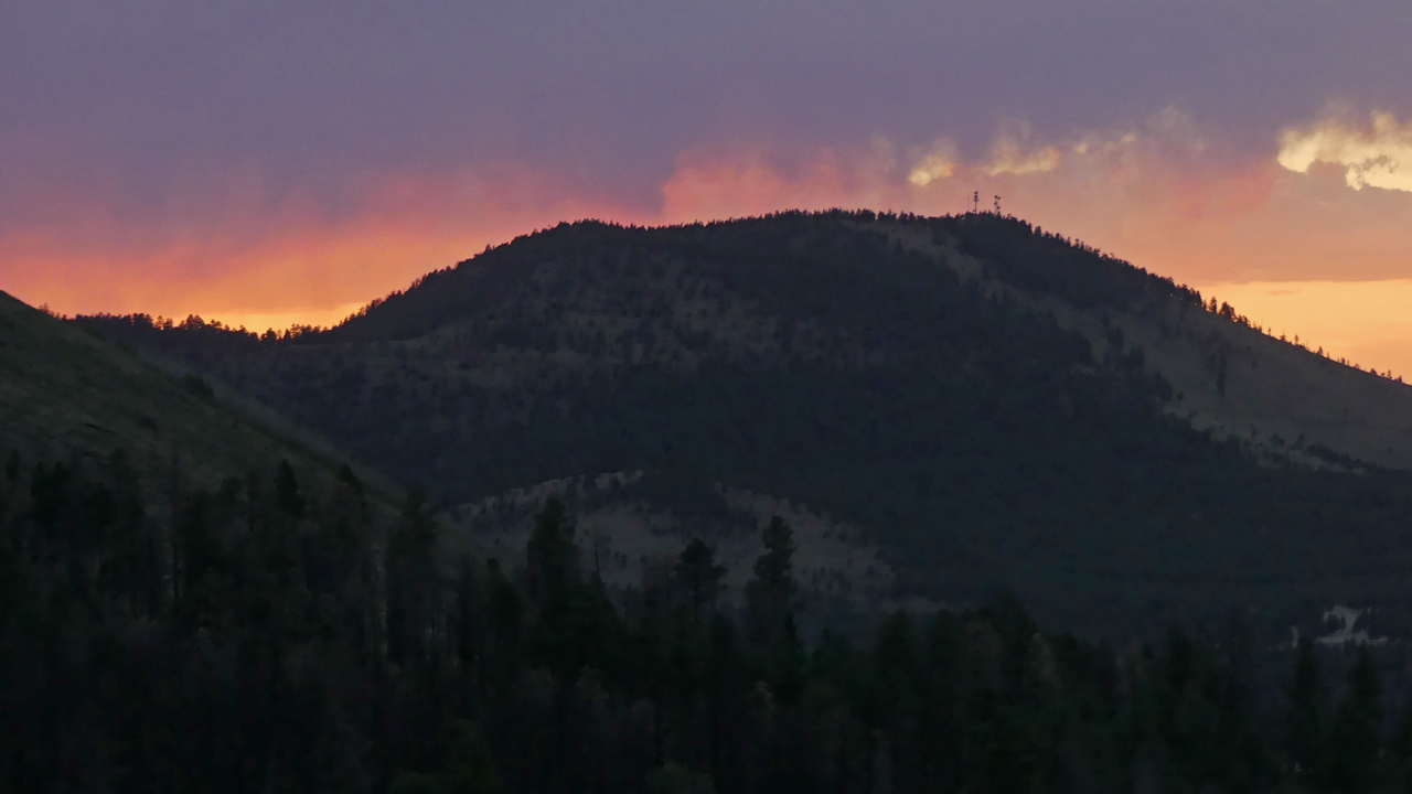
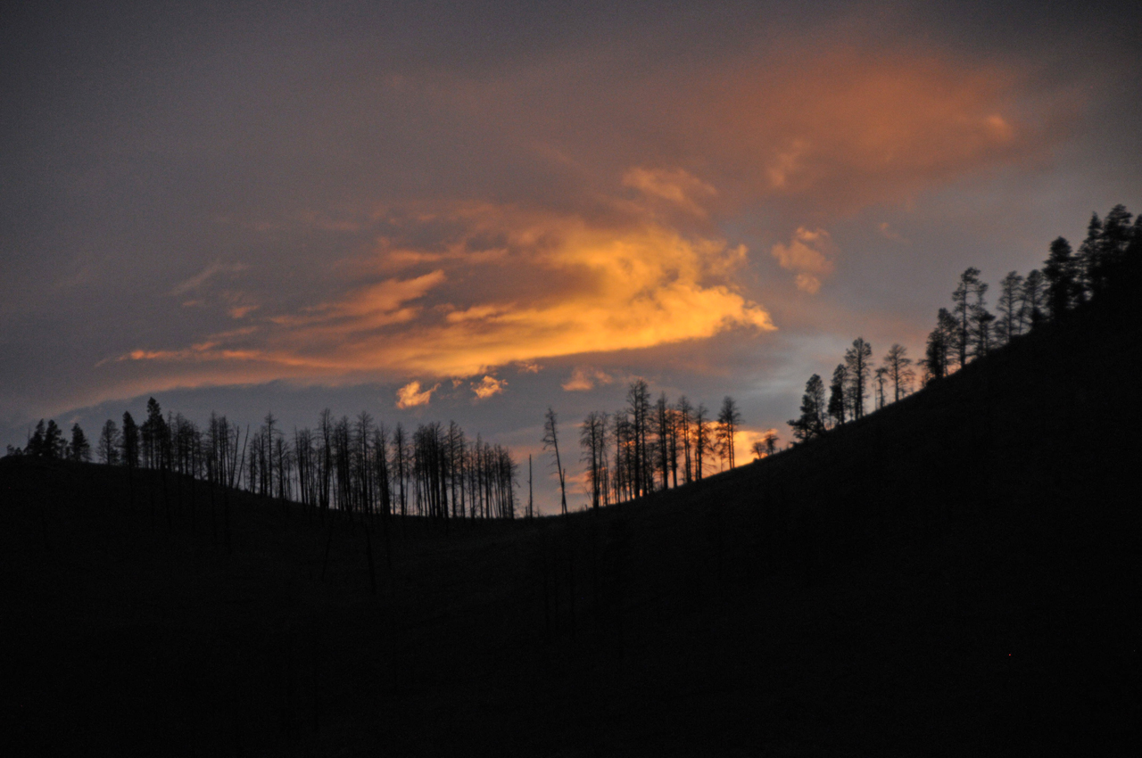
Sun showers gave way to a watercolor sunset.
The next morning we started up Abineau Trail, but a thunderstorm drove us back down the mountain. I wasn't disappointed to have a quiet day to read, write and relax with the kitties.
Monday dawned clear and sunny, a "go" for a hike up Bear Jaw Trail. The trail wanders through a handsome Ponderosa pine forest, and then rises into swaths of aspens and Douglas fir. We made it all the way to Waterline Road, five miles RT, with a 1400' elevation gain.
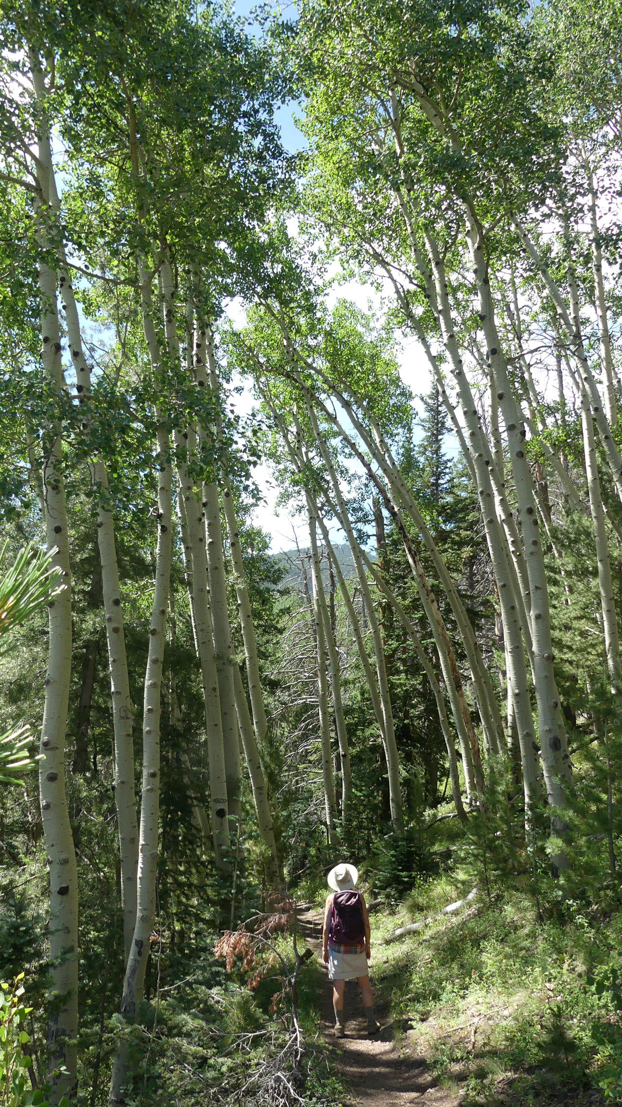
The gleaming white aspen seem to generate their own light. Many of them were carved with curious graffiti, much of it in Spanish. Only later did I learn that many of the carvings were made by Basque sheepherders beginning in the 1800s.
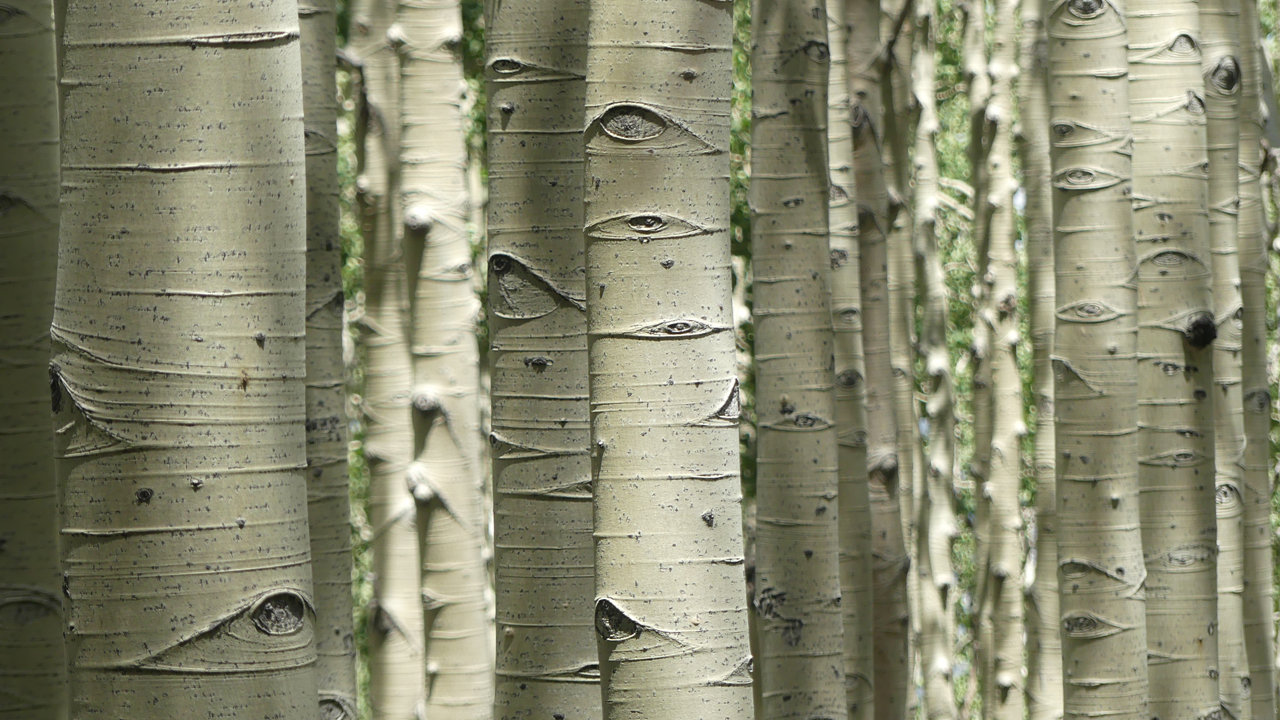
At the higher elevations, the aspens were pristine, and for the first time I noticed that their trunks are covered with human-like eyes. Now I can't unsee them!
After my Tuesday morning meeting and a few hours of gainful employment, we thought we'd shortcut via a forest road to a section of the Arizona Trail. But when we reached the numbered road, we found it convincingly barricaded behind an imposing steel gate.
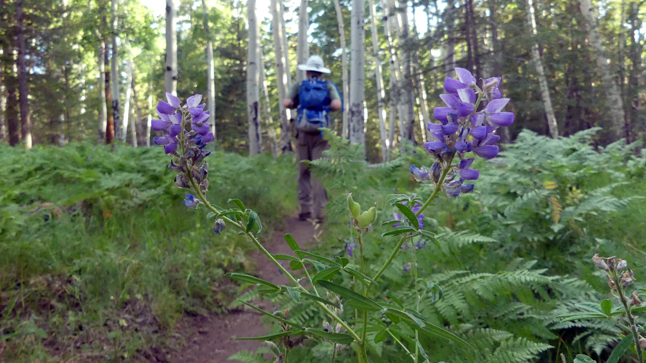
So we bushwhacked around the McMansion on the handkerchief-sized inholding, then wandered down the AZT through a dreamy aspen forest with an understory of giant ferns, stemless point-vetch, silvery lupines and sunflowers.
It was about five miles RT, with a fair bit of road walking.
About every six days we need to go into town for water, since we have a 30-gallon tank and even being very conservative we still use about five gallons/day for showers, cooking and dishwashing. On our way into town, we took a short side trip to Sunset Crater National Monument to hike around Lenox Crater, where we postholed to the summit after the big storm of February, 2019.
After exploring south via a forest road that quickly became impassable, and nosing down several minor roads where we narrowly escaped getting wedged between the branches, we settled into a spot just a few miles west of our previous campsite.
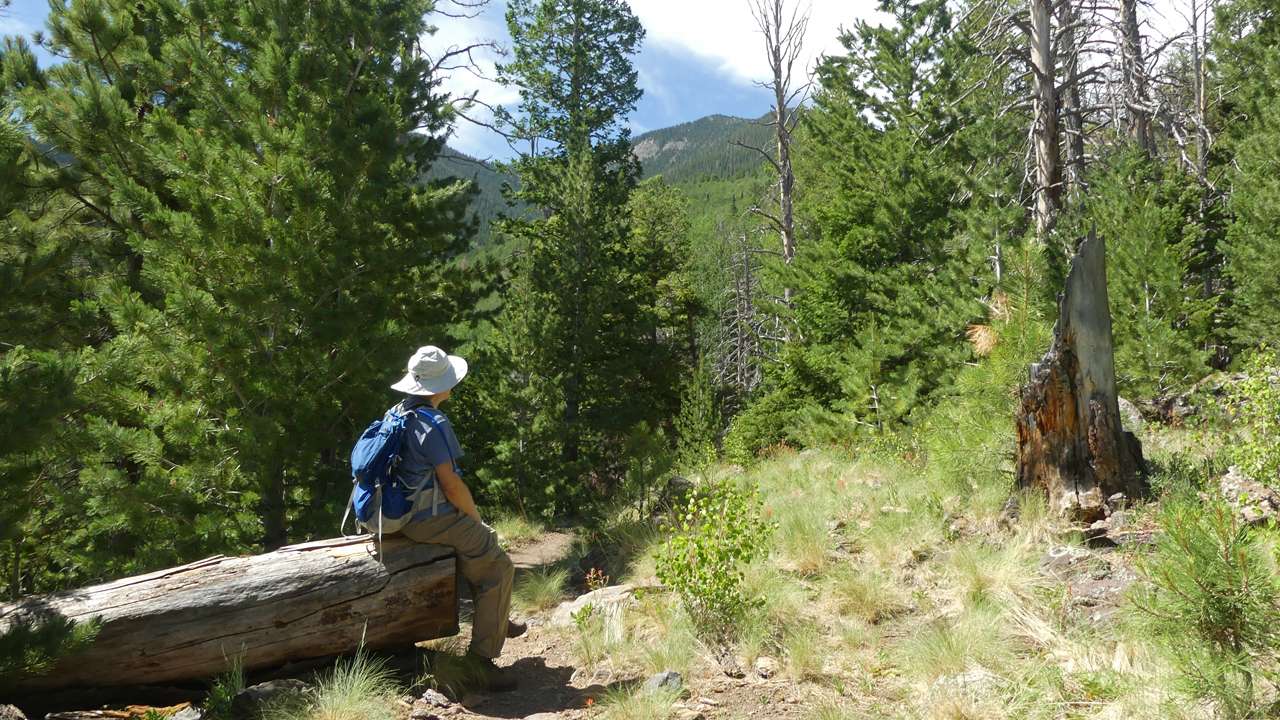
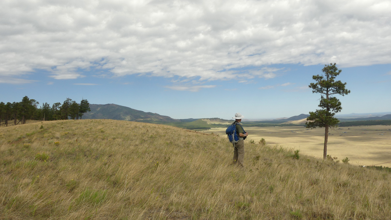
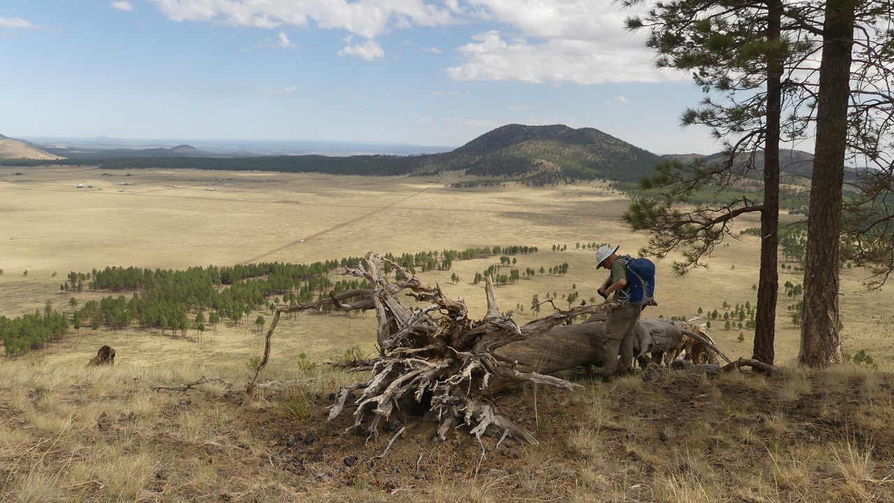
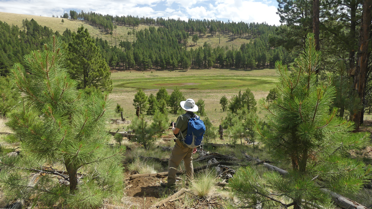
We set out for a big hike the following morning ...
"It's just a small cloud," he said. "It's not going to produce any rain."
"Okay, it might rain, but it will blow over quickly."
"At least it's rain and not hail."
"It's not hail, it's more like sleet."
"So we got hailed on, but we're okay. That was fun!"
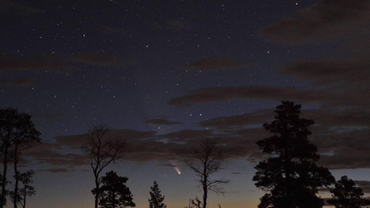
Almost every day for a week, we got up at 4:00 am, hoping for a good view of Comet NEOWISE. This was our best morning shot.
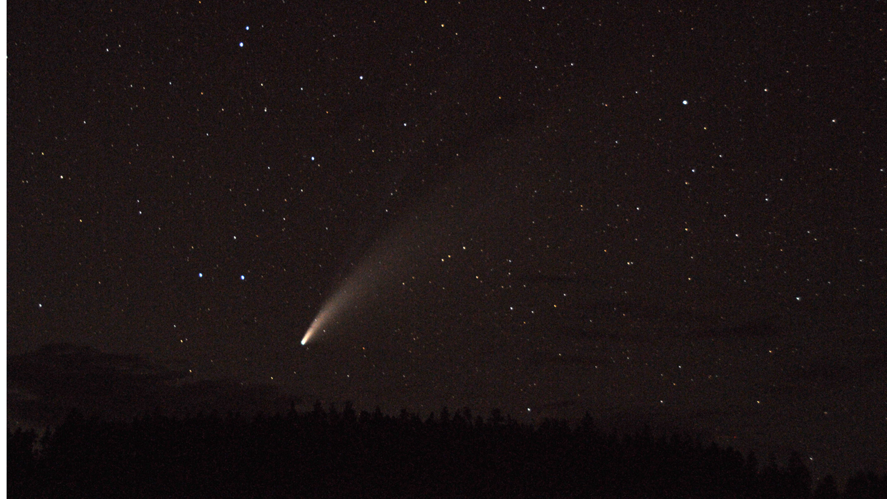
Later, when the comet became visible in the evening, we captured it just above the local horizon.
Dyna's backside, after a full week of playing in the mud.
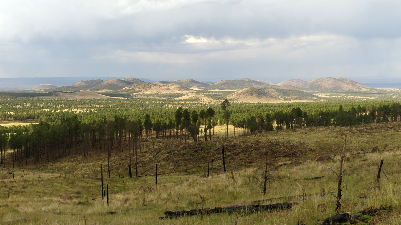
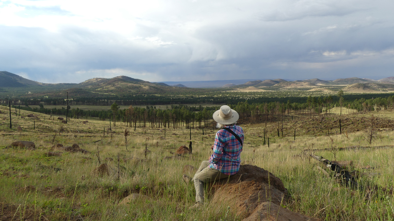
With an earlier start the next morning, we scrambled to the top of the nearest cinder cone and stumbled onto a great trail that loops around the caldera and then drops into an actual lake in the bowl of the crater.
Later I learned that these conical mountains are not cinder cones at all, but "laccoliths", formed 850,000 years ago when a volcanic eruption injected molten lava into preexisting layers of rock, causing them to arch upward and form domes.
There was abundant evidence that this watering hole is very popular with local wildlife!
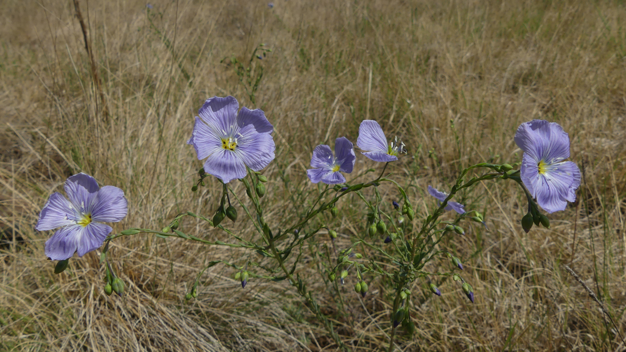
The rains brought out a profusion of summer wildflowers. Lewis flax.
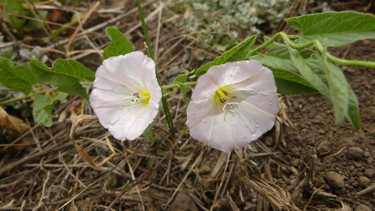
Field bindweed, an invasive plant (but so pretty!).
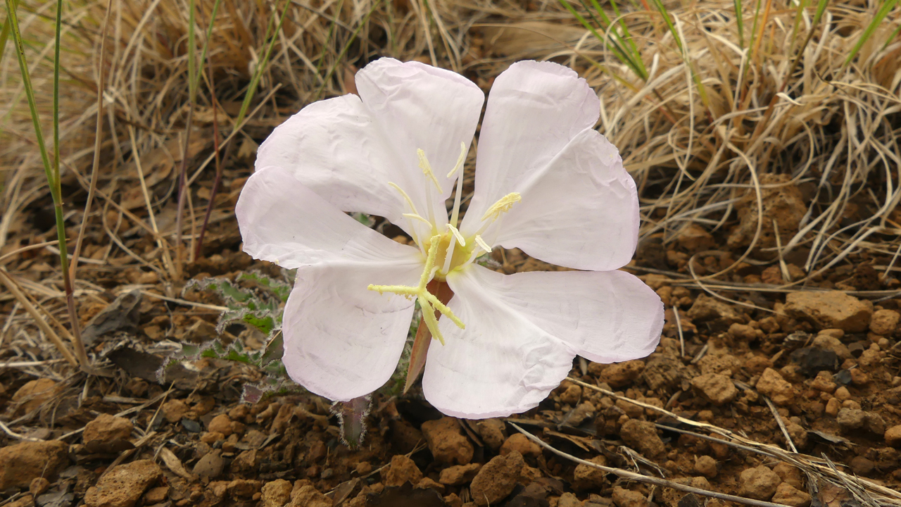
Fragrant evening primrose.
Our new location offered easy access to the Arizona Trail. But it was Sunday, and the parking lot was jam-packed with mountain bikers. So we took off through the aspens, and once again, we stumbled onto a perfectly fine trail — probably an old road — that parallels the AZT, cutting off the switchbacks. But once again, Dook'o'ooslííd, now cloaked in a more-or-less permanent dark cloud, began rumbling and throwing bolts of lightning. So we followed our newfound trail all the way back to the main road, exiting by the walls of signs for "private road", "no trespassing", posted on a numbered forest road many yards inside the well-marked national forest boundary.
Stemless Point-Vetch
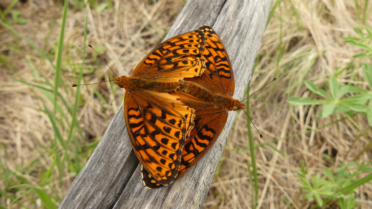
The rare "two-headed" Northwestern Fritillary.
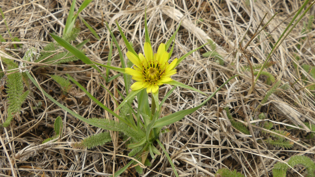
Yellow Salsify
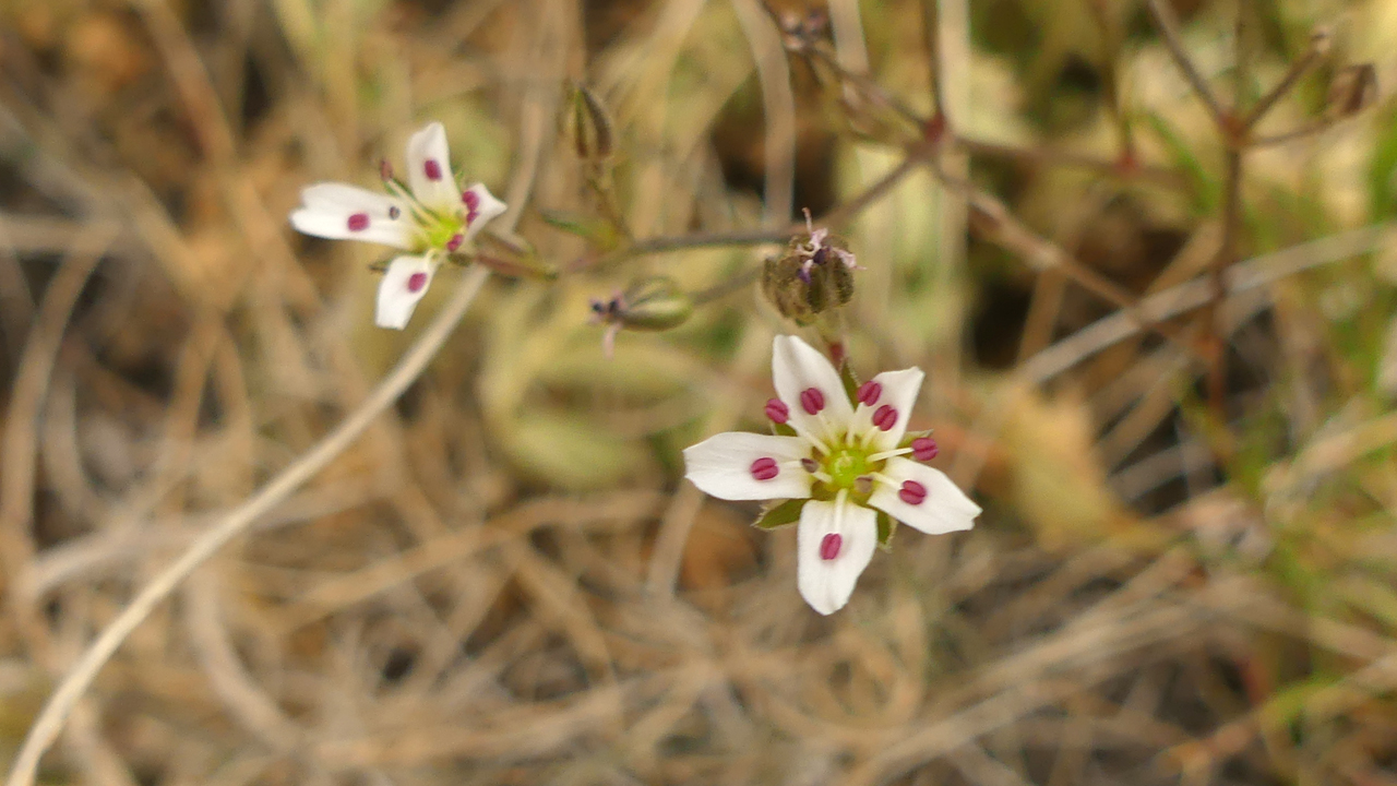
King's Sandwort
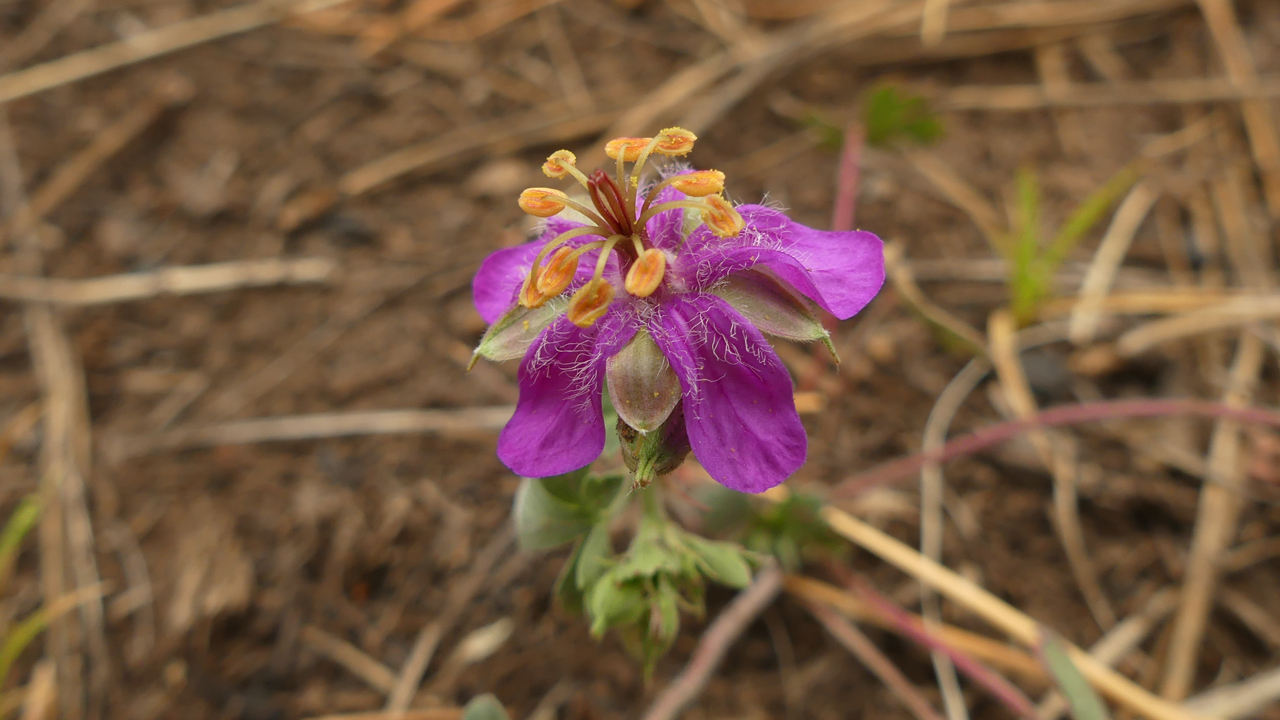
Pinewoods Geranium
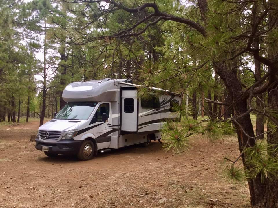
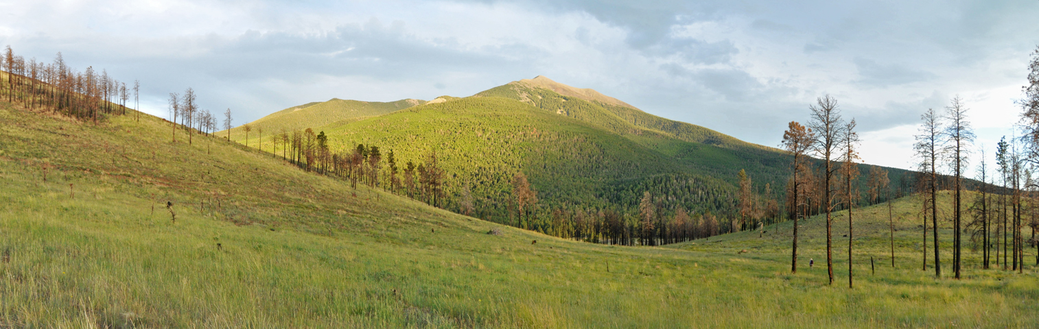
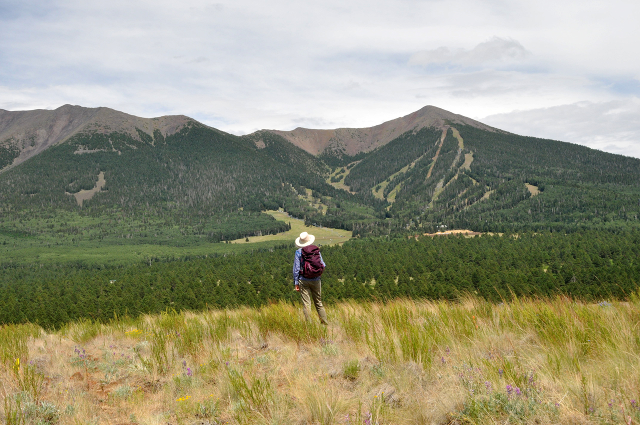
"Moving Day" once again. This one was more exciting than usual. After our usual trip to town for water and supplies, we ventured up another forest road on the west side of the mountain. A few miles in, we came face-to-face with a road grader. Dennis quickly swerved onto a side road, but there was a BIG drop-off, Dyna rocked crazily and the back end came down hard. There was no apparent damage other than a bent trailer hitch. So we spent a solid hour piling rocks in the ditch and covering them with dirt. Then Dennis drove through the woods to approach at angle. As he did, first the back right and then the front left wheels came off the ground, and more than just a few inches! We continued up the road until we reached Hart Prairie, which was not just another open area denuded by fire, but a vast alpine meadow with an incomparable view of the western slope of Humphreys Peak. We set up camp on a side road just south of the prairie. But we couldn't open the slide. While I prepared dinner, Dennis dug out the manuals and worked through an elaborate troubleshooting procedure which, from my point of view, involved using a wrench to trigger a particular sequence of flashing lights while murmuring a series of magical incantations. Incredibly, it worked! Apparently our ride through the ditch partially opened the slide, and it's programmed not to open unless it is first fully closed.
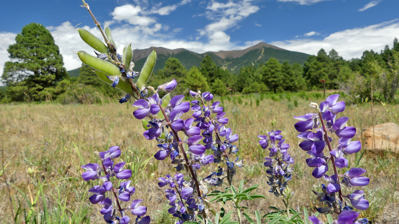
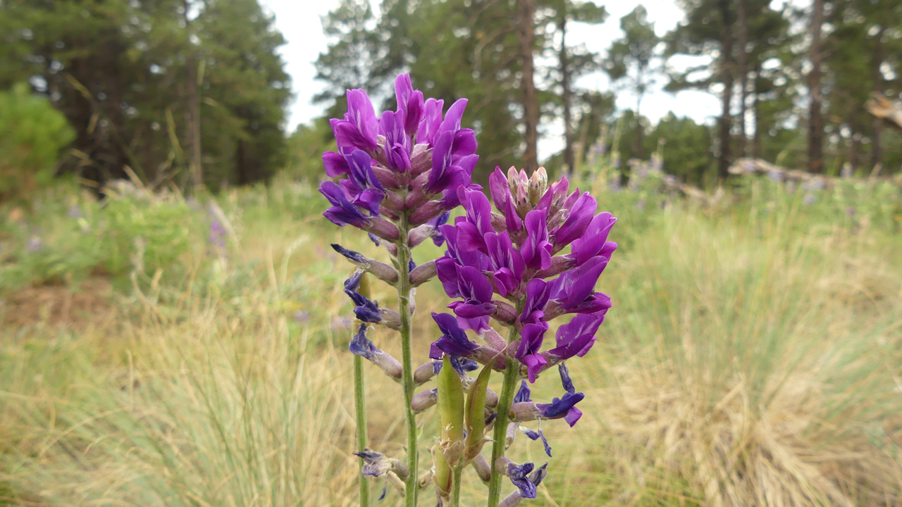
Silvery Lupine.
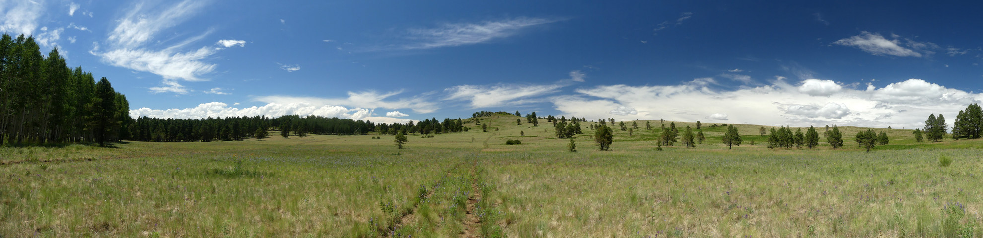
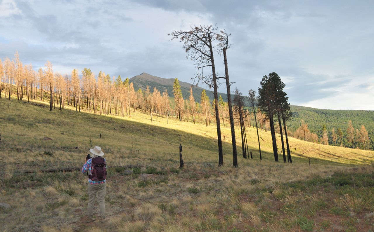
Delightful trails criss-cross the prairie.
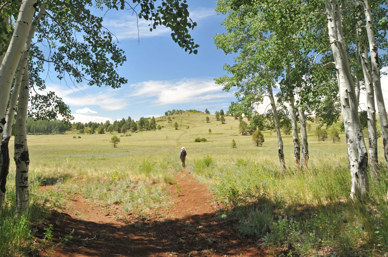
Additional trails — not marked on any map — wind through the nearby forest.
Persistent rains would finally send us packing back to Tucson.
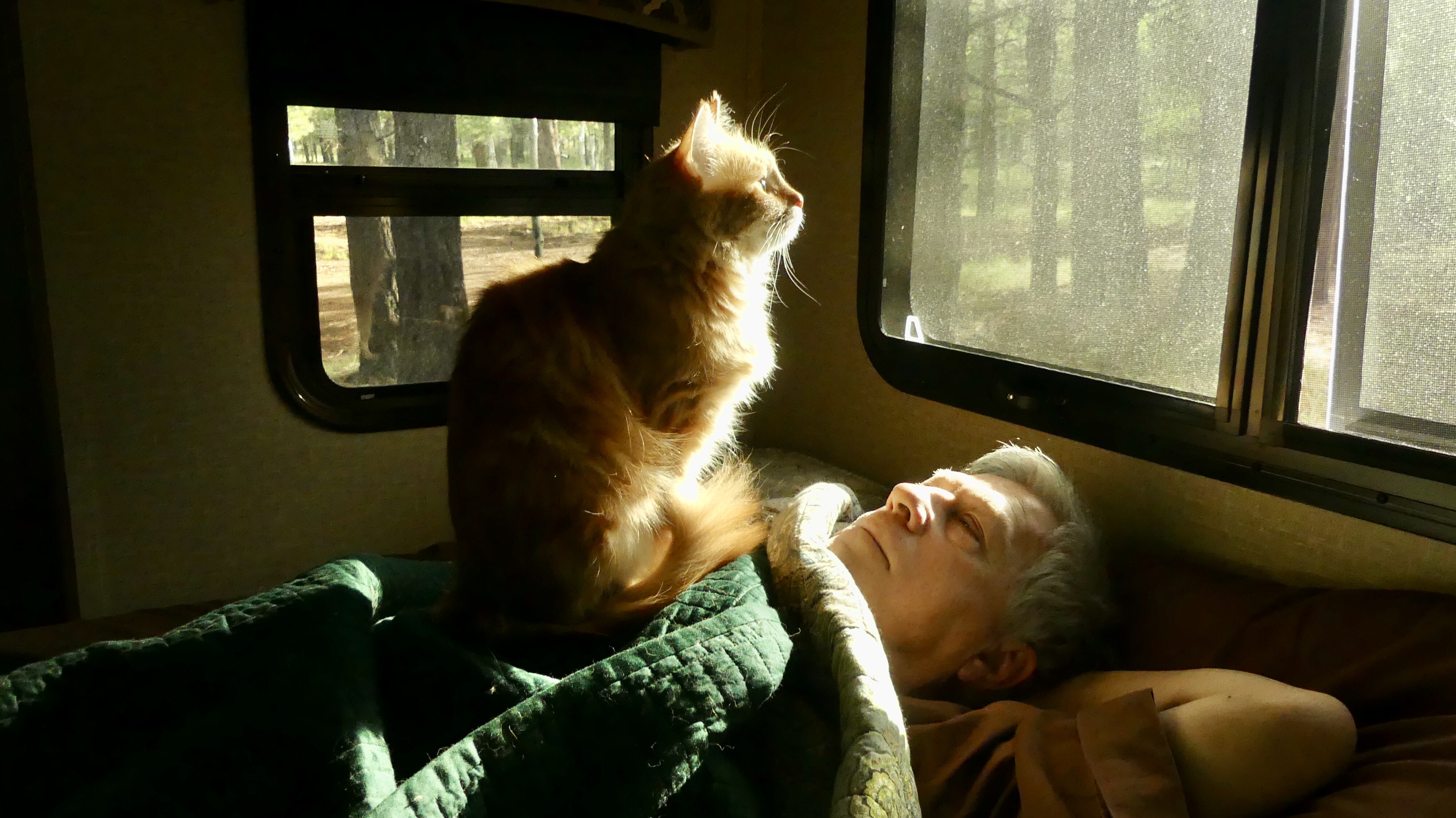
Our last evening on the mountain, Elio got outside and we couldn't figure out how he did it. But the next morning we caught him in the act. Watch him pull the cover aside, push the handle down and open the door. We've created a monster!
I think we may have found our new summer home.
