Anza Borrego
December 21-28, 2015
For our first major trip with the new camper, we chose Anza Borrego Desert State Park, an easy day's drive from Tucson and far enough south to have reasonable weather during the last week in December.
Dos Cabezas Spring
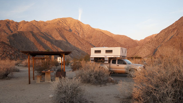
We arrived at sunset at the south end of the park and navigated to a "primitive campground" at Dos Cabezas Spring. The minute we left S2, we found ourselves on a two-rut sand road that bore little resemblance to the route shown on Caltopo digital maps, wandering crazily through an enormous field of giant wind turbines.
Relying on ESRI images, we finally made our way to a small turnaround at the base of a boulder-strewn ridge. There wasn't another soul in site, and the spring was dry.
We set up camp, made dinner and tucked ourselves in for the night. But after dark, gusty winds roared across the desert, twisting and tossing and squishing the camper like a tiny sailboat on a stormy sea.
It was impossible to sleep, and in the early morning when the winds became even more violent, we decided we needed to deflate the camper and drive off the mountain to a safer location.
The wee hours found us creeping downhill, admiring the twinkly lights of Ocotillo and the erratic firing of the aviation clearance lights atop the giant invisible blades.
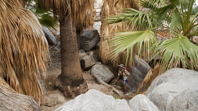
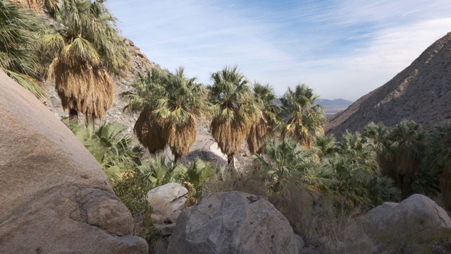
Mountain Palm Springs
We drove to the parking lot at our next destination, the trailhead for Mountain Palm Springs, and snoozed in the cab of the truck until dawn. There's a 3.5-mile hike here that loops through a series of palm groves in a shallow ravine. The largest grove, Torote Palm Bowl, contains over 200 palms, creating an astonishingly lush oasis in the midst of one of the Southwest's driest deserts.
Arroyo Tapiado Mud Caves
Our next objective was locating the mud caves in Arroyo Tapiado, a bewildering web that includes 22 known caves and nine slot canyons, some up to 1000 feet long with ceilings as high as 80 feet. We wandered up several ravines, marveling at the size and texture of the mud dunes, carved into myriad shapes resembling everything from leather to giant ferns to cave drapery.
Blair Valley
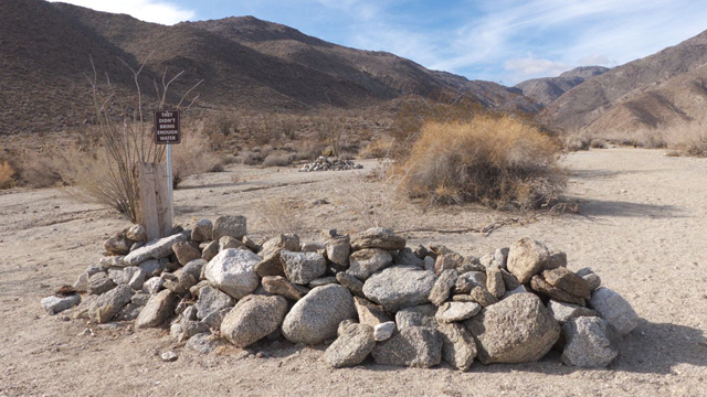
From Arroyo Tapiado we continued north to Blair Valley. The wind was still howling and we hoped we might find a calmer spot tucked into the rocks at a "first-come, first-served 52-space primitive campground". We passed the ruins of the "ranger station" shown on Caltopo, and nearby was an unmarked road on the shores of a large dry lake where we saw one lonely A-liner. We pulled off in a wide spot in the road under the rocks, but there was no place to hide from the wind, so we fell asleep once again on our stormy, stormy sea.
The evening coverlet of clouds gave way to a spectacular sunrise, and we were on our way to visit a pictograph site in Smuggler Canyon. The sand road looping around the lake and then over the ridge to Little Blair Valley was one of the loveliest drives in the park. Under a brilliant blue sky we hiked up to a saddle where there is a single boulder with several unusual brightly colored pictographs painted by the Kumeyaay people between 200 and 1000 years ago, perhaps as part of female puberty initiation rituals.
We continued past the pictograph site, attracted by a basin about another half mile down-canyon. We thought it might be a spring, and were very surprised when it turned into a narrow passage that gave way to an impressive pour-off that drops 2000 feet to Vallecito Valley.
Hellhole Canyon
We had planned to camp that night at Culp Valley, but did not realize that it was up in the clouds at 3200 feet. So we rolled back downhill and forked over the $25 for a campsite at the Borrego Palm Canyon Campground.
Fish Creek
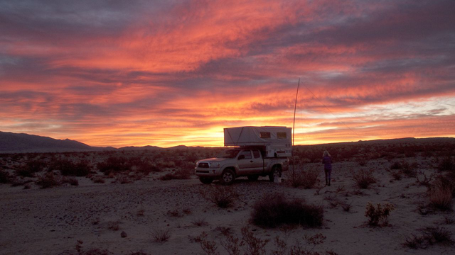
After the hike, we made a beeline for the primitive camping area at Fish Creek on the east side of the park. On a gravel shelf above the wide dry creek bed, there is a pit toilet with a couple of pull-offs and some metal fire rings. The campground was virtually deserted and particularly scenic, with the windblown desert on one side and Split Mountain leaping up on the other side.
In the morning, we wound our way through the narrows, marveling at the bewildering shapes and colors in the rock walls. This area is very subject to flash flooding, and a massive storm in 1914 filled the canyon with debris and killed off its pupfish population. We blew right by the Wind Caves trail, but luckily we met a helpful ranger who pointed us in the right direction and also explained that a flood 2½ years ago took out most of the signs.
We scampered up a side canyon and were surprised to find it turned into a smooth stone ramp that climbed steeply to a rounded sandstone mountain riddled with smooth holes. There were jaw-dropping views in all directions of a rumpled landscape where tilted mesas shed darker stone composed almost entirely of fossilized oysters, attesting to this area's past as an ancient seabed. We continued far up the creek, stopping periodically to try to puzzle out what processes had created the landforms around us. This is an area that merits further exploration, armed with more knowledge of the area's geology.
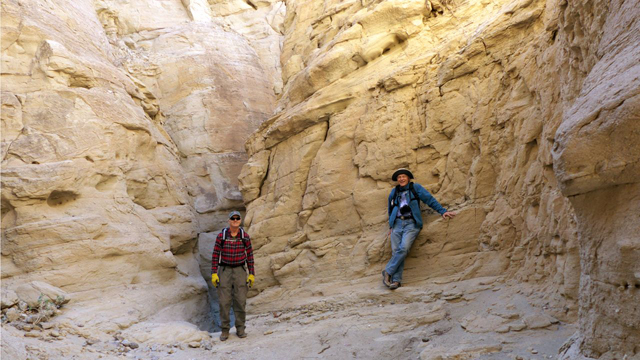
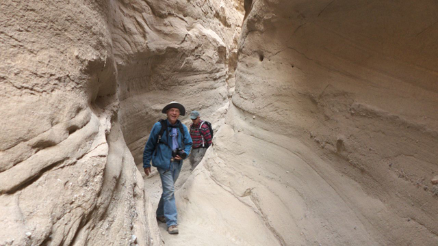
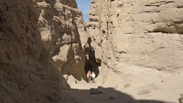
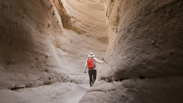
The Slot
We spent a second night at Fish Creek and awoke to a violent dust storm, whipping up an ugly brown cloud and sweeping blades of sand across the road. We thought we'd hide out in a coffee shop in Borrego Springs until the storm cleared, but on our way we passed Buttes Pass road and decided to go take a look at "The Slot." Some of the descriptions made it sound like a difficult or even somewhat dangerous hike, but it was a piece of cake, with just enough stair-steps and narrow passages to make it interesting. The Slot is about a mile long, with many side canyons, and the walls are constructed of somewhat sturdier siltstone rather than mud. We enjoyed the hike so much that we continued well past the end of the slot and up West Butte, where we found many more wind caves, along with a tantalizing view of the broad valley crossed by San Felipe Creek.
Calcite Mine
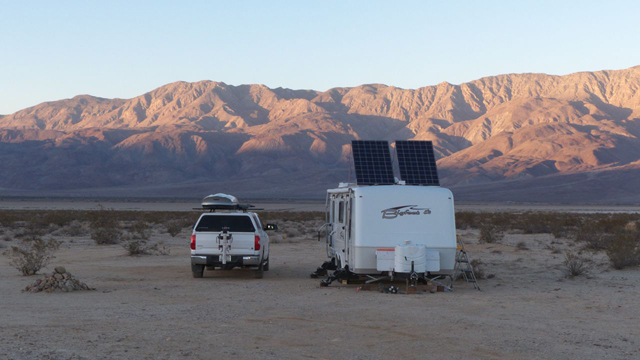
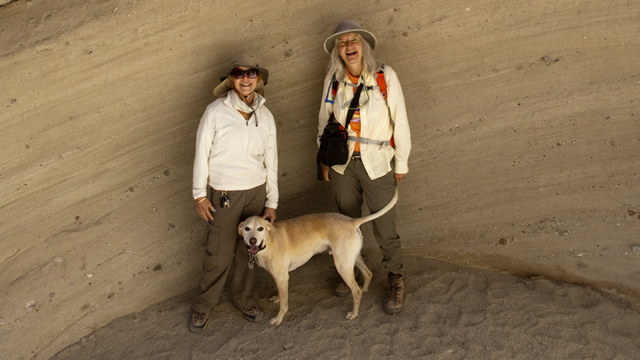
After a coffee stop in Borrego Springs, we made our way to a boondocking area near Clark Dry Lake, looking for our friends Hans and Debra. We had no trouble locating their offroad-capable rig well off the beaten path with two giant solar panels!
Along the Way