Starvation Draw
January 24, 2023
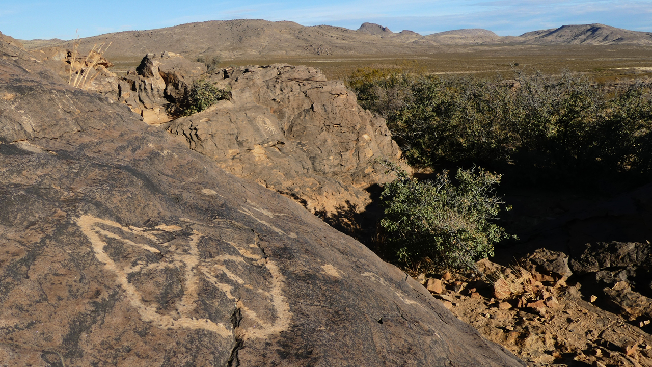
We returned to the petroglyph area in Starvation Draw, taking new photos of some of our favorites, but also discovering a few we had not seen before.
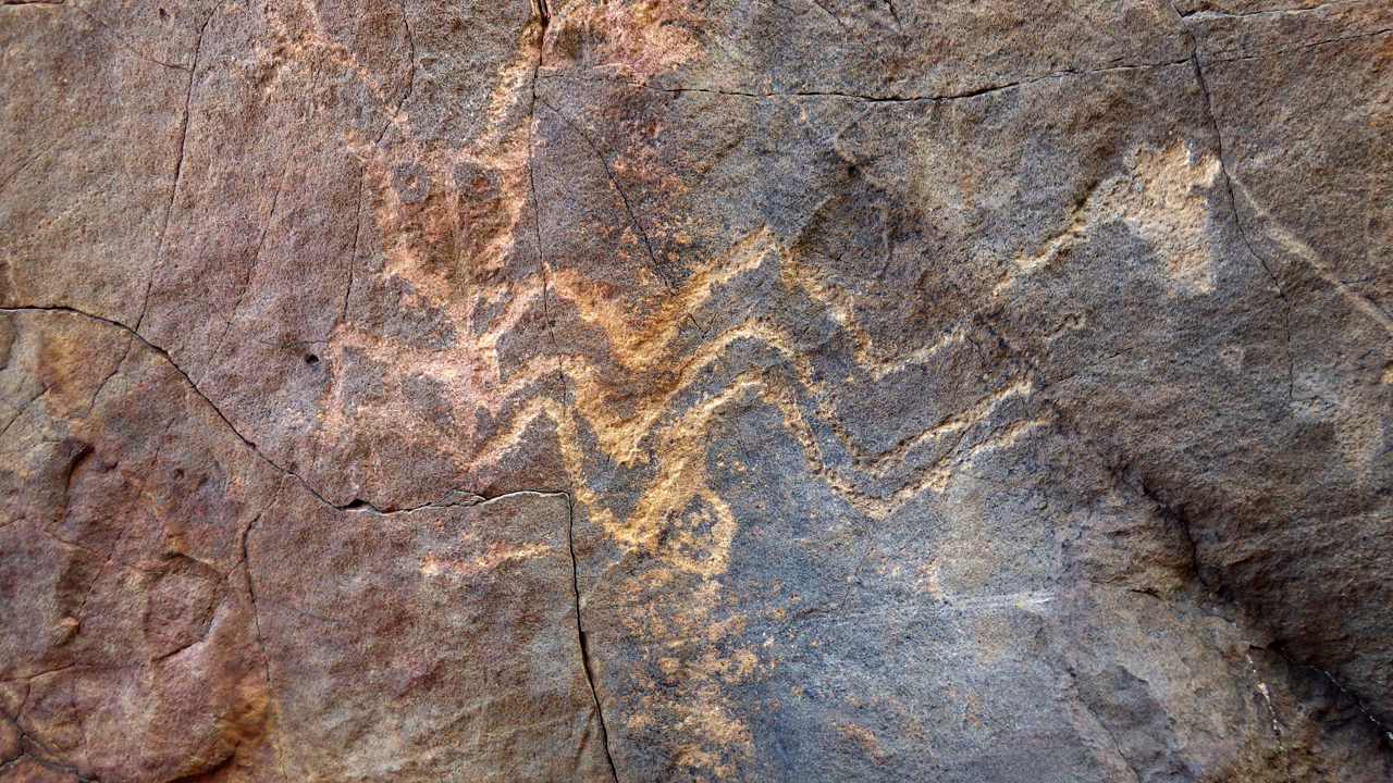
Everyone's favorite, the rattlesnake
In a particularly rich area, you can see that some a$$hole cut one away.
Turtle. Or tortoise?
I see a space capsule with a space alien nearby. But it's probably a basket.
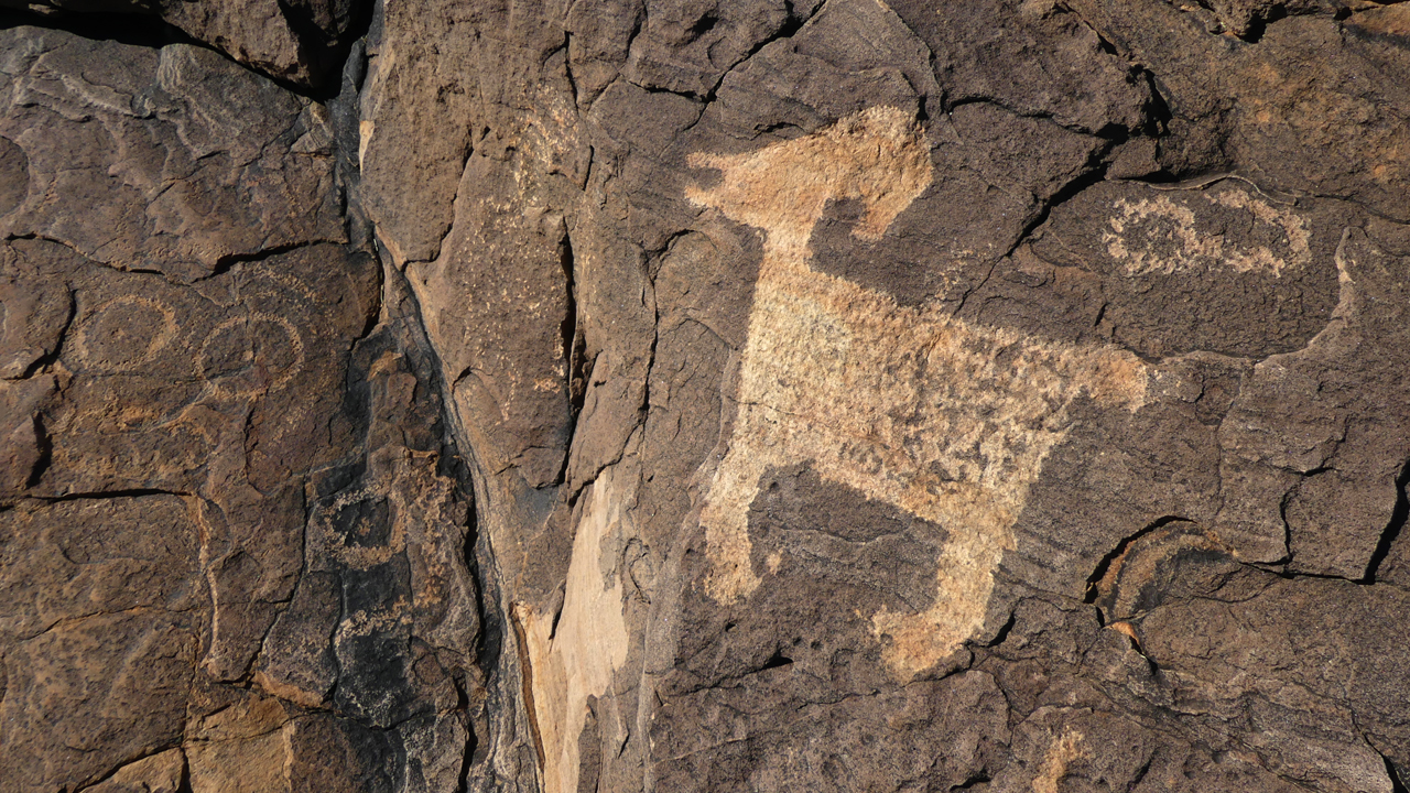
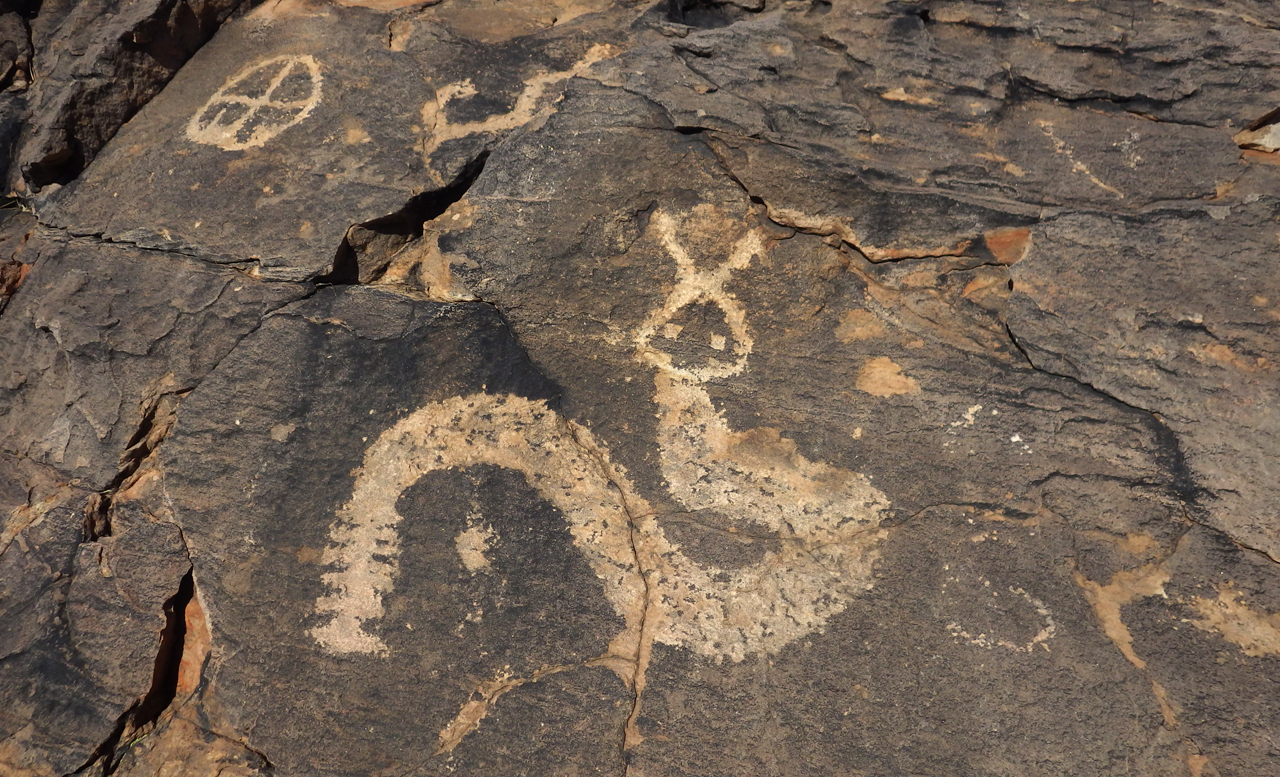
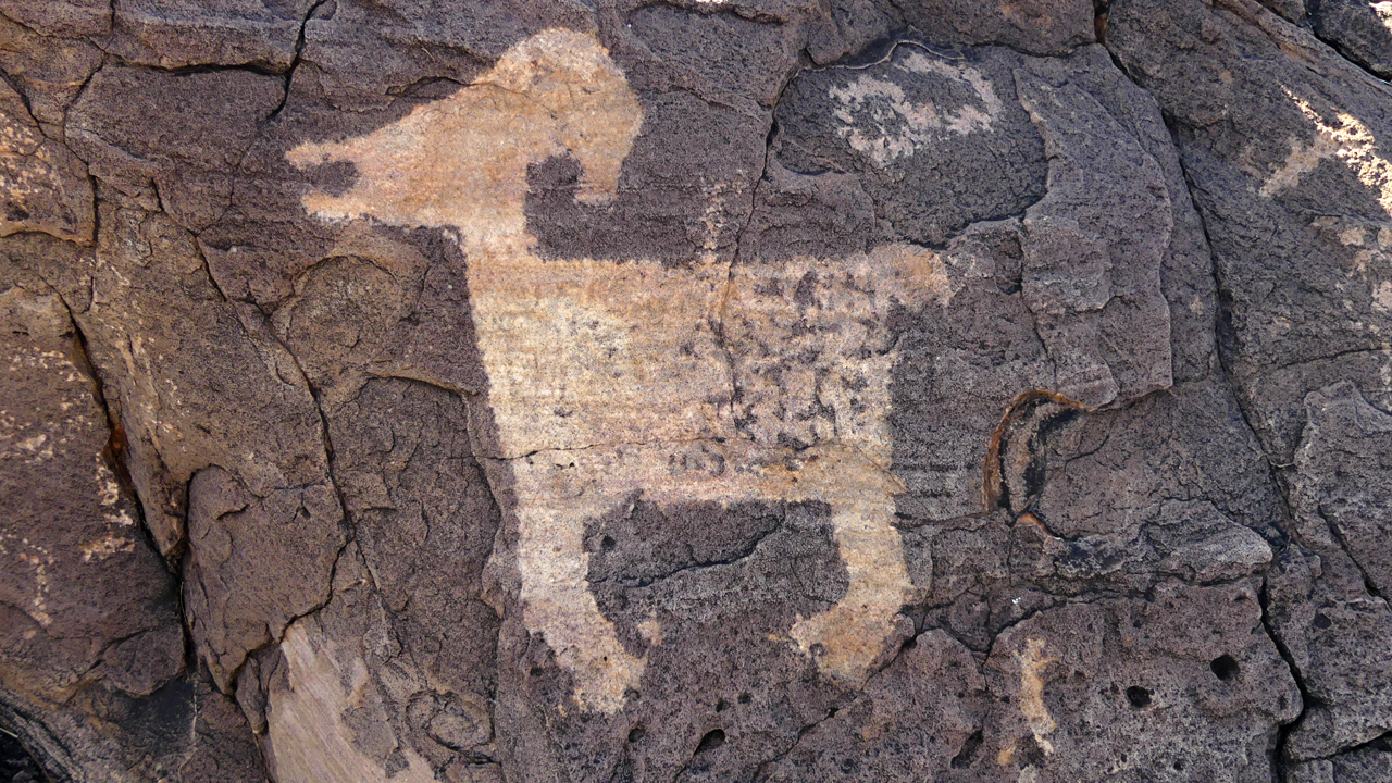
The fabulous bighorn sheep.
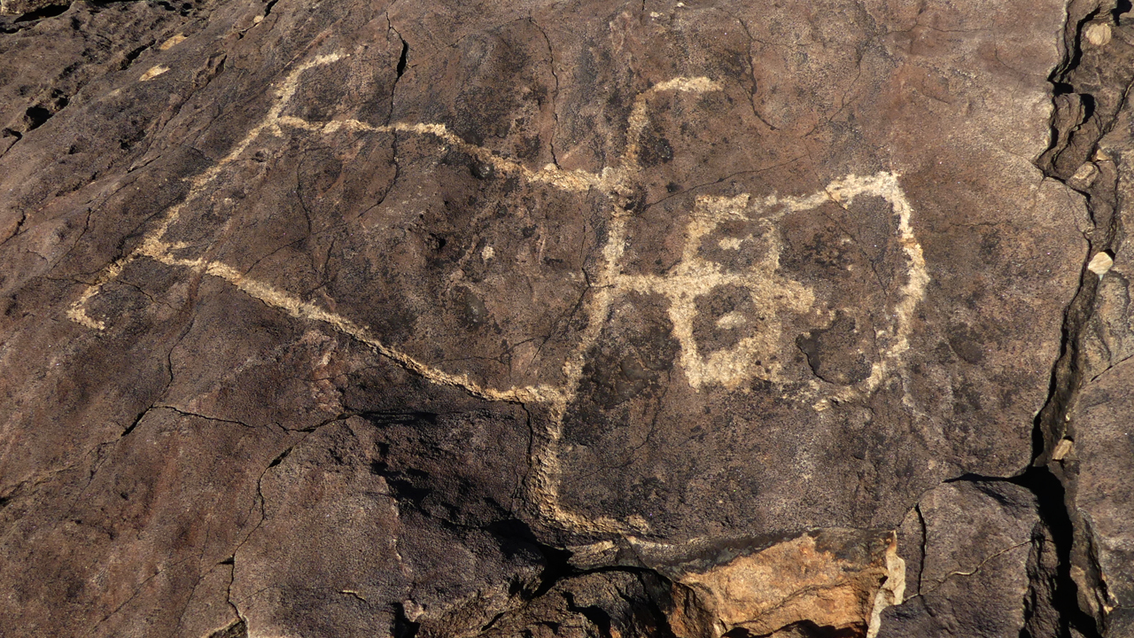
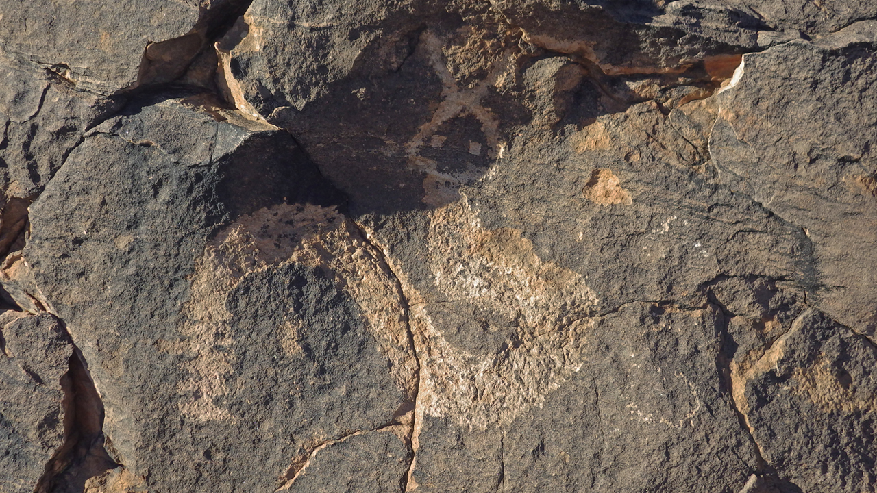
What is this odd square-jawed creature?
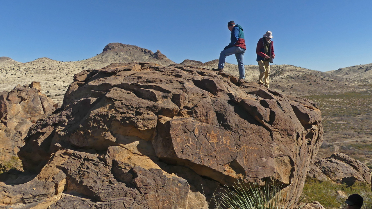
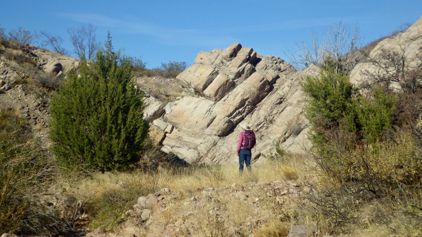
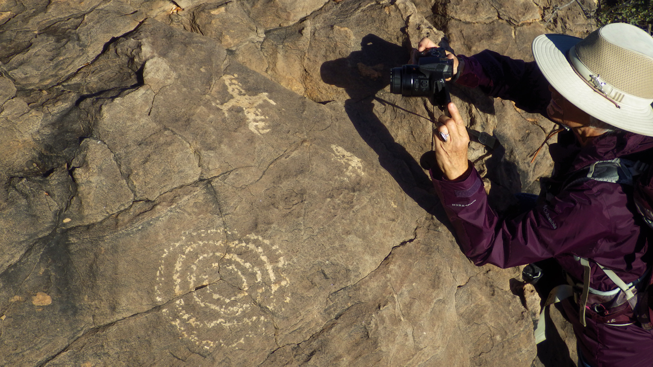
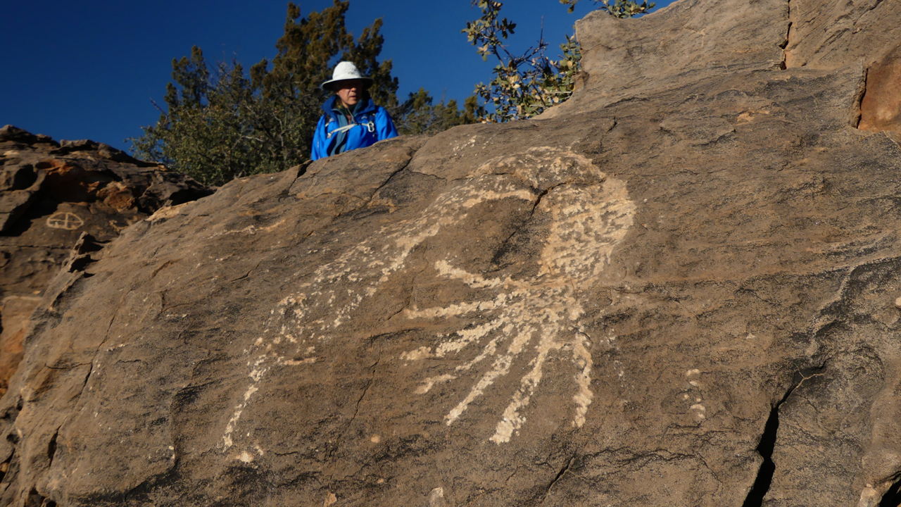
Dennis and Miguel climb up for a better look.
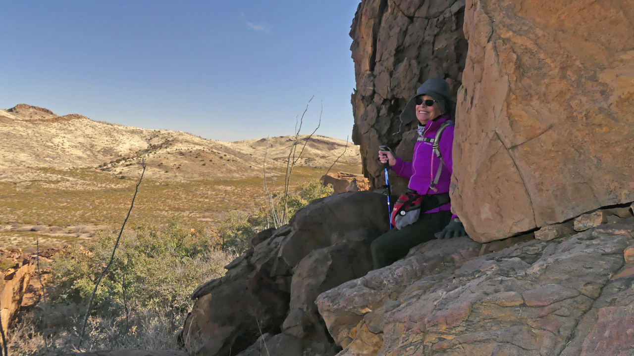
Kim in her happy place.
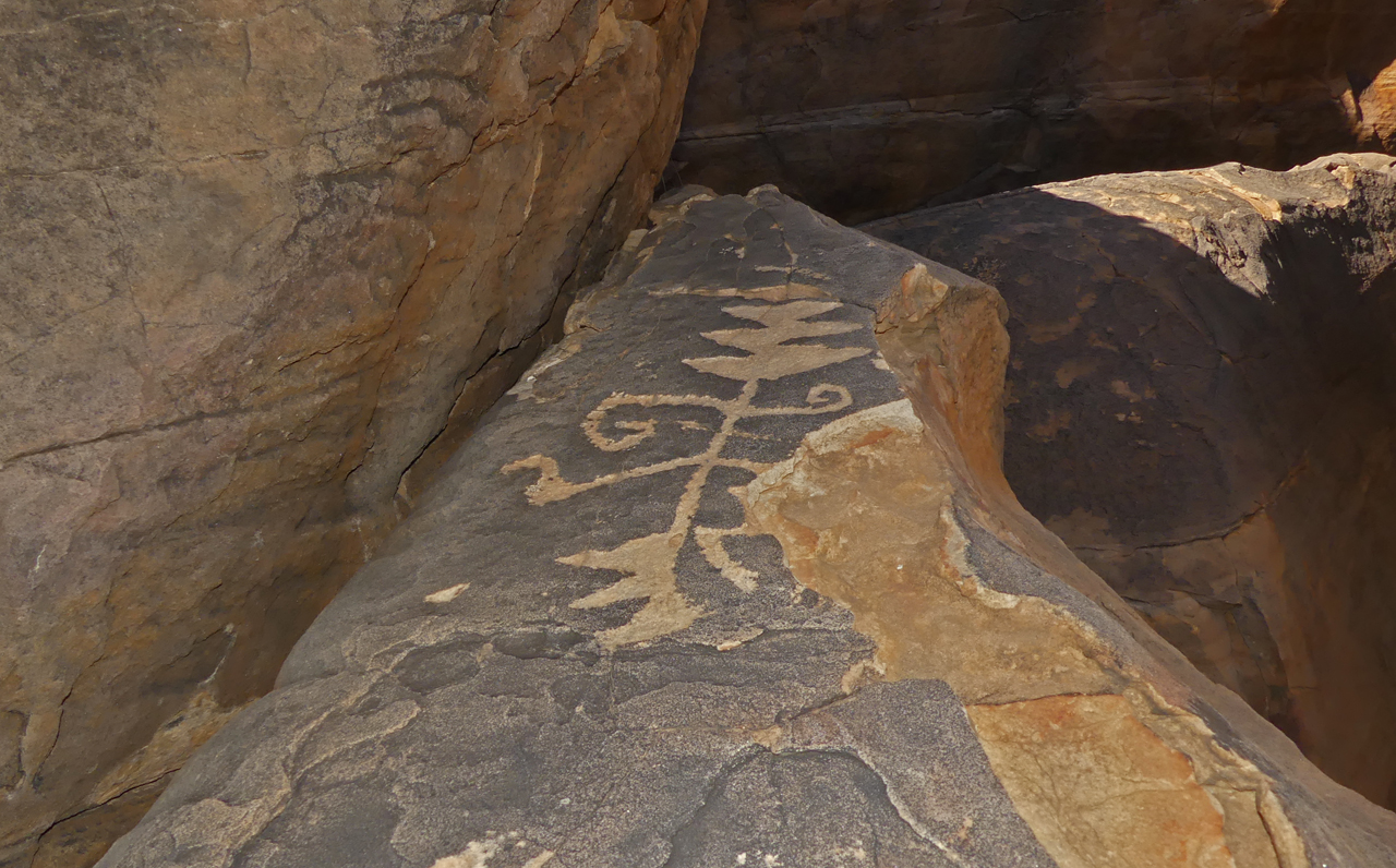
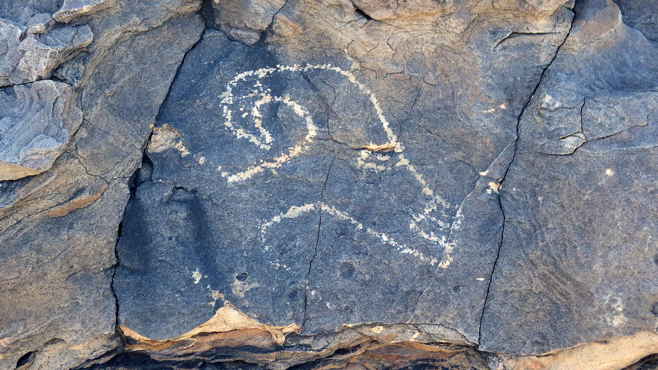
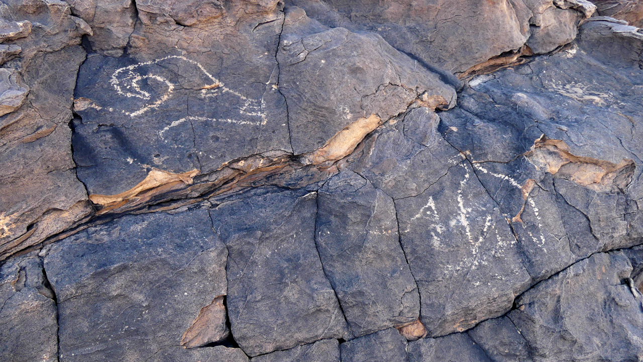
Such a graceful form, intriguing form! A corn stalk?
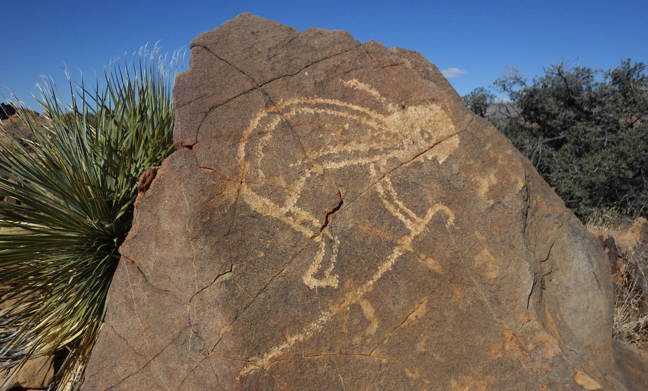
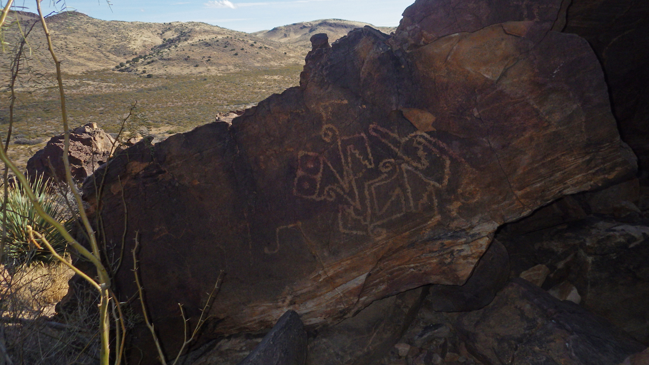
We finally found the Kokopelli!
BTW I had always dismissed Kokopelli as somewhat trite because of his omnipresence on the swag in every tourist shop, but he is more interesting than I thought. From Wikipedia: "Among the Hopi, Kokopelli carries unborn children on his back and distributes them to women; for this reason, young girls often fear him.... Kokopelli may have originally been a representation of Aztec traders, known as pochtecas, who may have traveled to this region from northern Mesoamerica. These traders brought their goods in sacks slung across their backs and this sack may have evolved into Kokopelli's familiar hump; some tribes consider Kokopelli to have been a trader."
December 14, 2021
In late December, we took a fews days off from scraping, scrubbing, sanding and painting. We used it to get acquainted with an area south of Cooke's Peak that has a rich and fascinating history. There are at least two major petroglyph sites in the area, created by the Mimbres people between 900 and 1150 AD. Apache peoples began moving into the Southwest around 1450 AD, eventually competing for land and resources with an influx of European settlers. In the mid-1800s, wagons heading to California on the Southern Emigrant Trail and the later Butterfield Overland Mail stagecoach route passed through this area to resupply at Cooke's spring, the only major water source between Mesilla and the Mimbres River. It was a dangerous place for travelers, who were often attacked and killed by Chiricahua Apache warriors. Frequent ambushes gave the name "Massacre Peak" to a nearby summit. Fort Cummings was established near Cooke's Spring in 1863 and abandoned at the end of the Apache Wars. Silver was discovered north of Cooke's Peak in 1876, and three major mining camps flourished in the area between 1882 and 1927, producing copper, fluorite, lead, gold, silver and zinc.
Reasoning that petroglyphs are often located near a water source, we followed the wash until it dead-ended at a dry spring in a box canyon.
We scampered up the sides of the canyon and found ourselves on an old road that winds through rounded hills that were lovely in the late afternoon light. Eventually this road joins with the old Butterfield Trail, and Fort Cummings is just over the rise, less than three miles away.
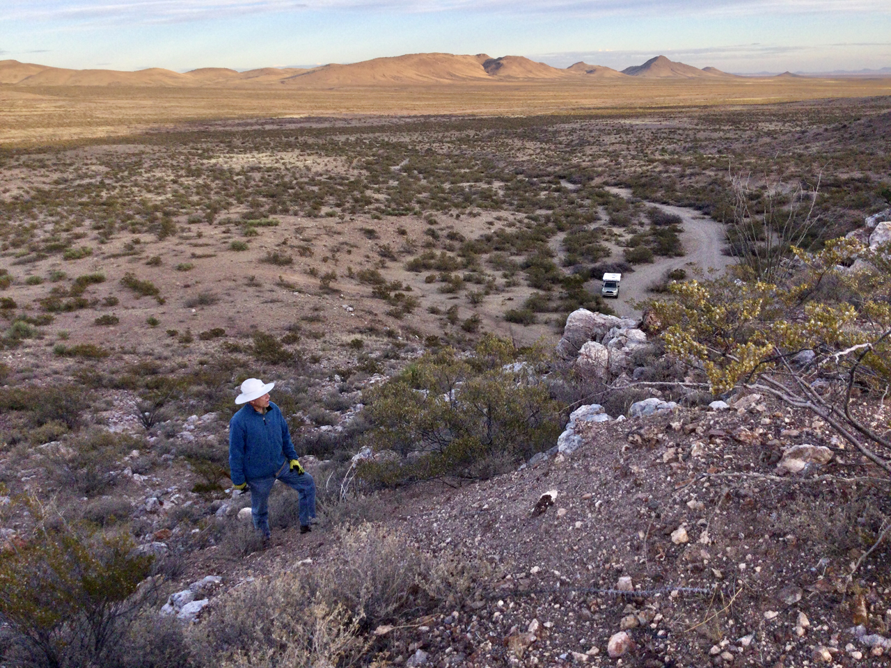
In lowering light, we did a short hike along Fluorite Ridge, and located a fine campsite.
December 25, 2021
Our Christmas present to ourselves was to return to the area on December 25, with more time, and having studied photos of the area that we compared with Google Earth projections.
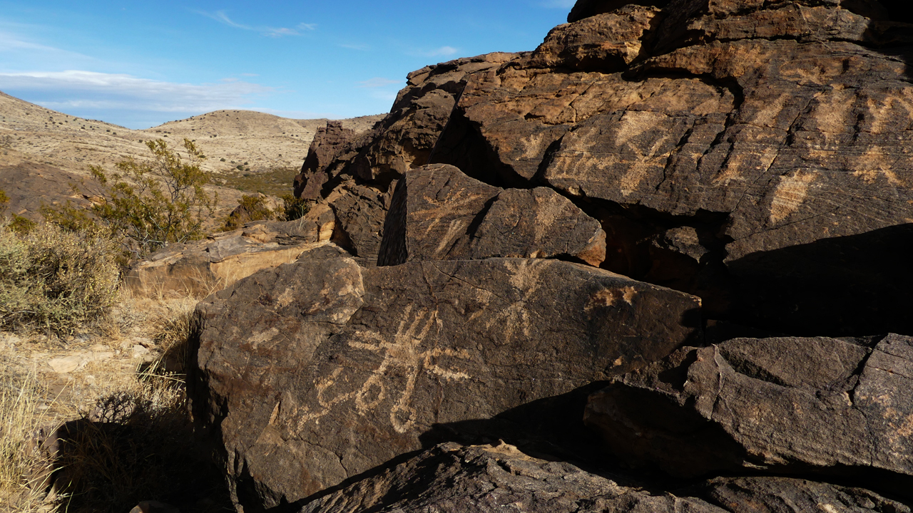
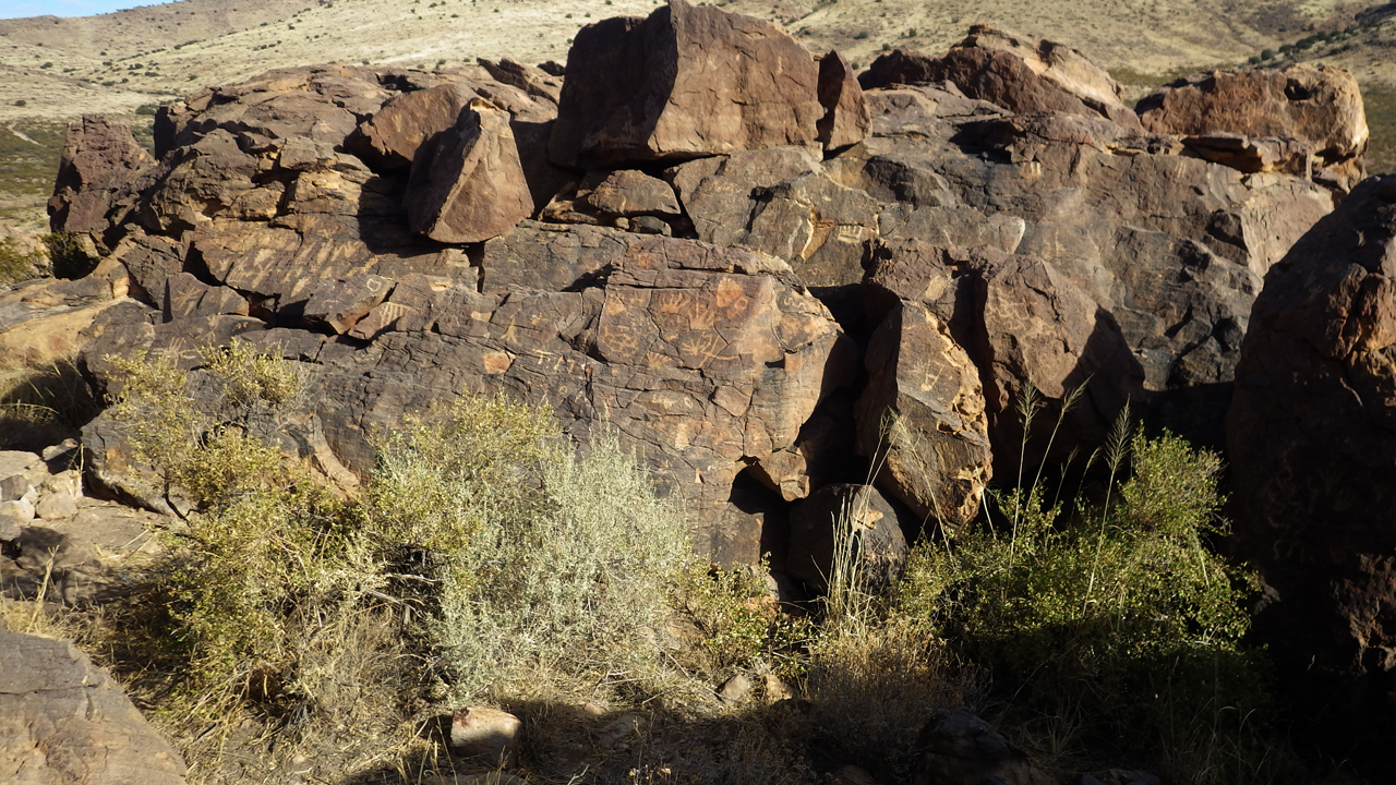
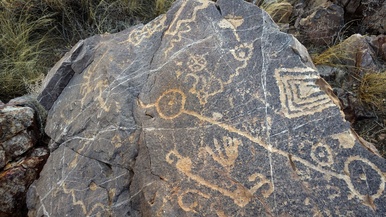
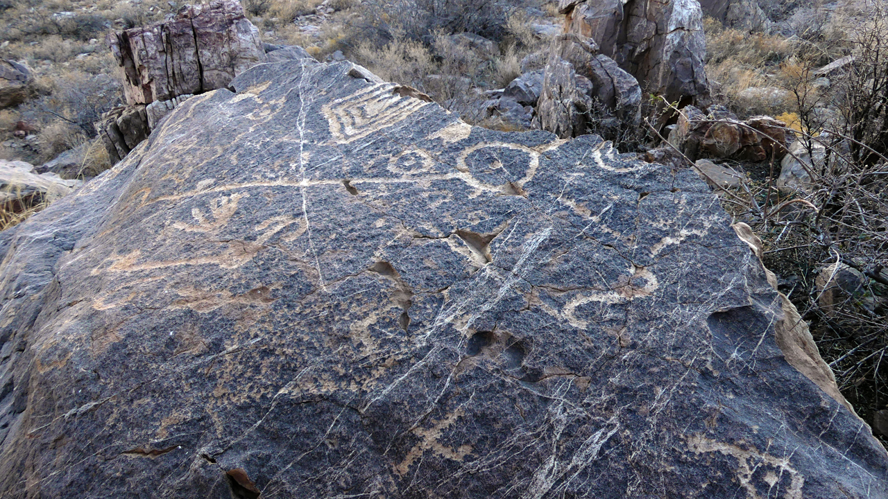
This time we walked directly to a dazzling collection of petroglyphs and a half dozen caves that showed signs of habitation.
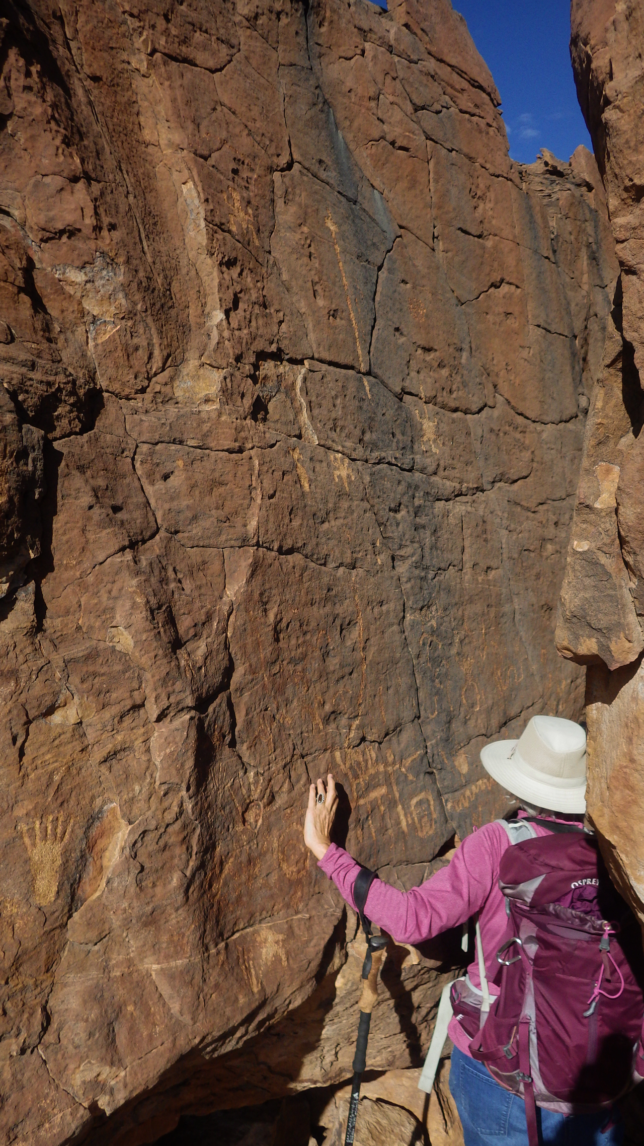
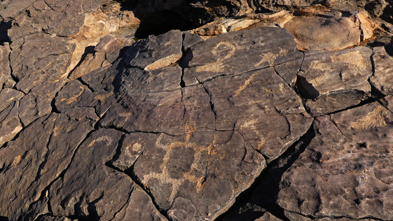
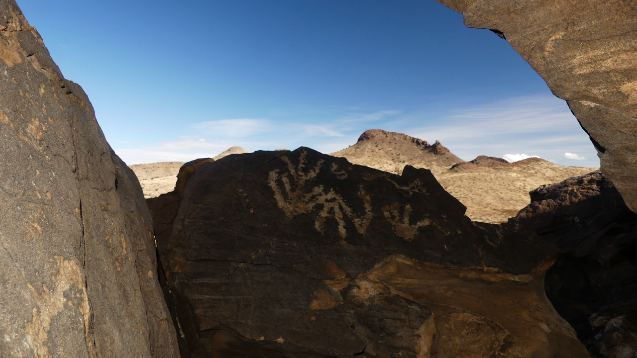
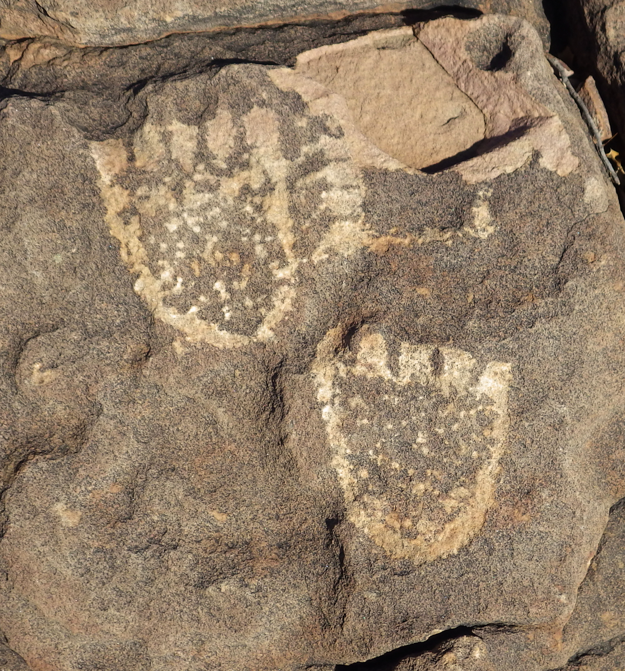
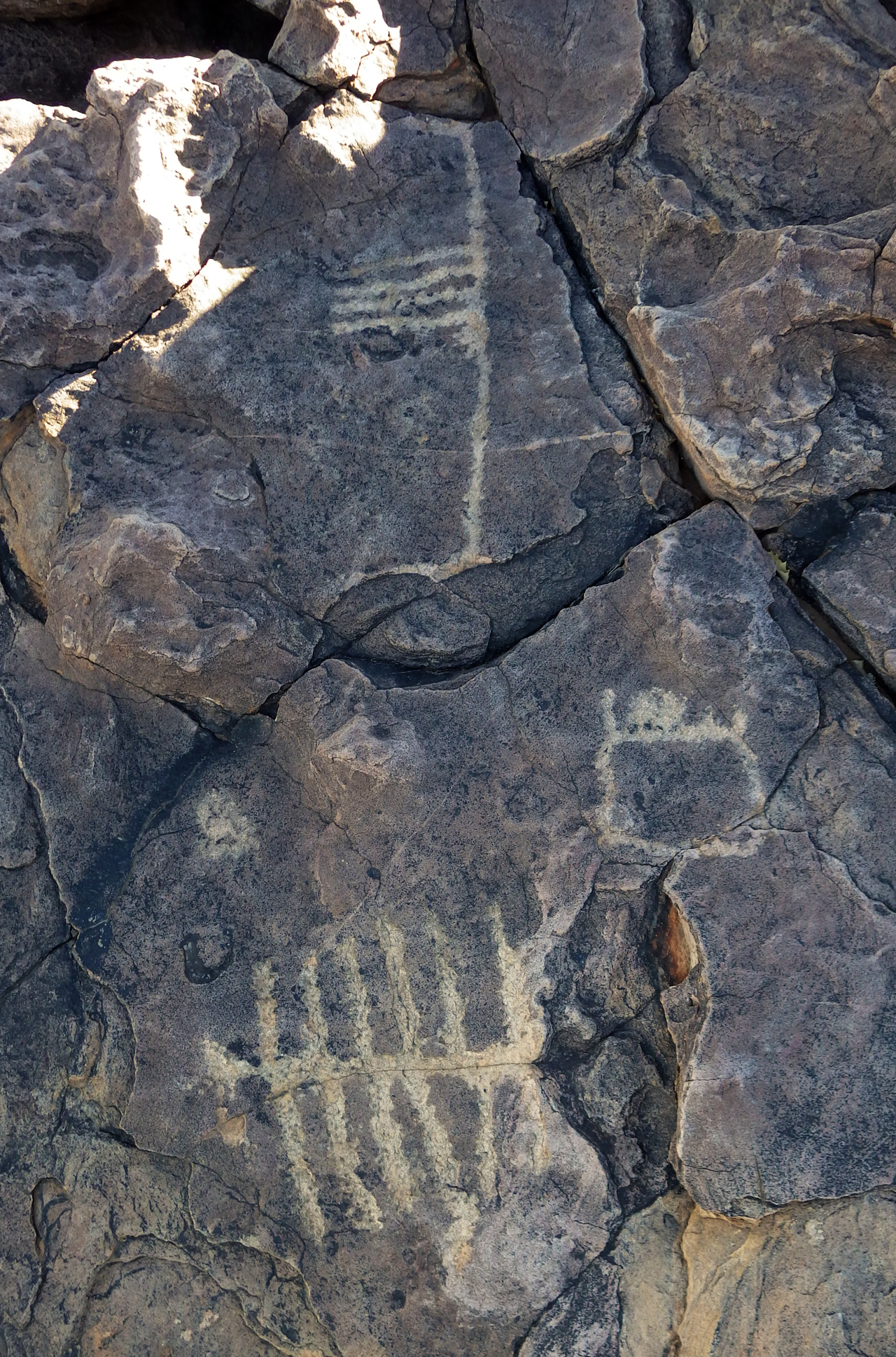
The walls of this crevice are decorated with an assortment of shapes including hand prints, footprints and much more.
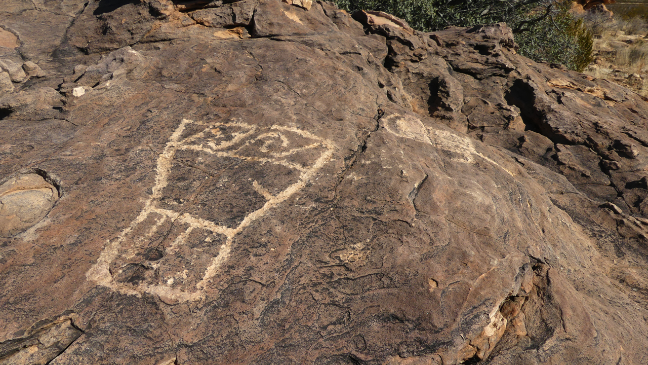
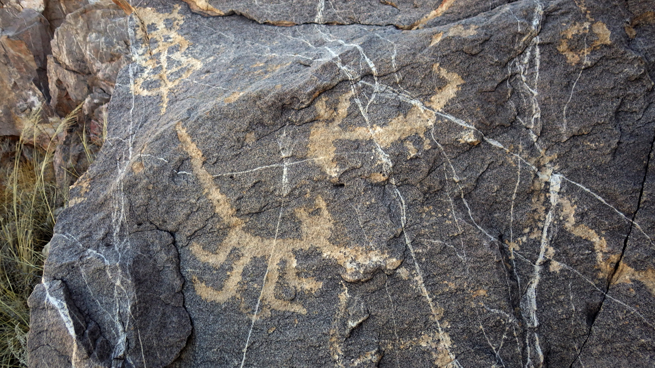
We were fascinated by this character with the wavy lines and the exotic headdress. A deer? Or a deer dancer?
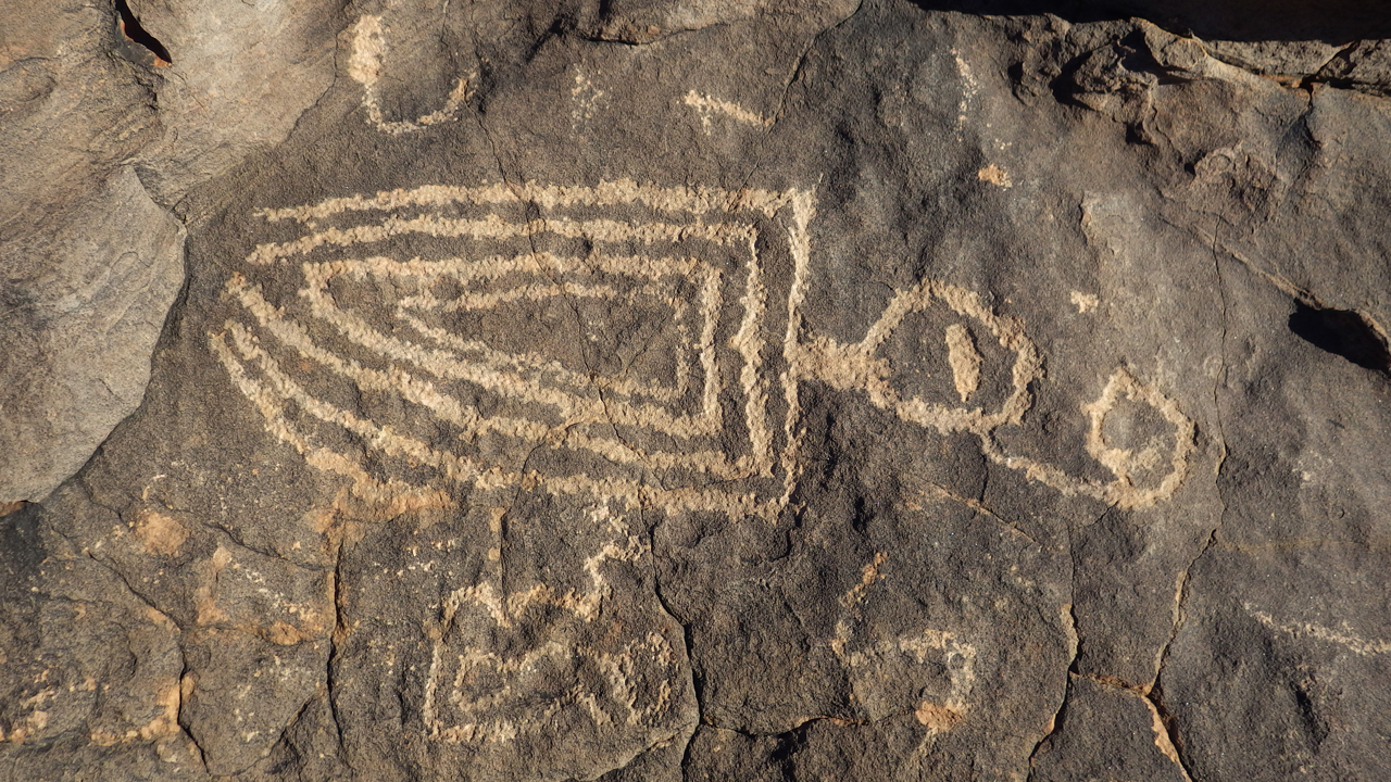
What could this detailed drawing mean? Or was it just random doodling?
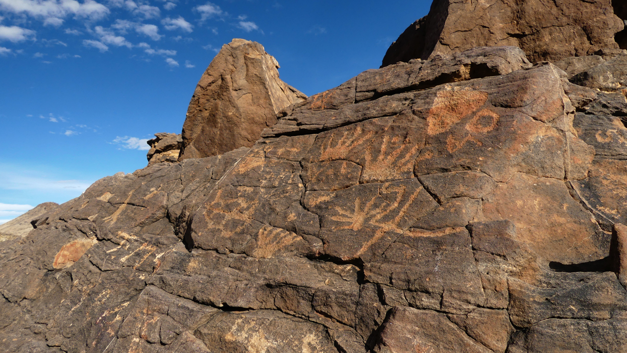
There are so many animal forms pecked into this rock, including deer and a turtle.
There is also and also a four-legged creature with what looks like a human face.
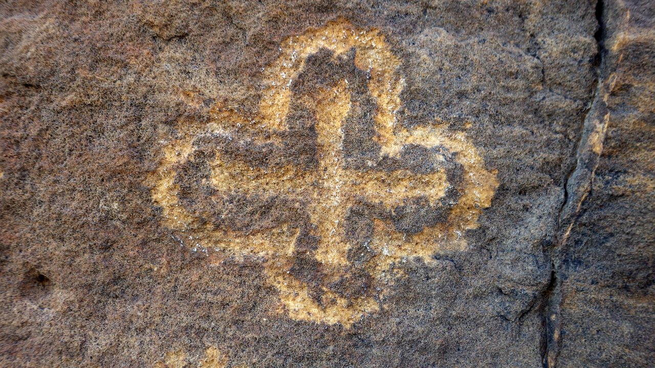
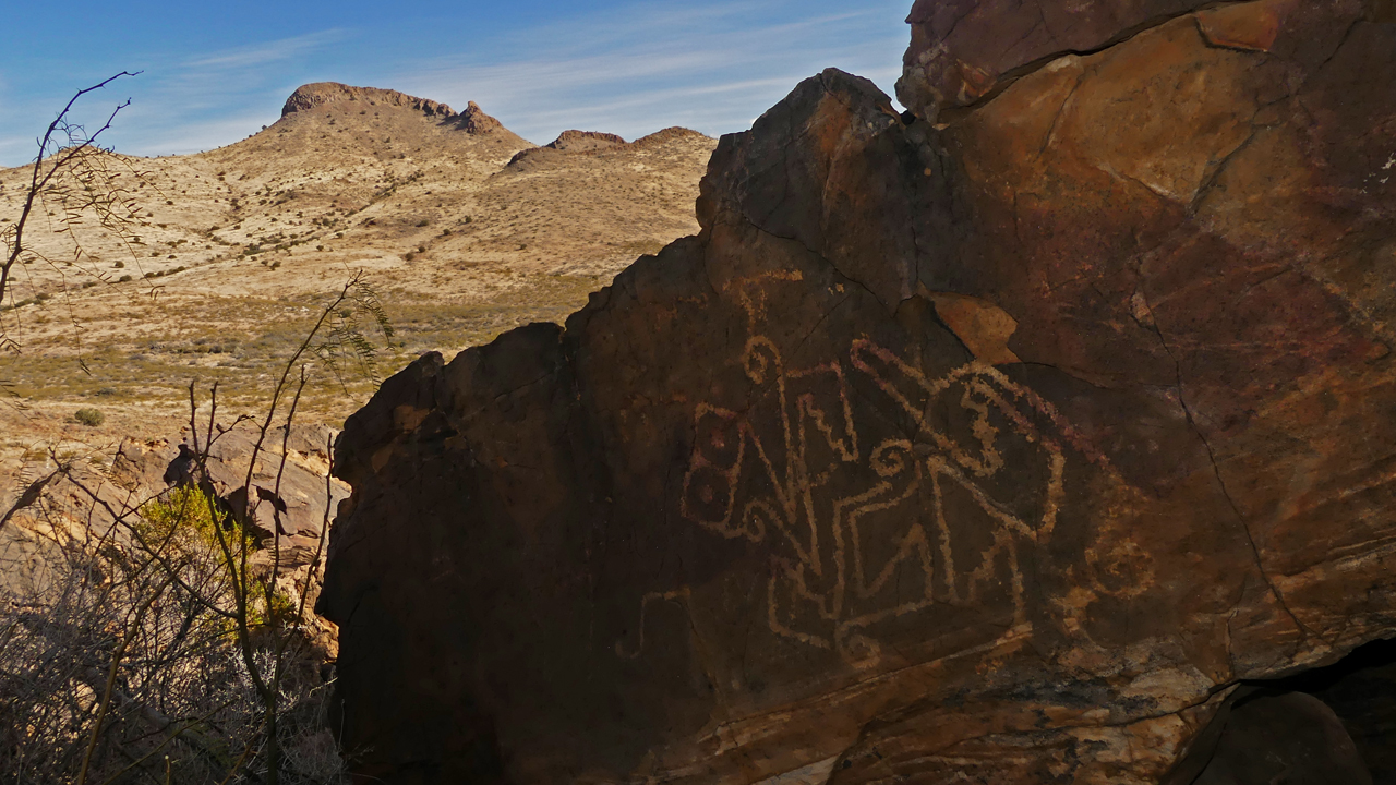
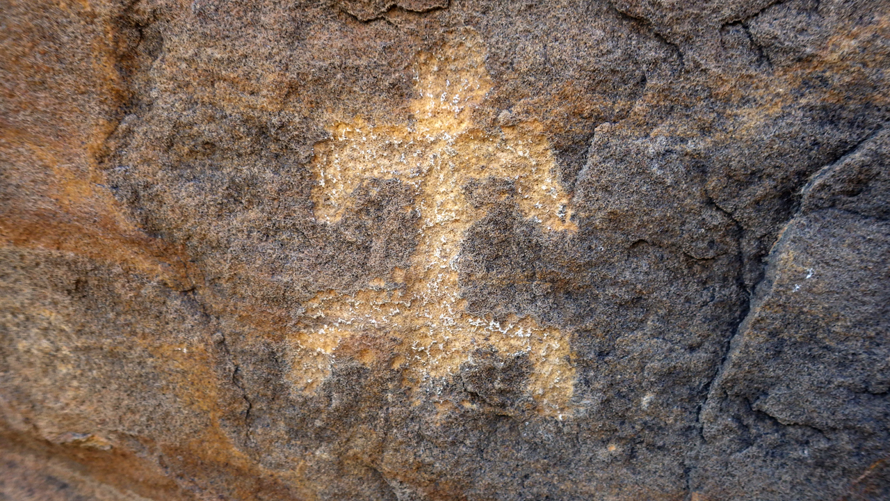
This symbol with what looks like a cross with scalloped edges occurs frequently at this site.
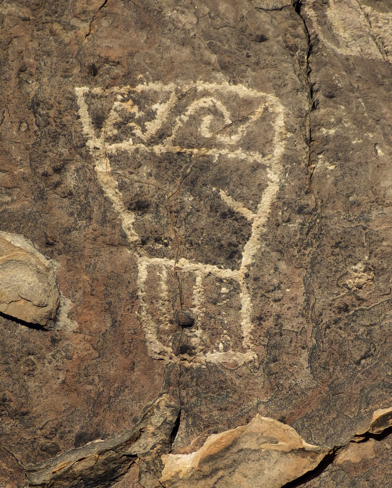
Corn? Or a human form?
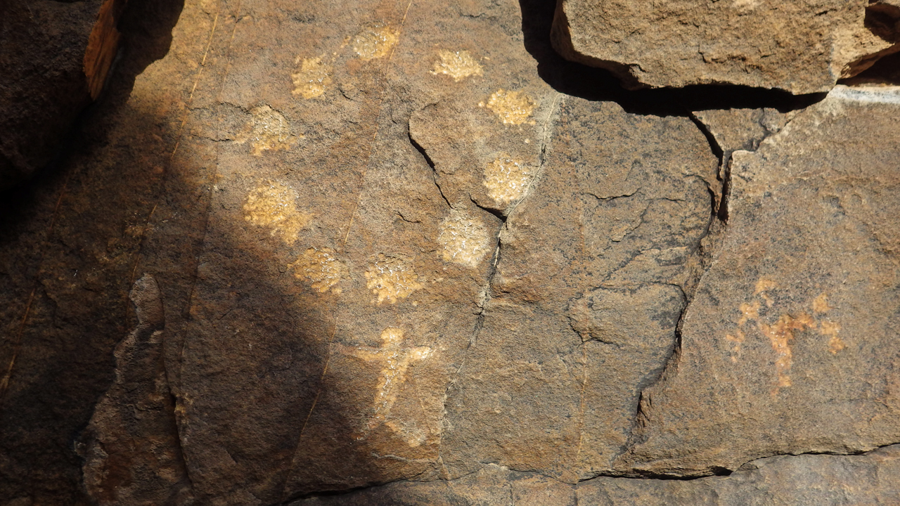
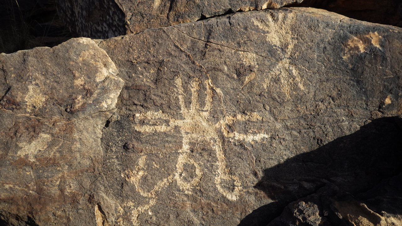
A circle of 10 dots above a human form with outstretched arms.
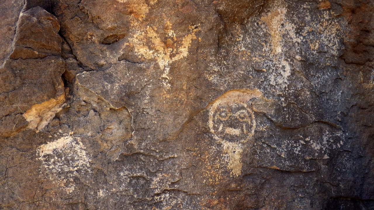
Is this quizzical face with glasses — or a mask — of modern or ancient origin?
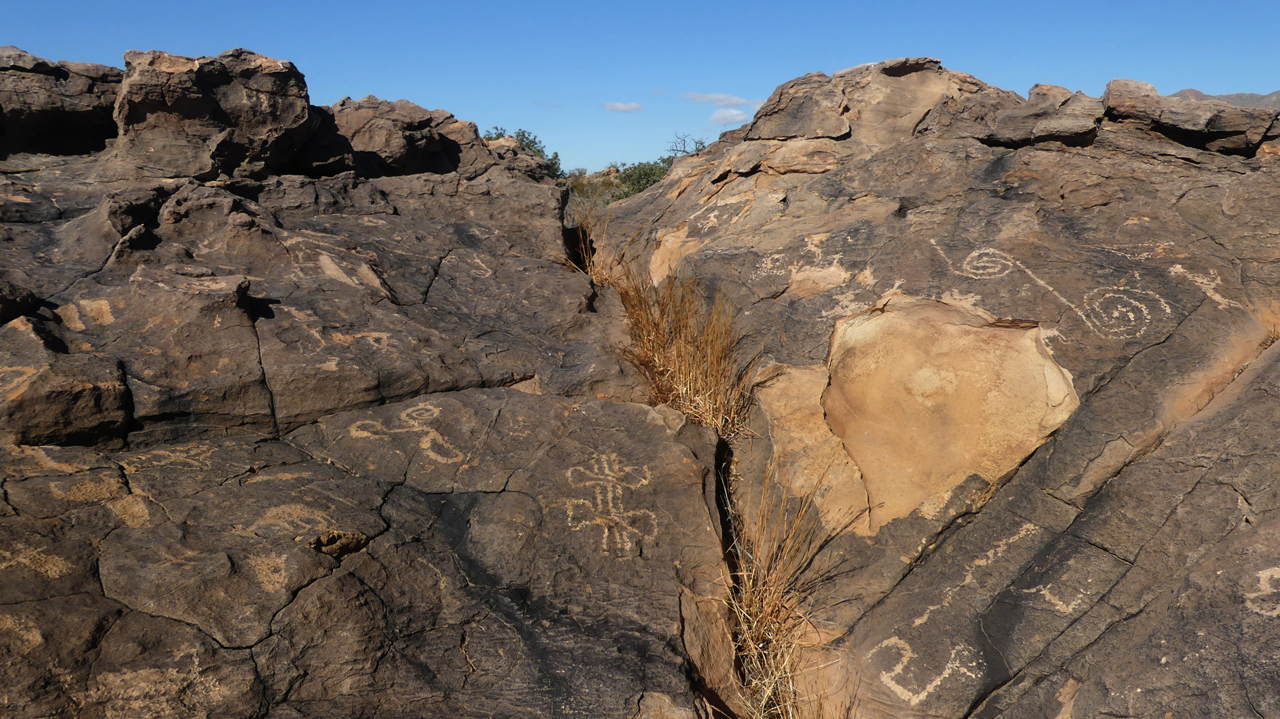
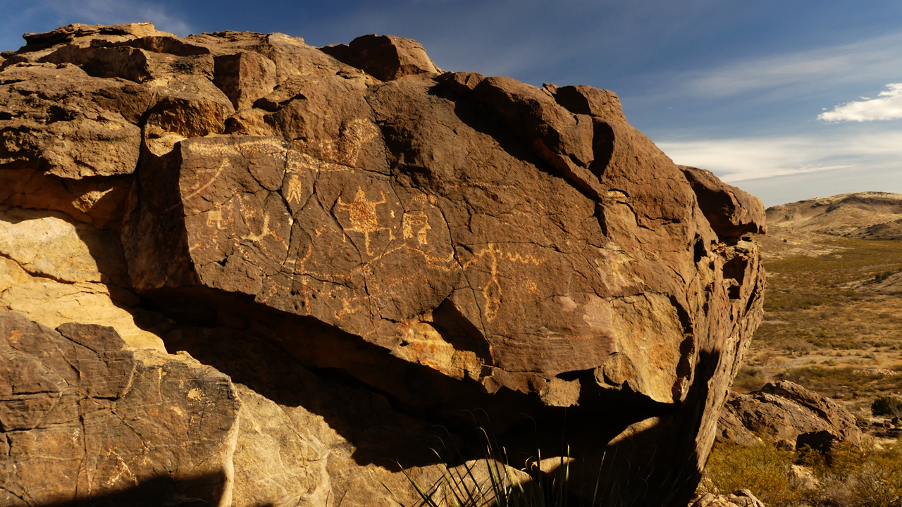
Overview
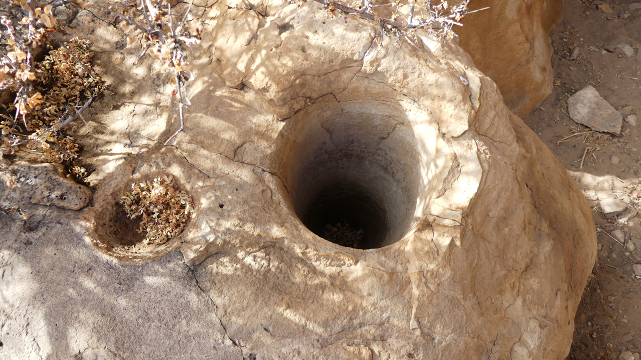
There were also numerous bedrock mortars, and they were the deepest we'd ever seen.
Their number and depth appear to indicate a long period of sustained use.
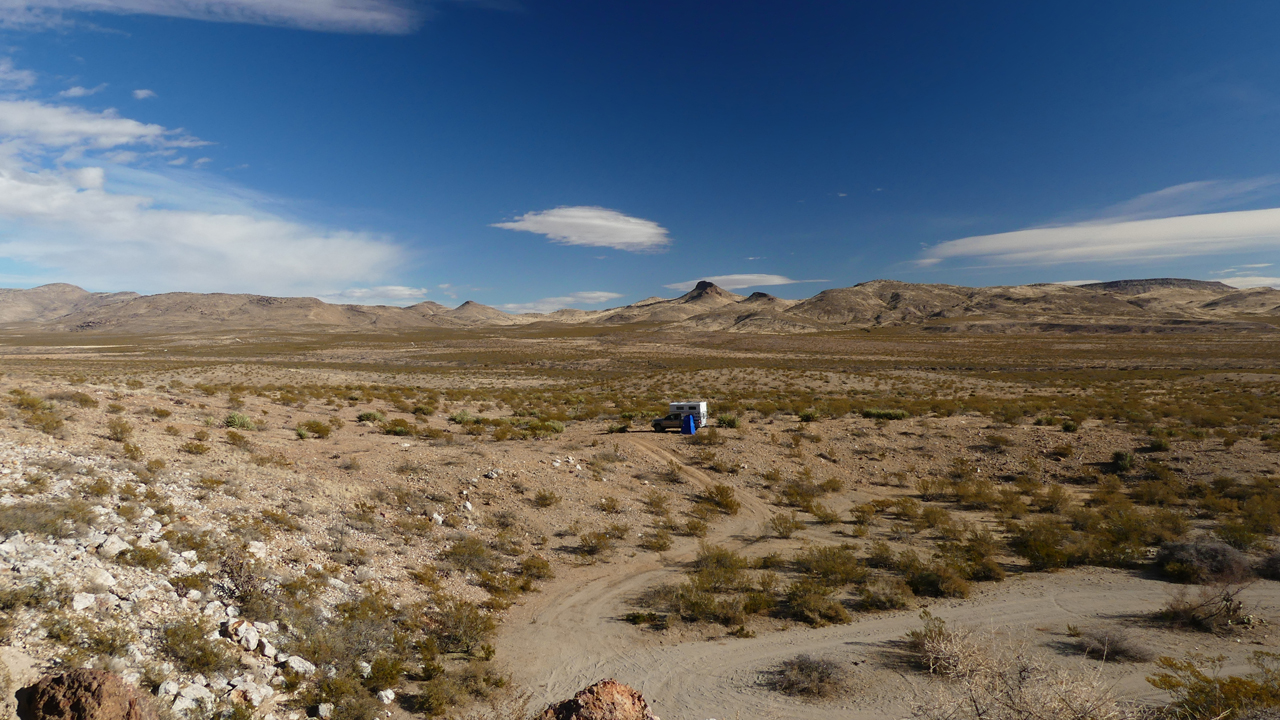
As planned, we camped at a prime spot near the base of Fluorite Ridge.
December 26, 2021
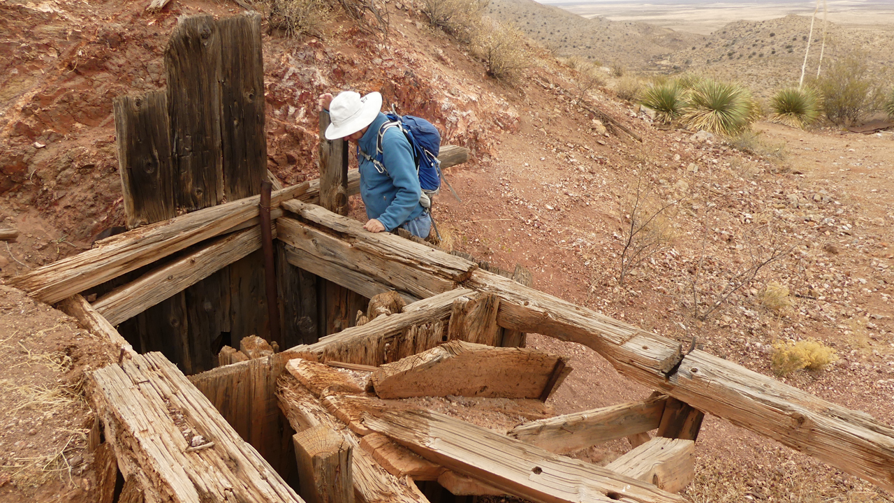
The next day was cold, cloudy and impossibly windy, but we bushwhacked to the top of the ridge as planned to check out a couple of abandoned mines.
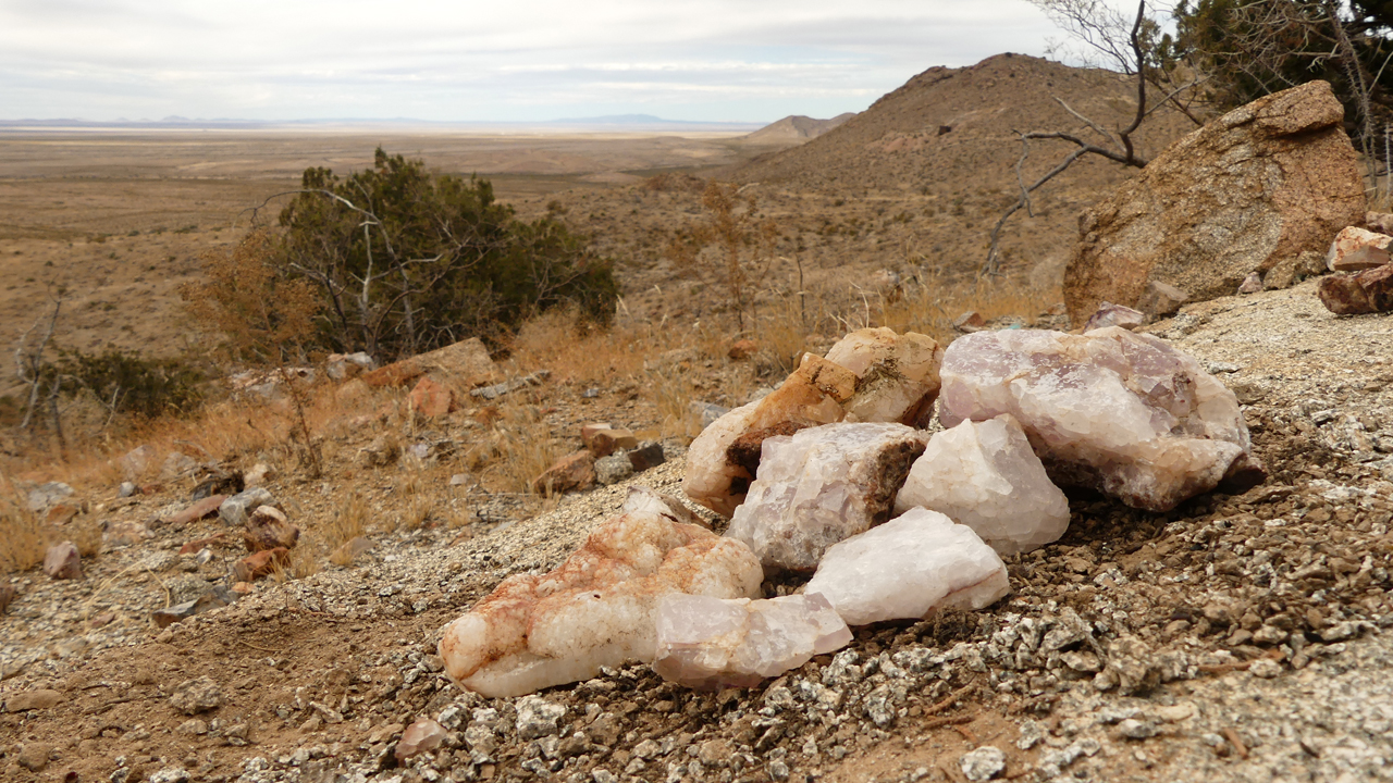
Despite a passing motorist's warning that "there are no more rocks on Fluorite Ridge", I inched down a tailings pile to retrieve several specimens, then found myself wallowing in unexpectedly loose scree. Like the parable of the fox and the monkey, I had to let go of my baubles in order to use both hands to claw my way back uphill.
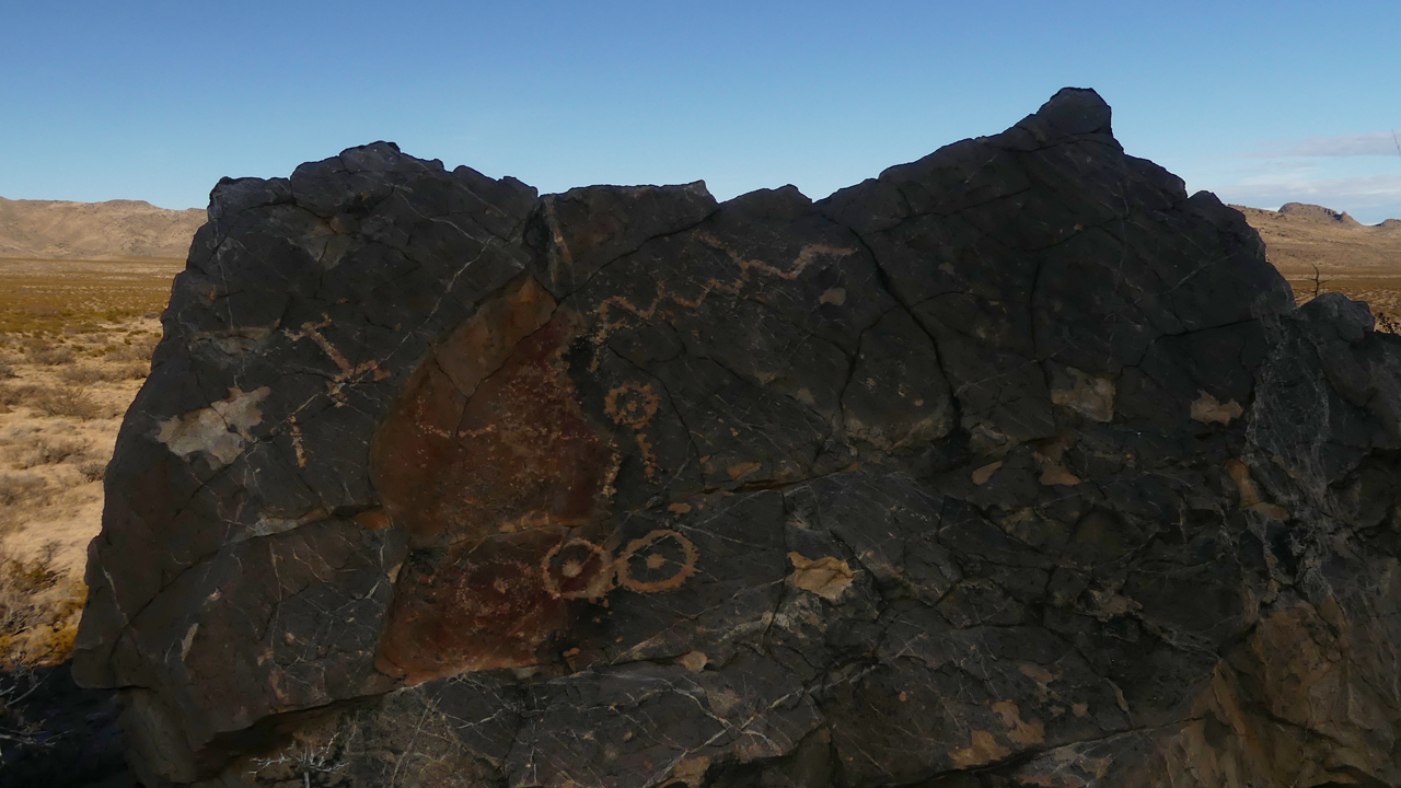
Tired of the wind, we were ready to pack up and head home when the sun finally made an appearance. So instead we decided to see if we could find the other set of petroglyphs.
With the sketchiest of directions, we spent several hours stumbling around in the rocks before finally happening upon the petroglyphs.
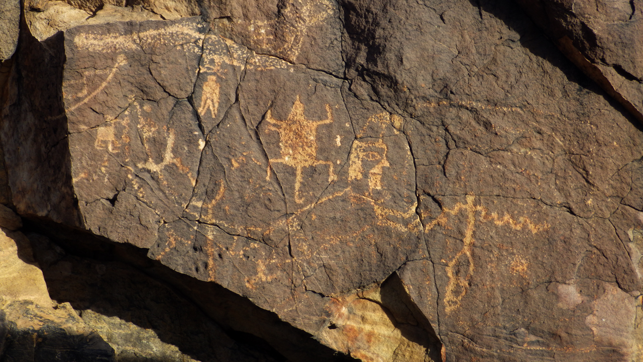
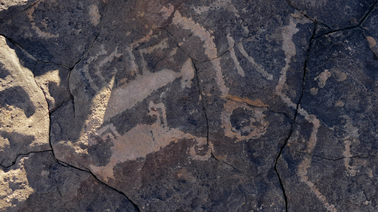
Could this be anything but a bighorn sheep and a hawk?
Bigfoot?
I see an insect, with a curled proboscis.
A skeleton and a flag at half mast?
A drooping yucca? Or a comet?
Surely a snake, with the rattles on the tail, and fangs.
Bighorn sheep.
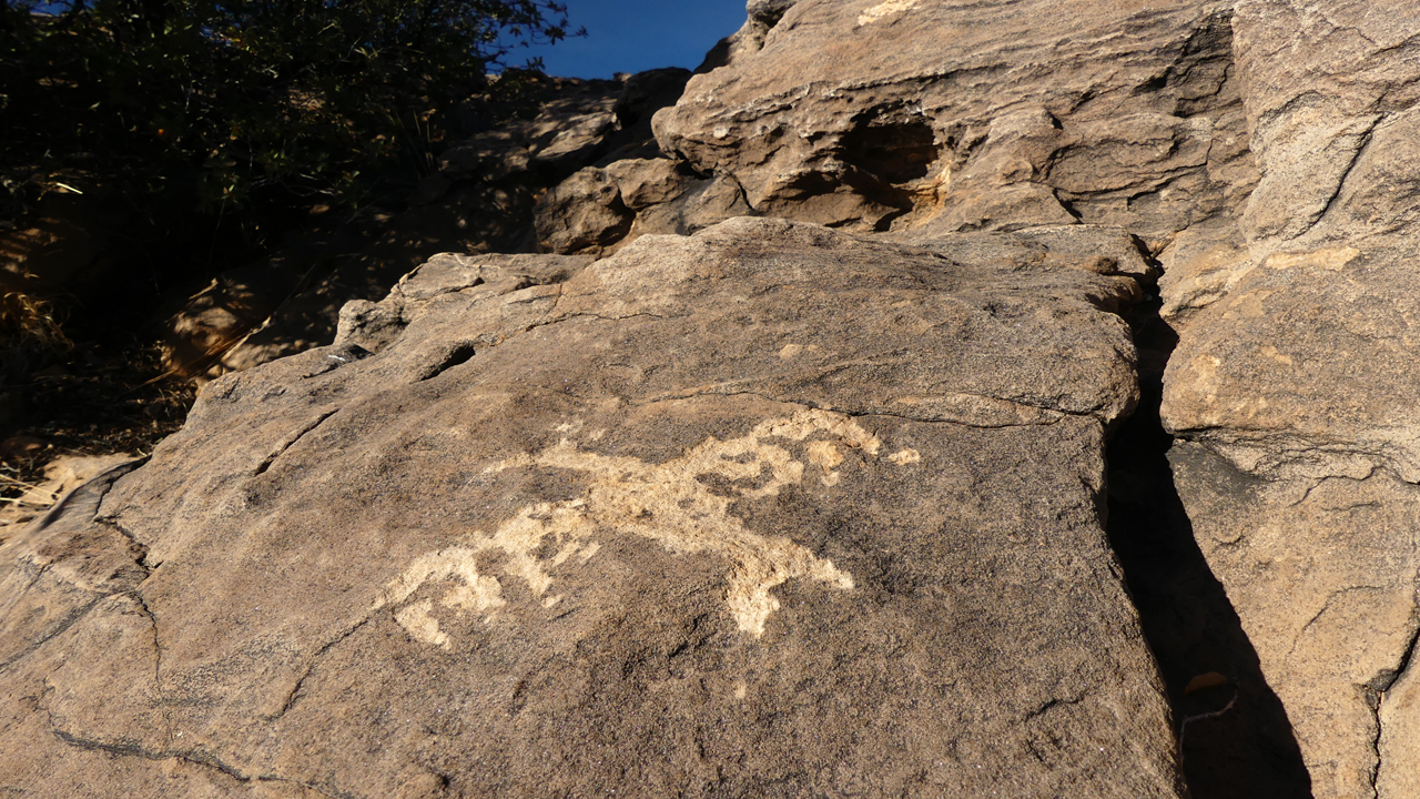
Nice cat!
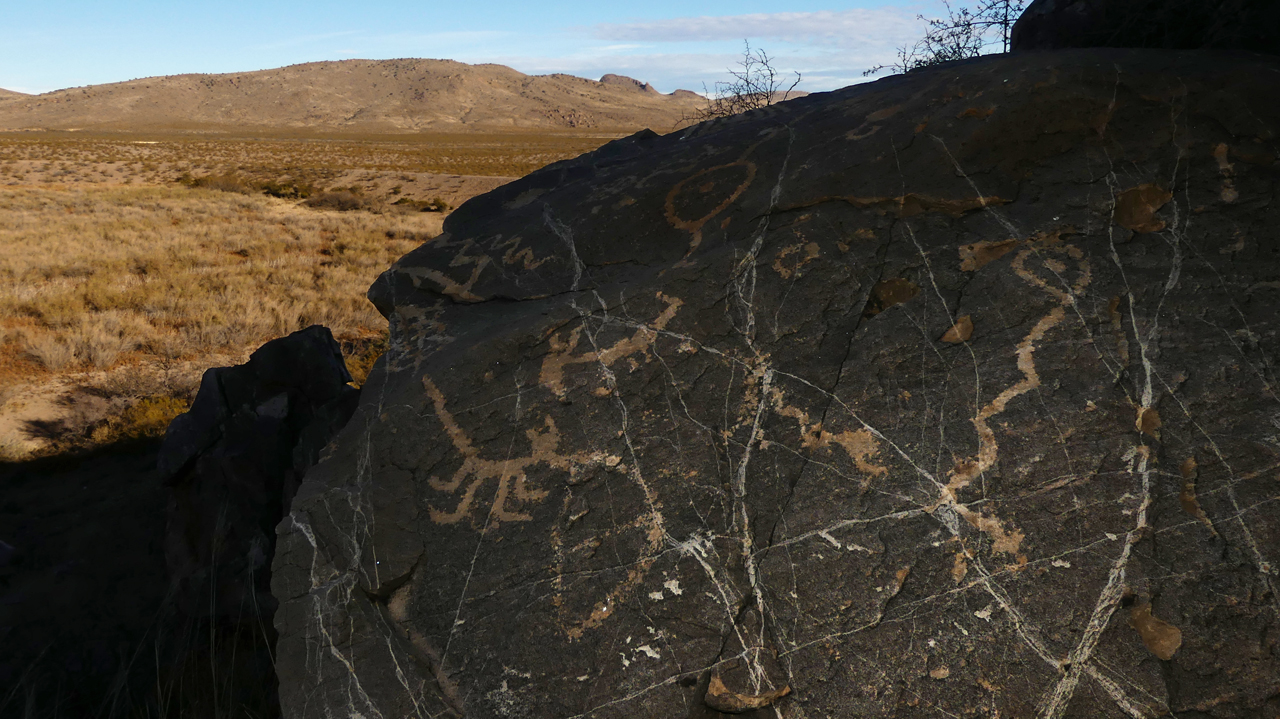
A longer view.
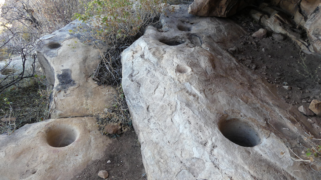
More of the very well used bedrock mortars.
I am omitting the photos of areas where petroglyphs have been chipped away by selfish, thoughtless people. These petroglyphs are carved into extremely friable rock. Please leave them where they are, to be enjoyed by all for as long as possible, and be cautious about sharing their precise location.