With a geriatric cat at home, we've been taking shorter trips this fall. And we rediscovered the Dragoon Mountains, not far from home with
a wealth of great hiking and camping possibilities.
November 11-13, 2016
This was a trip where we got everything wrong, but still came out alright. We decided we'd try for another SOTA peak, and to our amazement,
nobody had activated China Peak in the Dragoon Mountains. Little did we know that there are several China Peaks in Arizona, and we were aiming for the wrong one.
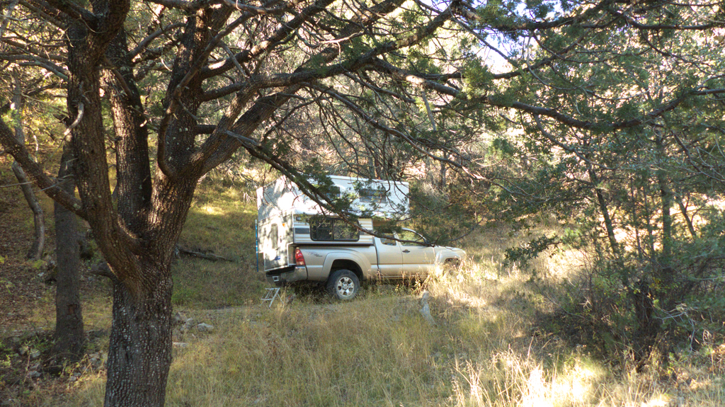
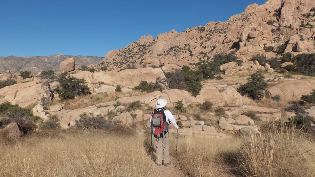
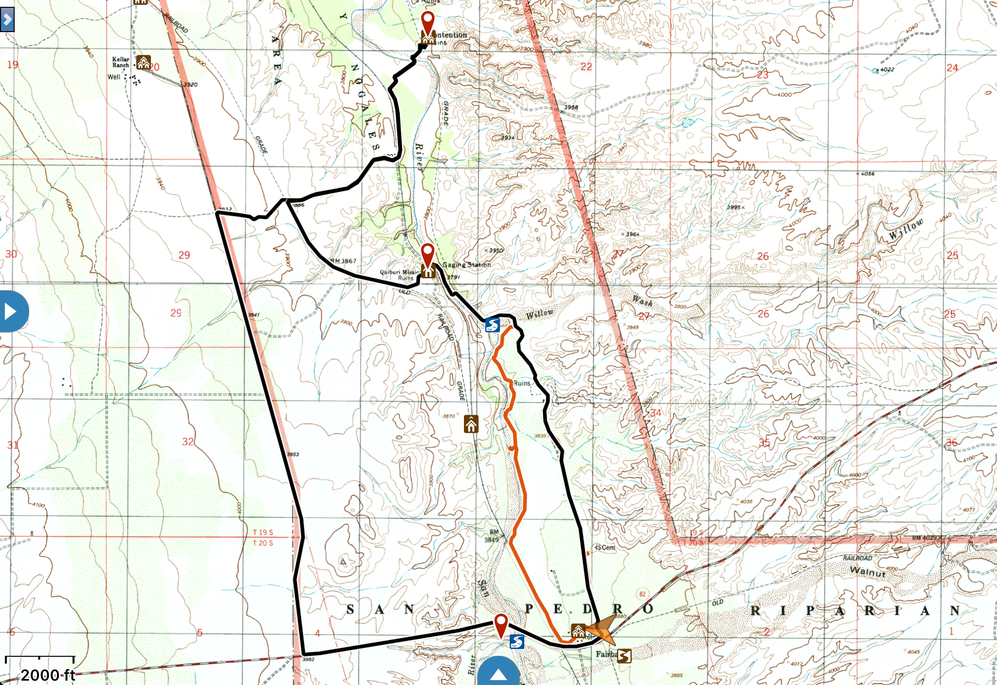
So off we went on a Friday morning, peeling off Middlemarch Road onto FR 345A, which climbs deep into the southern Dragoons. We
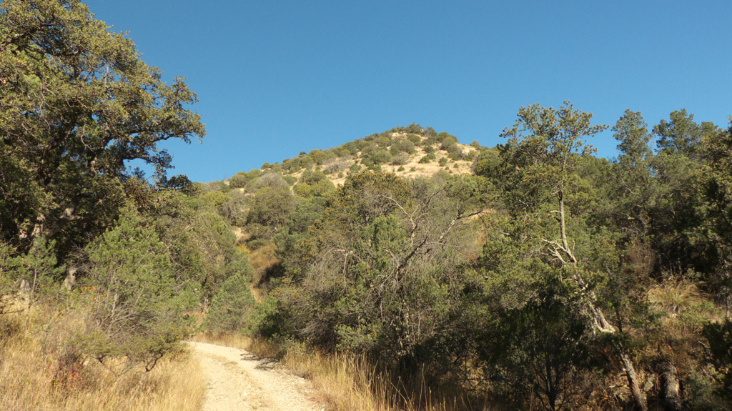
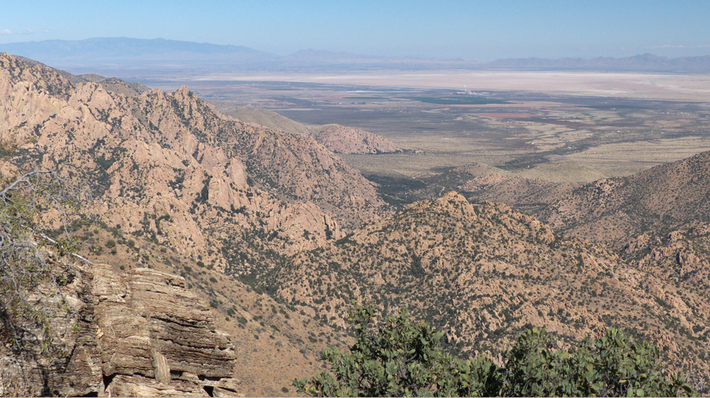
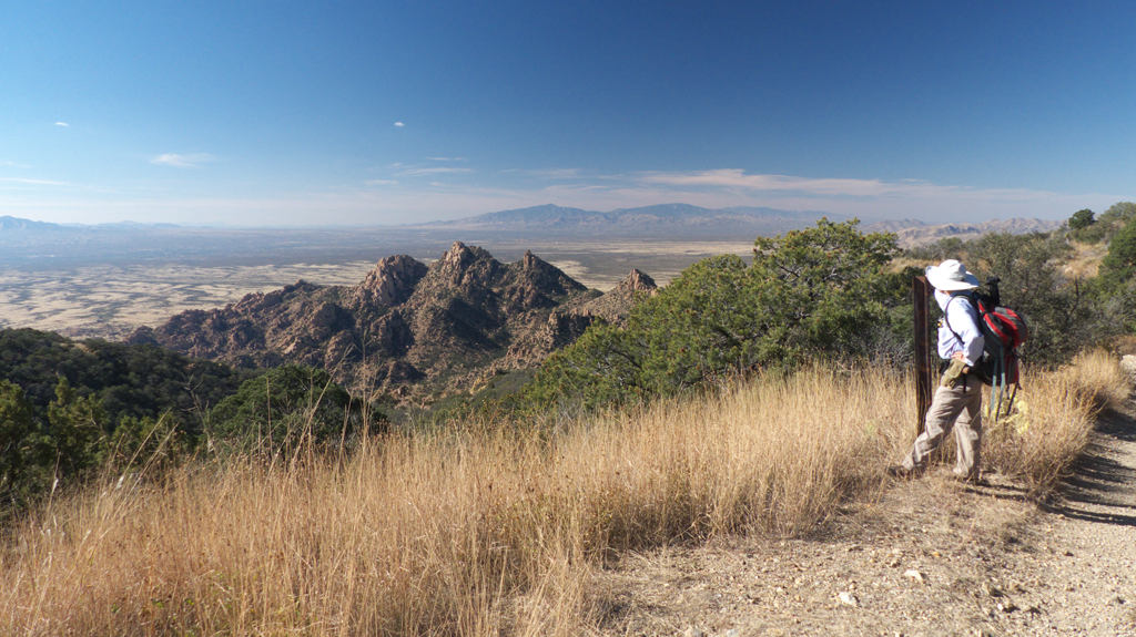
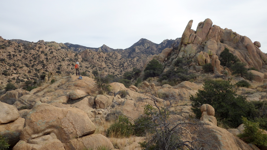
clawed our way to a fine campsite at about 6300 feet.Instead of China Peak, we decided to bushwhack to the top of this neaby summit, which we identified as Cochise Peak.
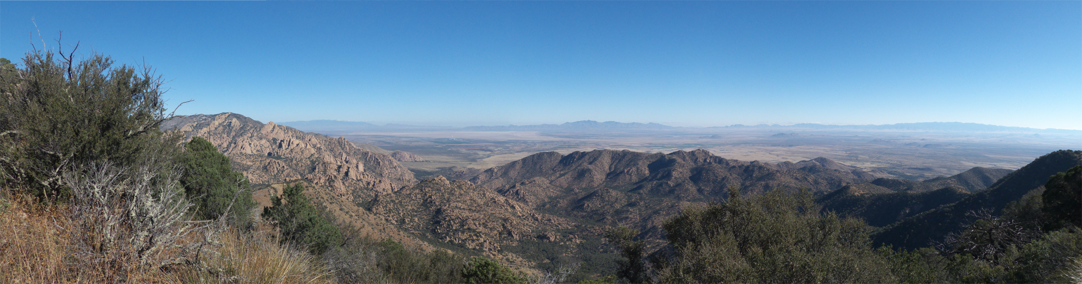
(Scroll for panorama). Though getting lost seemed pretty unlikely, we turned on GPS tracking. We were almost to the top when we
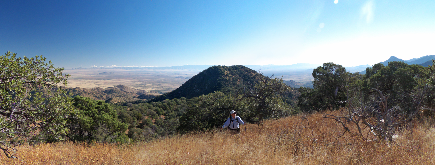
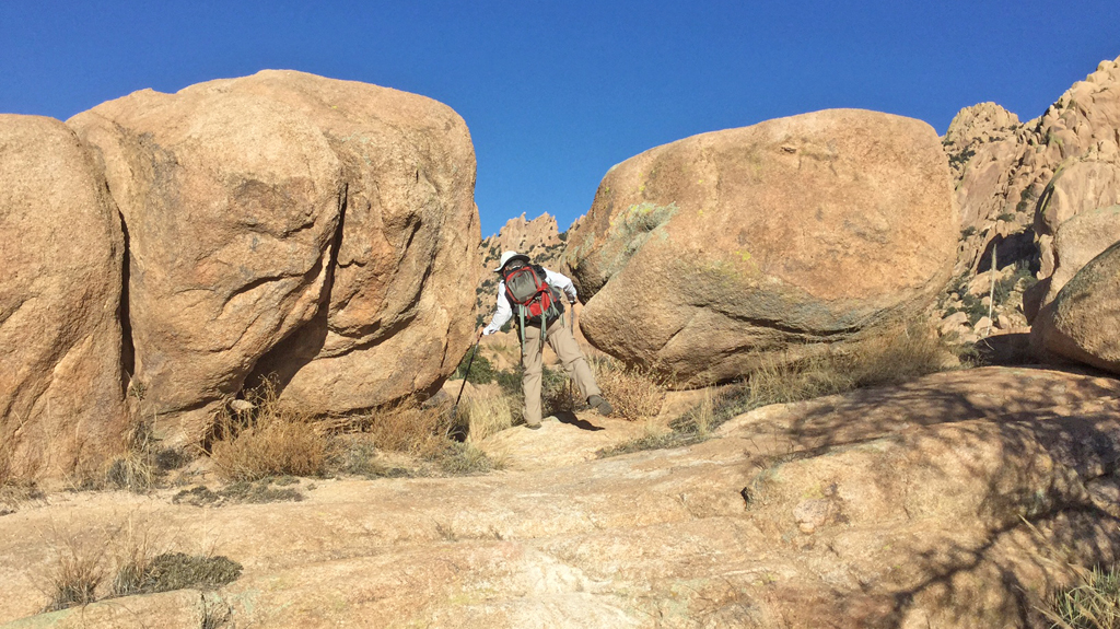
realized we had climbed the wrong mountain. Instead of Cochise Peak, we climbed an unnamed peak with an elevation of 7010' — 213 feet taller than our original objective.
It was a tough scramble. We're sort of amazed that we
can still do this stuff at our age!
(Scroll for panorama). We weren't disapointed. This mountain has a rocky summit composed of weirdly stratified
gray and rust ancient seabed and has fabulous views across the Willcox Playa to the Chiricahuas and south into Mexico.
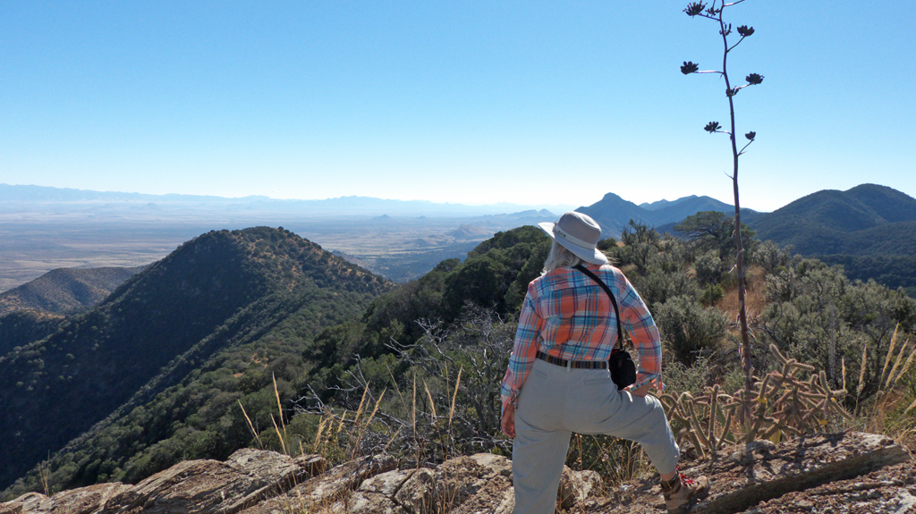
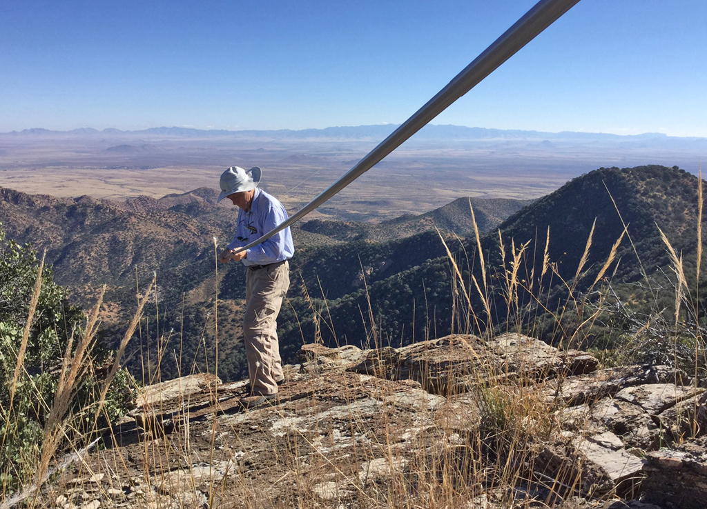
Dennis setting up his telescoping fiberglas amateur radio antenna.We actually made a few contacts. Too bad this peak is not SOTA-eligible.Striking the antenna. If it looks like he was a few feet from a precipice,
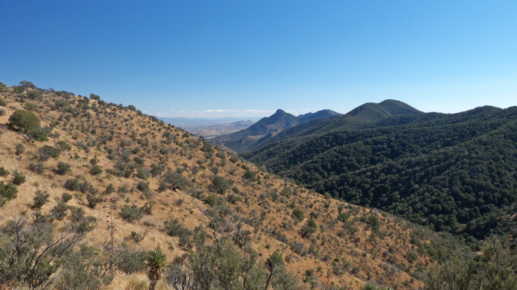
it's because he was!Looking northeast at the ruddy rounded rock formations that are more typical of the Dragoons. In raven miles, we were just a short
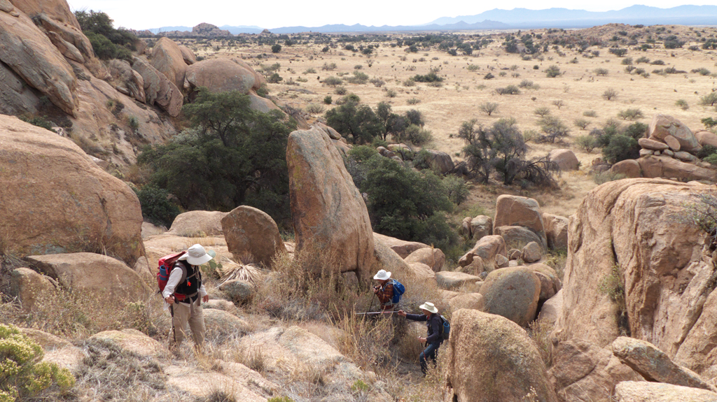
distance from Cochise Stronghold.Instead of retracing our steps, we decided to see if we could avoid losing so much elevation by slabbing around the side of the ridge and
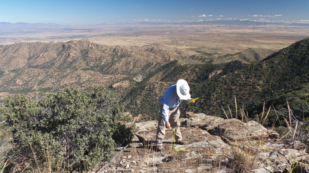
intersecting the road higher up the canyon. With game trails everywhere, it was pretty easy walking through waist-high yellow grass.We ended up at Pear Tank (now dry).From there, we hiked up the road to a high saddle, where we had great views to the west and down into
Slavin Gulch, where we
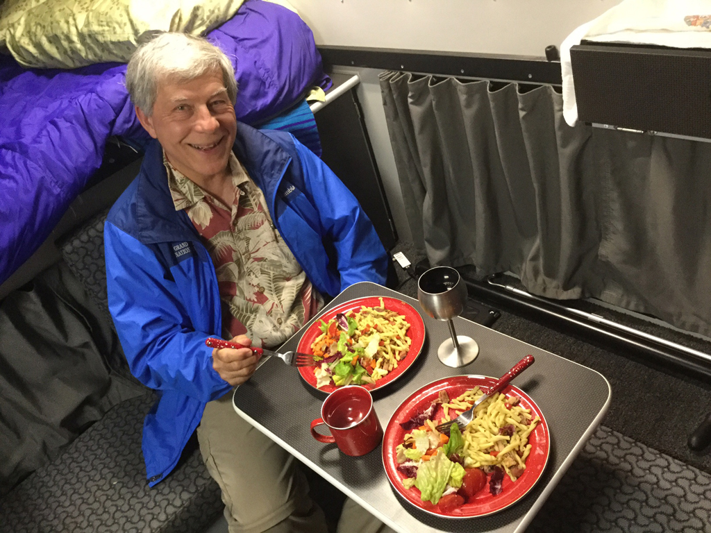
have backpacked several times. The road continues downhill to Abril Mine, at the top of Slavin Gulch. Dennis is leaning on a rail from the line that once served this canyon.That night we continued east on Middlemarch Road, eventually making our way to Whitewater Draw, where we were happy to be able to cook
a nice evening meal in the comfort of the Taco Grande.
We were hoping to see the Sandhill Cranes lift off
in the morning. There were very few cranes, and the water seemed curiously low given all the rainfall we had this summer. Agribusiness is
buying up land like crazy in Cochise County, where they have unrestricted access to water for thirsty crops like pistachios and almonds. Over the last few years, I have noticed a drastic
decline in water levels here and on the eastern side of Aravaipa Canyon. Is anybody paying attention?
November 18-20, 2016
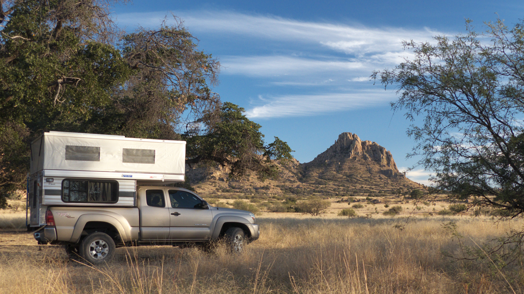
That was way too much fun! So back we went the following weekend to the sunnier west side of the Dragoons.
We had
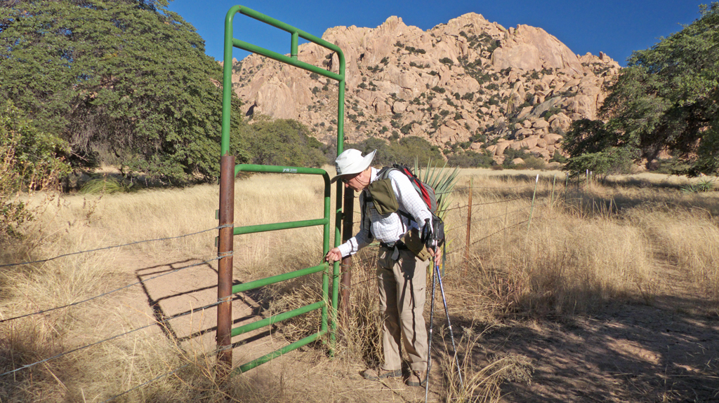
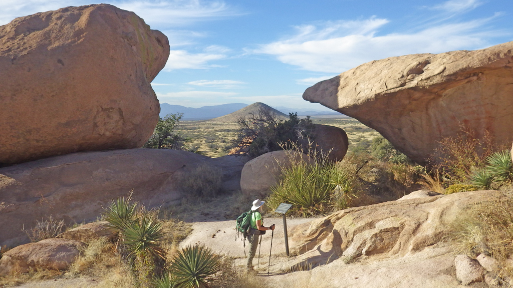
no trouble finding a spectacular campsite on the sunnier west side of the Dragoons.Nearby was a convenient metal gate that connects
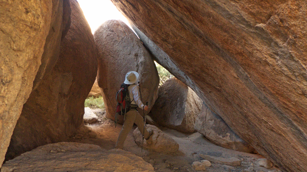
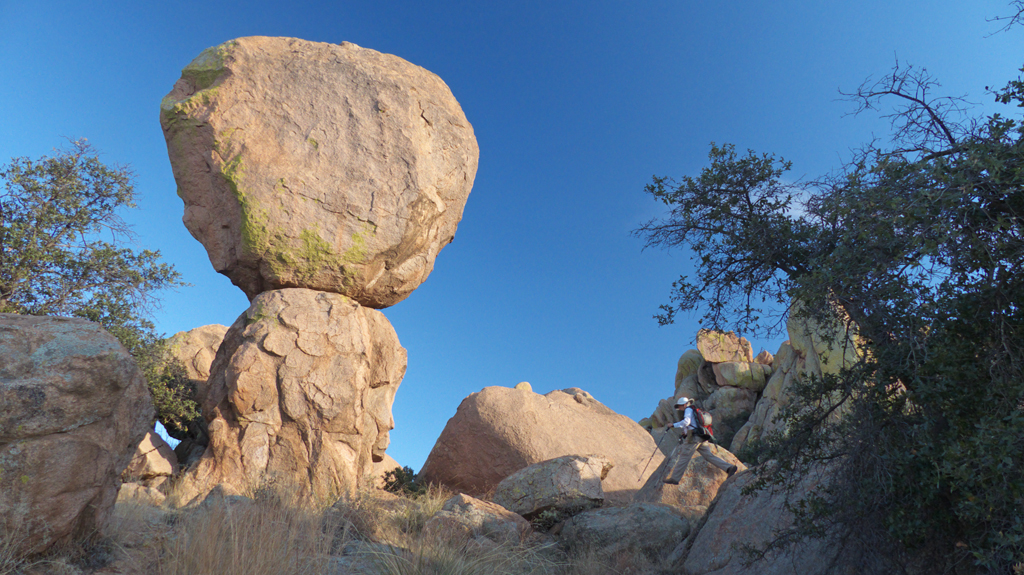
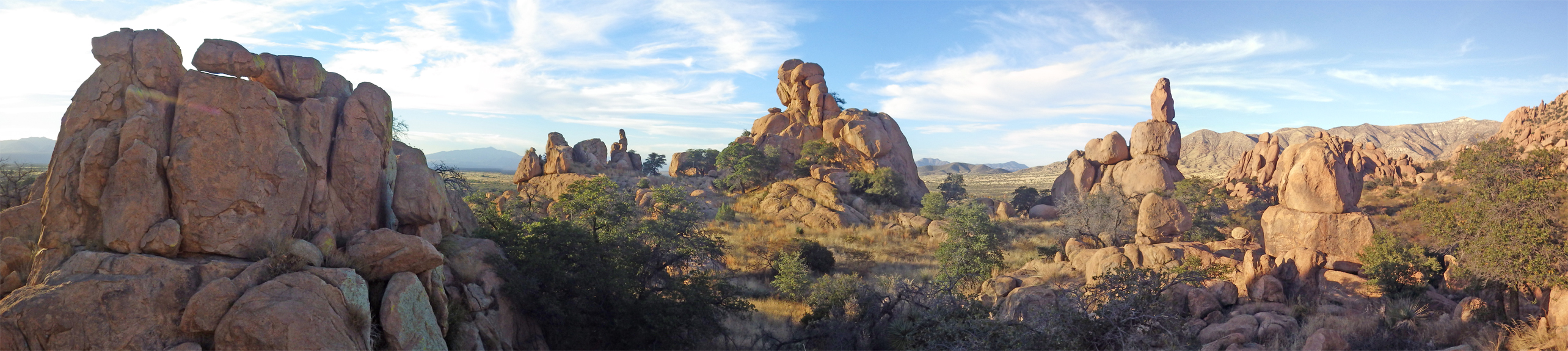
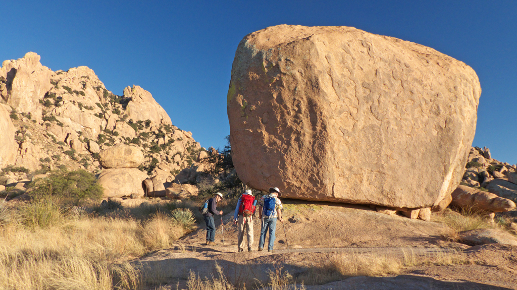
to a trail that leads to Council Rocks.There are casual trails throughout this tumble
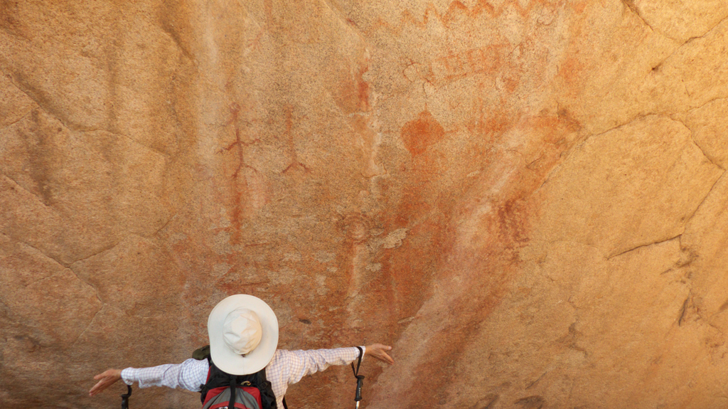
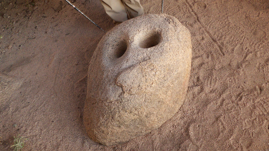
of weird hoodoos and spires, and we did a thrilling loop that included a climb high above the campsite.Passing through a natural gate.There are pictographs, mano metates and other reminders
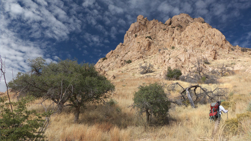
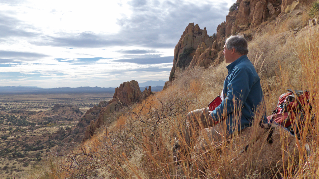
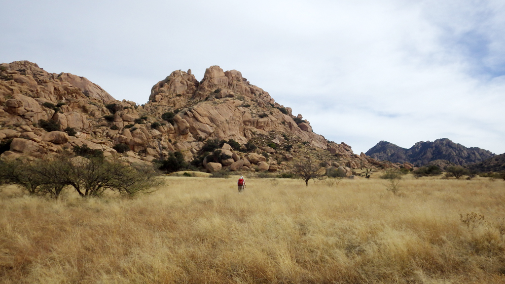
that this area's long-term habitation by the Chiricahua Apaches.A tumble of rocks create a natural shelter.Mano metate with a human face.Day two, we tried to climb nearby Little Elephant Head,
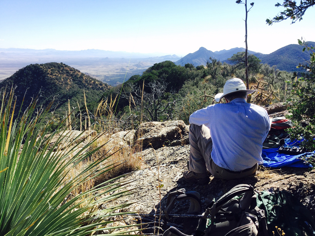
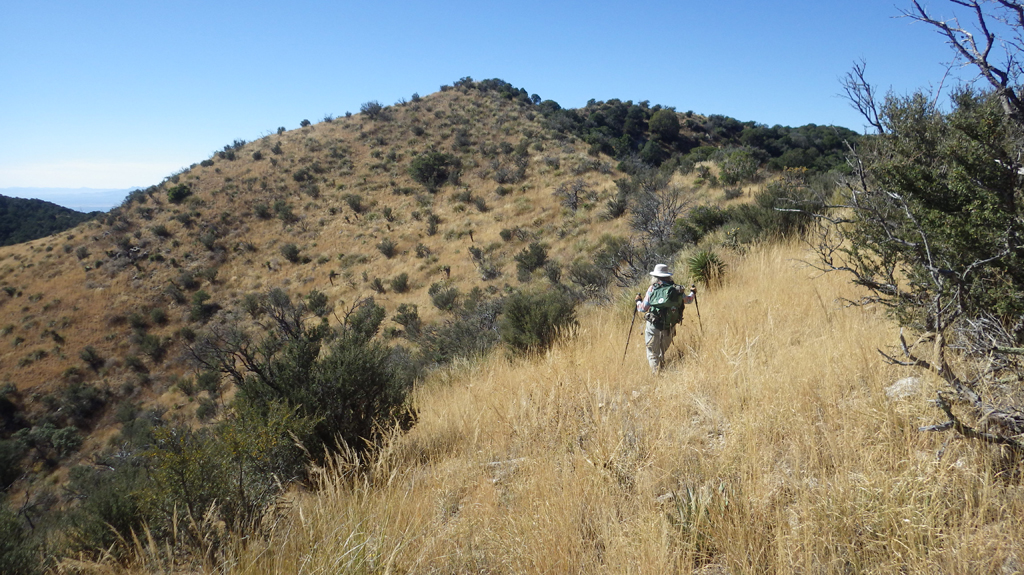
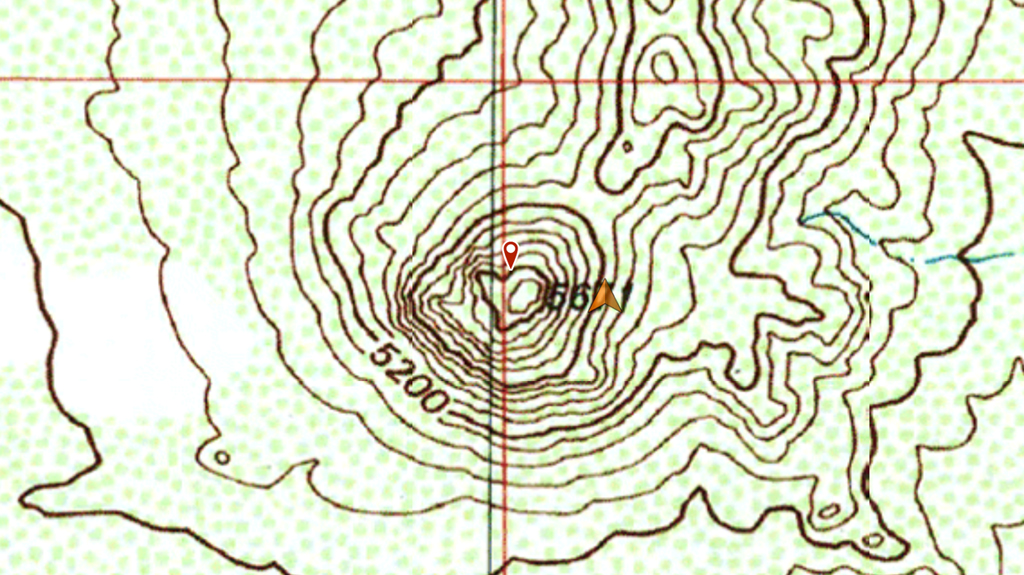
a SOTA-elible peak.The trail that appears on ESRI Images is long gone, and it was
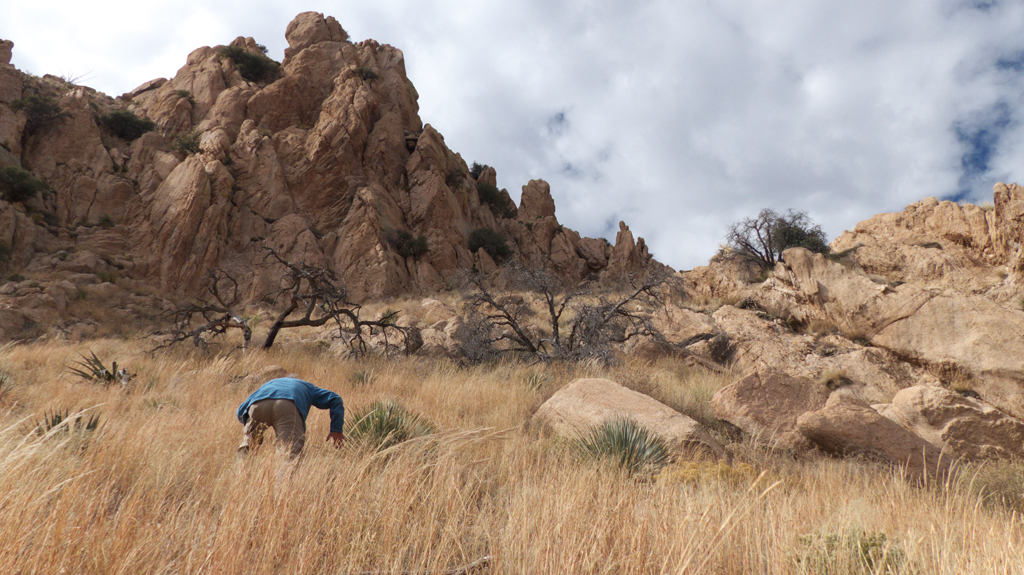
a long, tough steep slog.We abandoned the effort just 300 feet from the top (5671 feet).Arrow shows our location. Our GPS track, cross-country via a non-existent trail, and
back down following a draw with several dry waterfalls.
(Scroll for panorama)
November 24-26, 2016
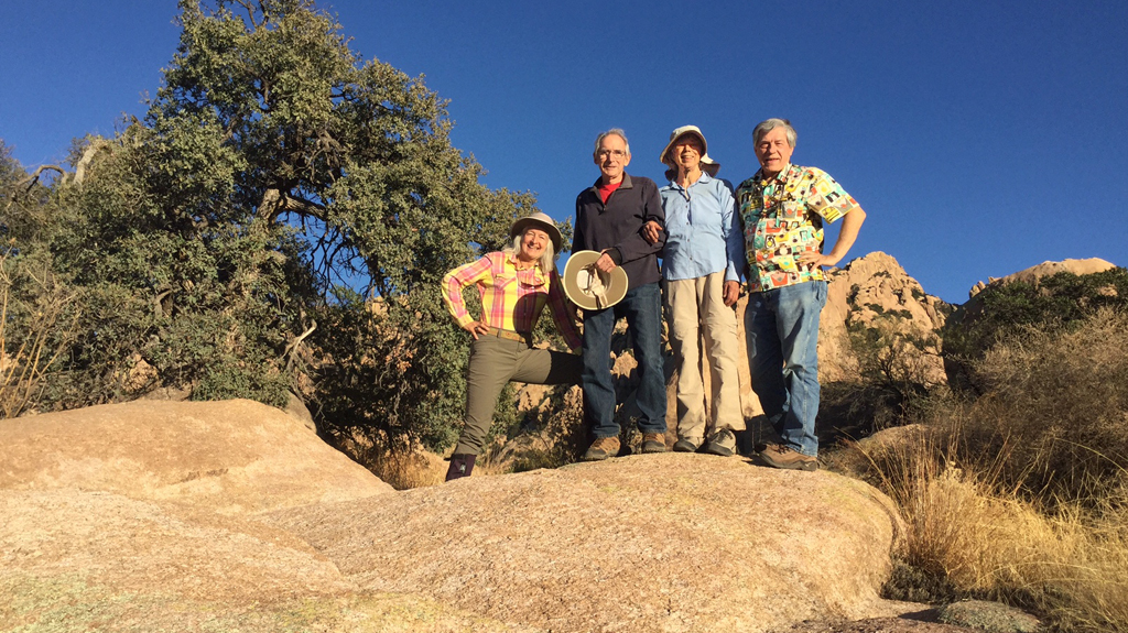
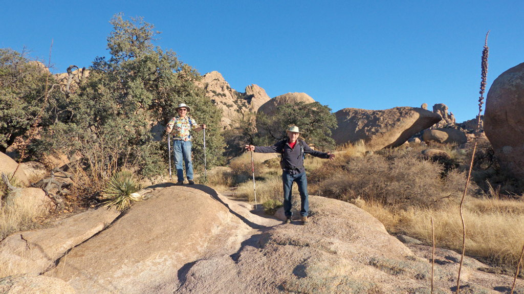
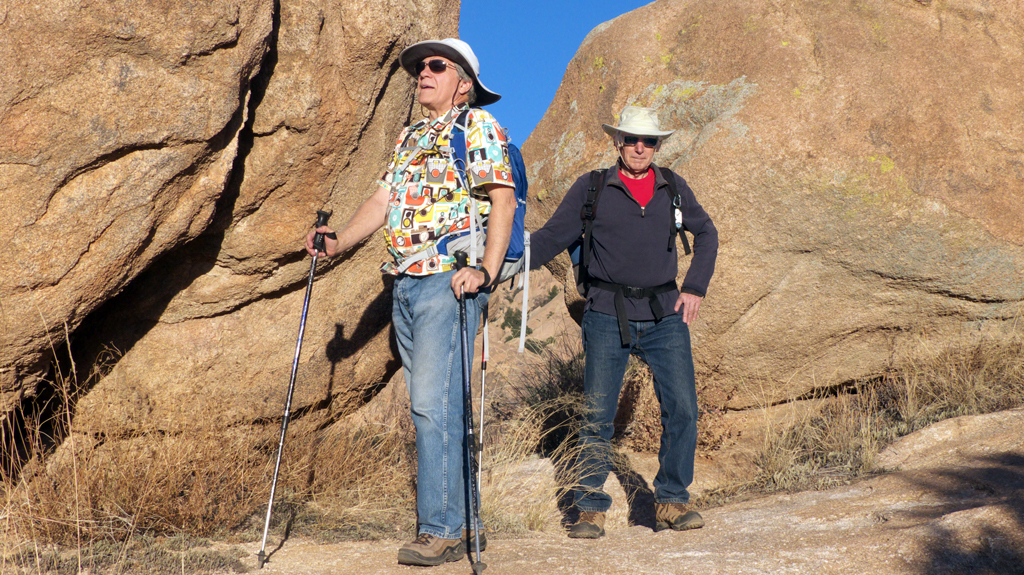
We returned to the west side of the Dragoons for Thanksiving with our friends Flo and Tom
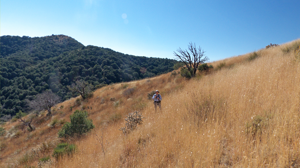
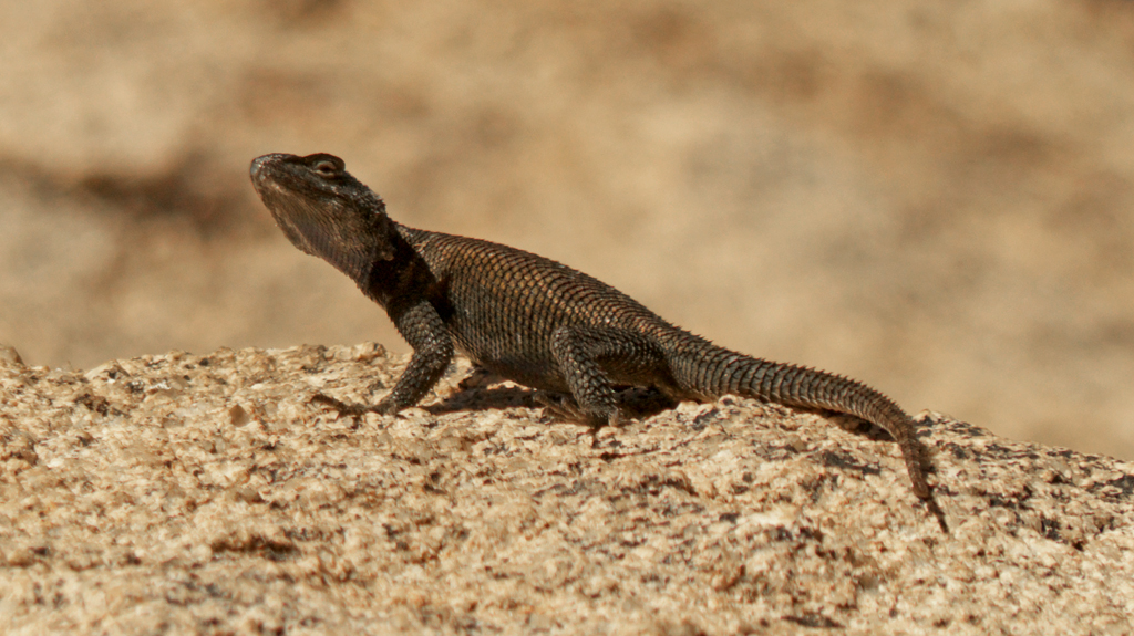
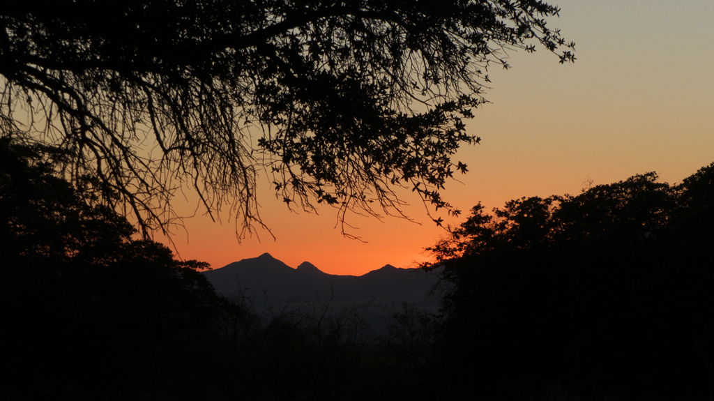
I'm not sure we haven't moved here part-time!We enjoyed a great afternoon hike to Council RocksWe saw the same deep copper-colored mountain spiny lizard that we had seen the previous week sunning himself on the same rock!House-sized boulder near Council RocksMarlboro Men!Fiery sunset from our campsite.On Day 2, we bushwhacked through waist-waist high yellow grass toward a saddle near
Little Elephant Head. We were surprised to
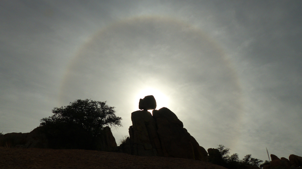
stumble on an old trail that leads from the campsite over the saddle and into a hidden valley that empties into Slavin Gulch.We scrambled up a tumble of rocks to capture this photo of a halo of ice crystals around the sun.On Day 3 we scrambled up some rocks behind the campsite and then dropped into a steep-sided canyon
that drops away from the saddle we visited the previous day and ends up at Council Rocks. The western slope of the Dragoons looks intimidating,
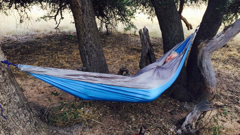
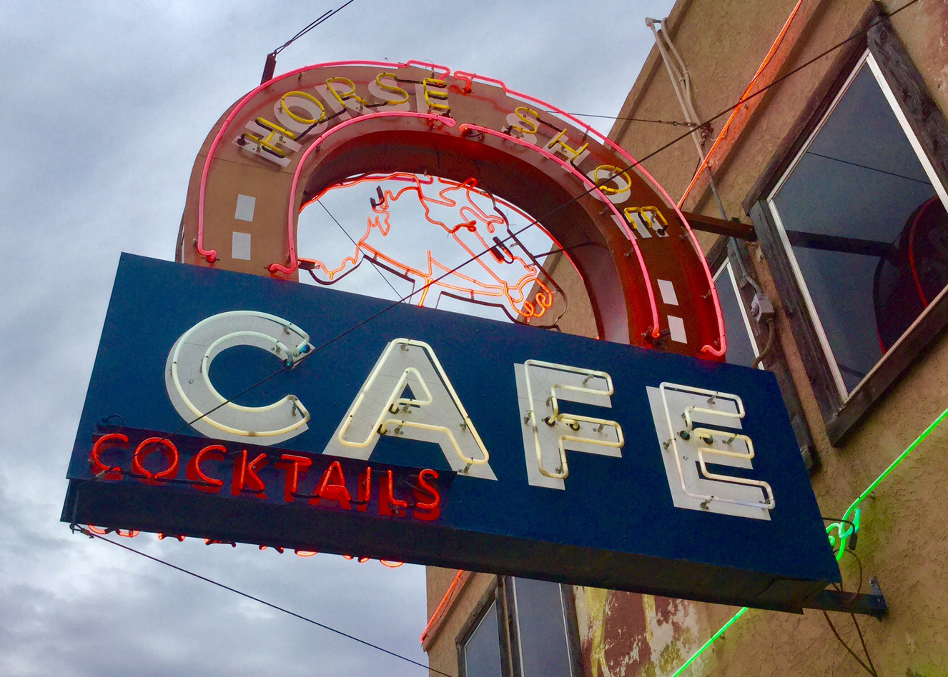
but the rough granite offers good footing and many natural "stairways" between the rocks."Pod people" relaxing in a lightweight backpacking hammock.A late lunch, cowboy-style, at the Horseshoe Cafe in Benson.