Our Pyramids
Agua Fria National Monument
January 11-13, 2019
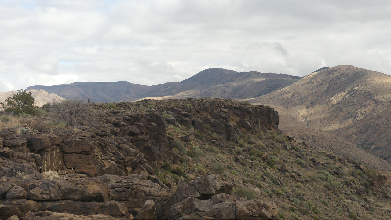
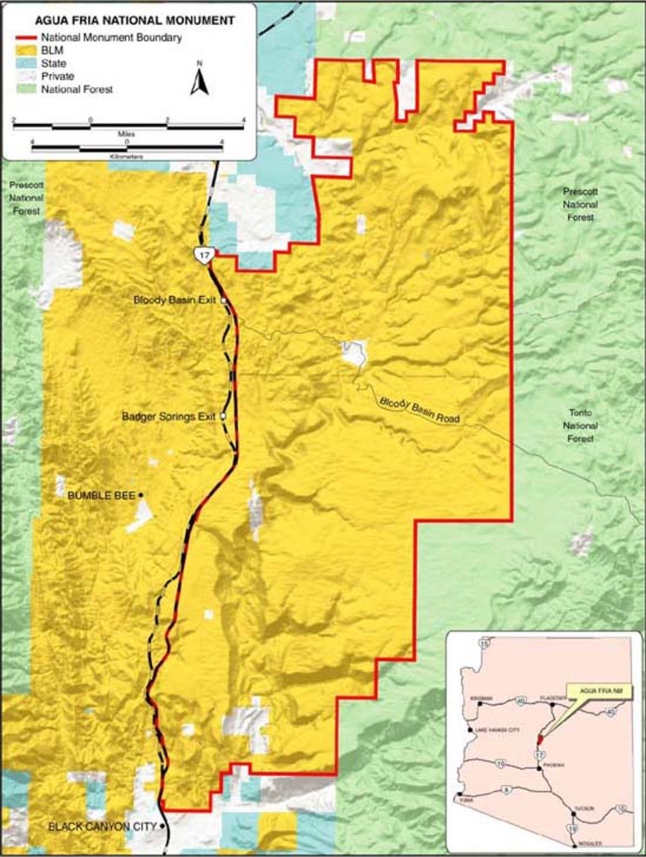
North of Phoenix near the Sunset Point rest area is large flat mesa deeply gouged by the many arms of the Agua Fria River. Most passersby would see little of interest here — just a vast expanse of yellow grass spiked with a few low thorny bushes and a handful of prickly pear cacti. But this mesa is part of Agua Fria National Monument, a 71,000-acre preserve that includes some of the significant late prehistoric sites in the American Southwest.
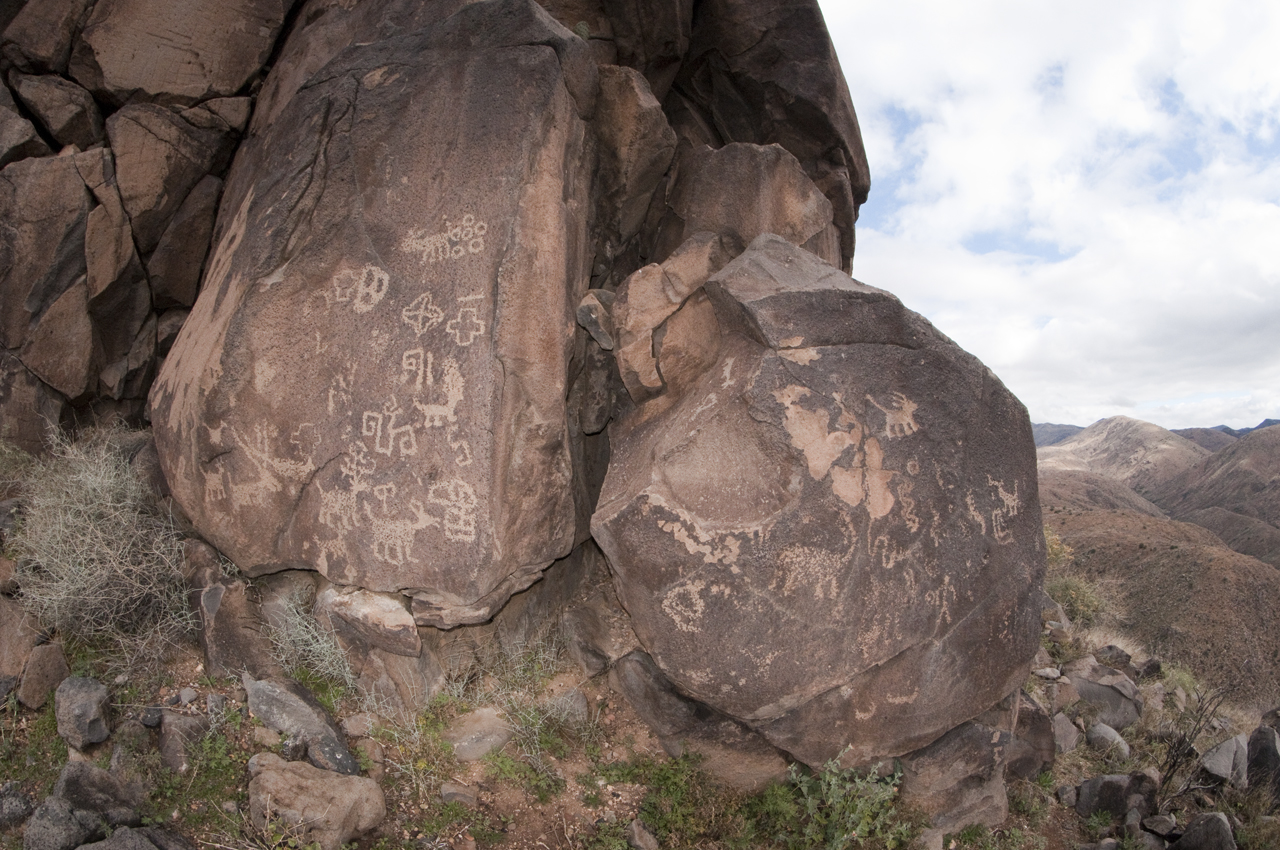
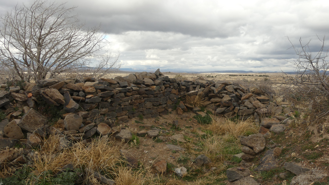
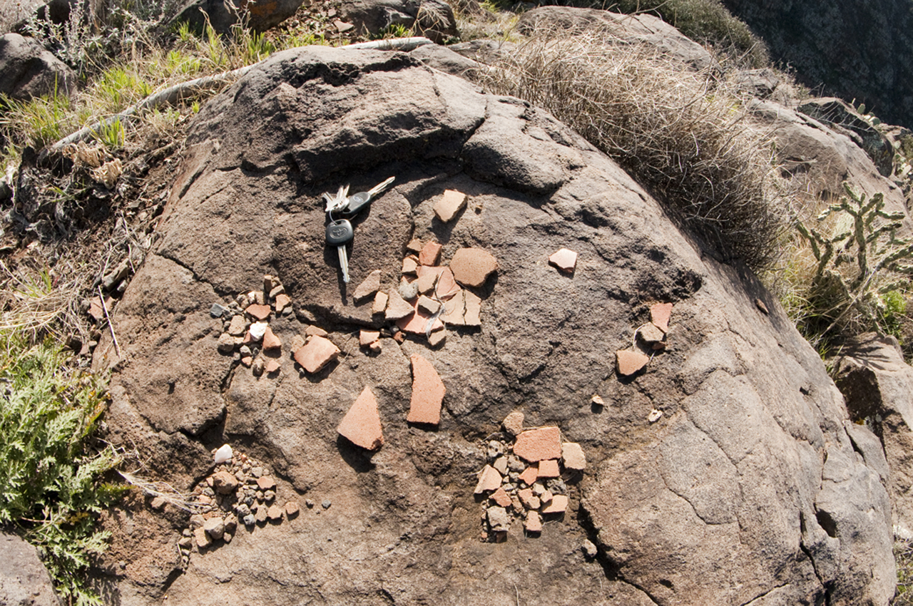
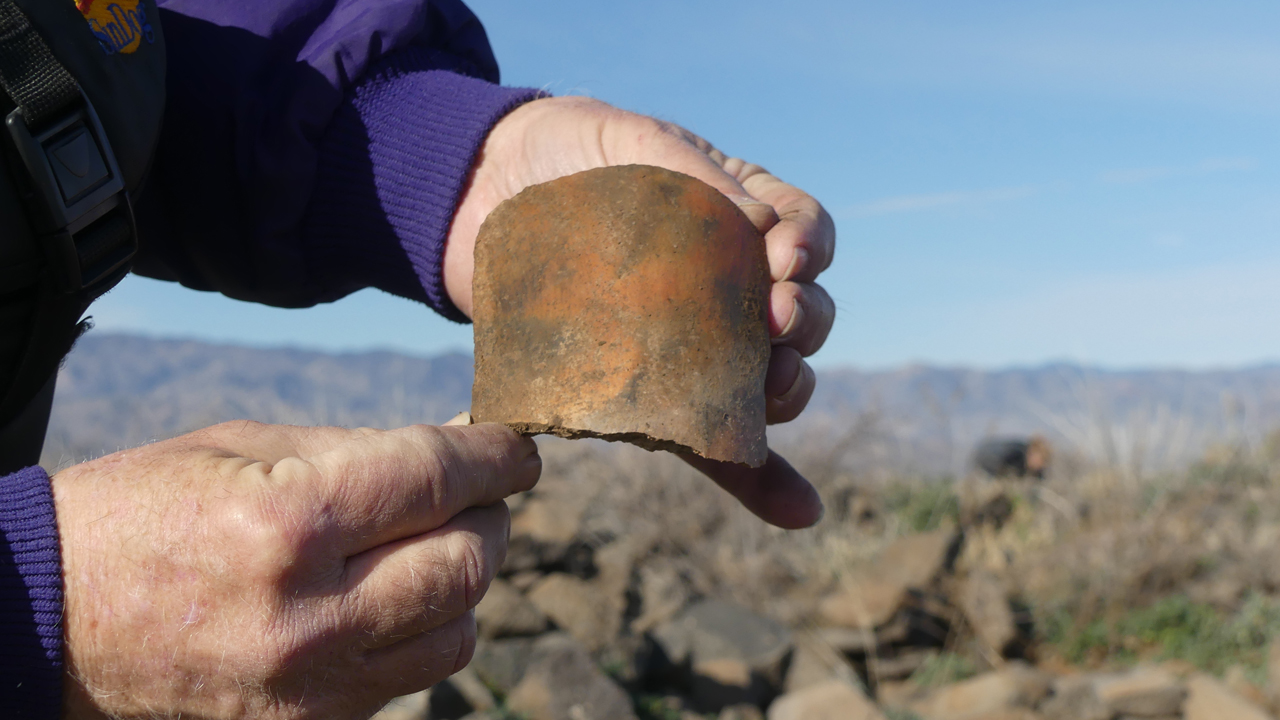
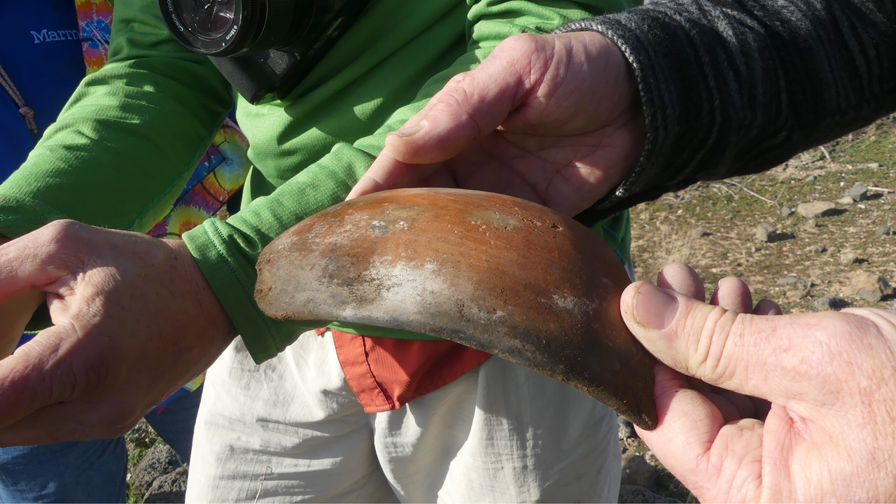
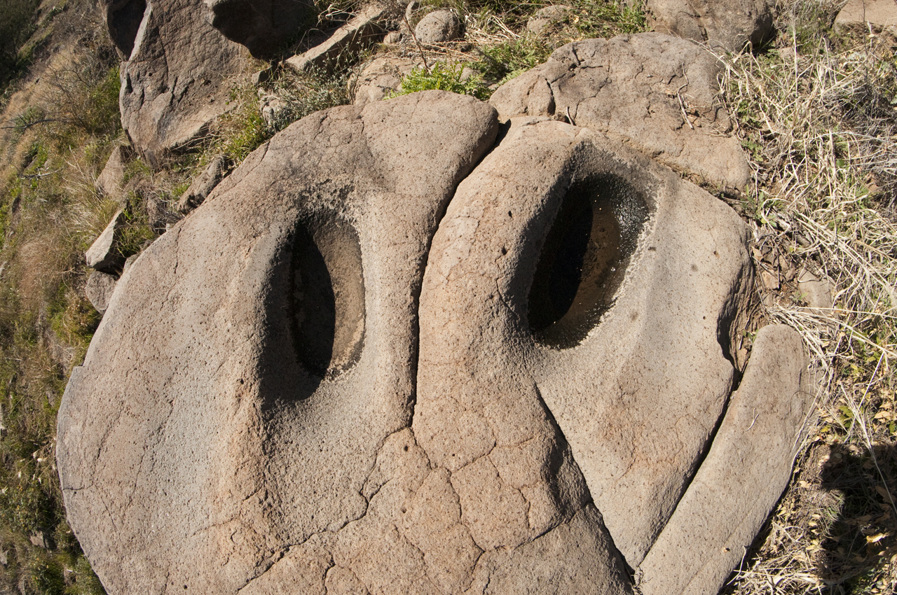
The Hohokam moved up the tributary canyons of the Agua Fria River and onto the mesa top about 1000 AD, drawn by rich volcanic soils and natural rock tanks that could hold up to a year's worth of water. By the mid 1300s the mesa top population was concentrated in seven communities, each made up of one or more large (30-50+ room) structures with a scattering of smaller buildings. Five of the seven pueblos were located at the edge of the mesa, overlooking steep side canyons of the Agua Fria River. During the late 13th century, a network of fortifications was constructed along the southern and western edges of the mesa, and the local population was greatly augmented by the arrival of some groups who had abandoned the Prescott Highlands in the late 1200s. However, by the late 14th century, the mesa top communities were abandoned, and they remained largely unoccupied except for itinerant Tonto, Apache and Yavapai Indians and Basque sheep herders.
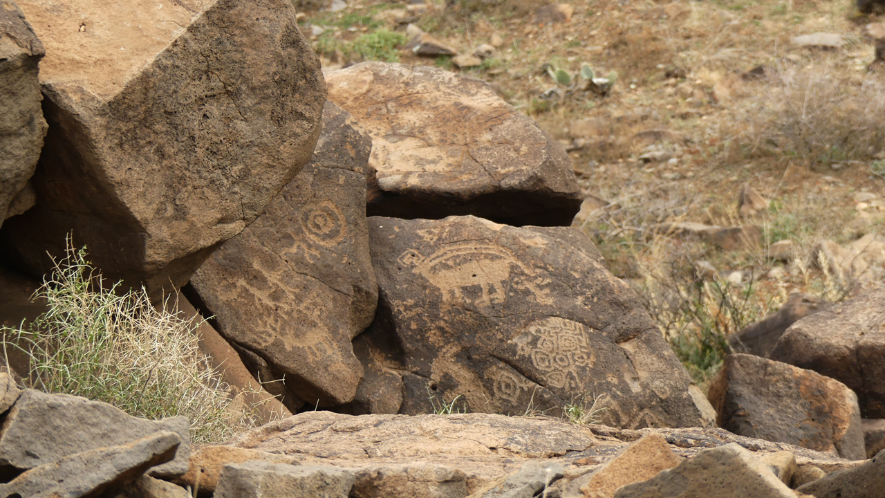
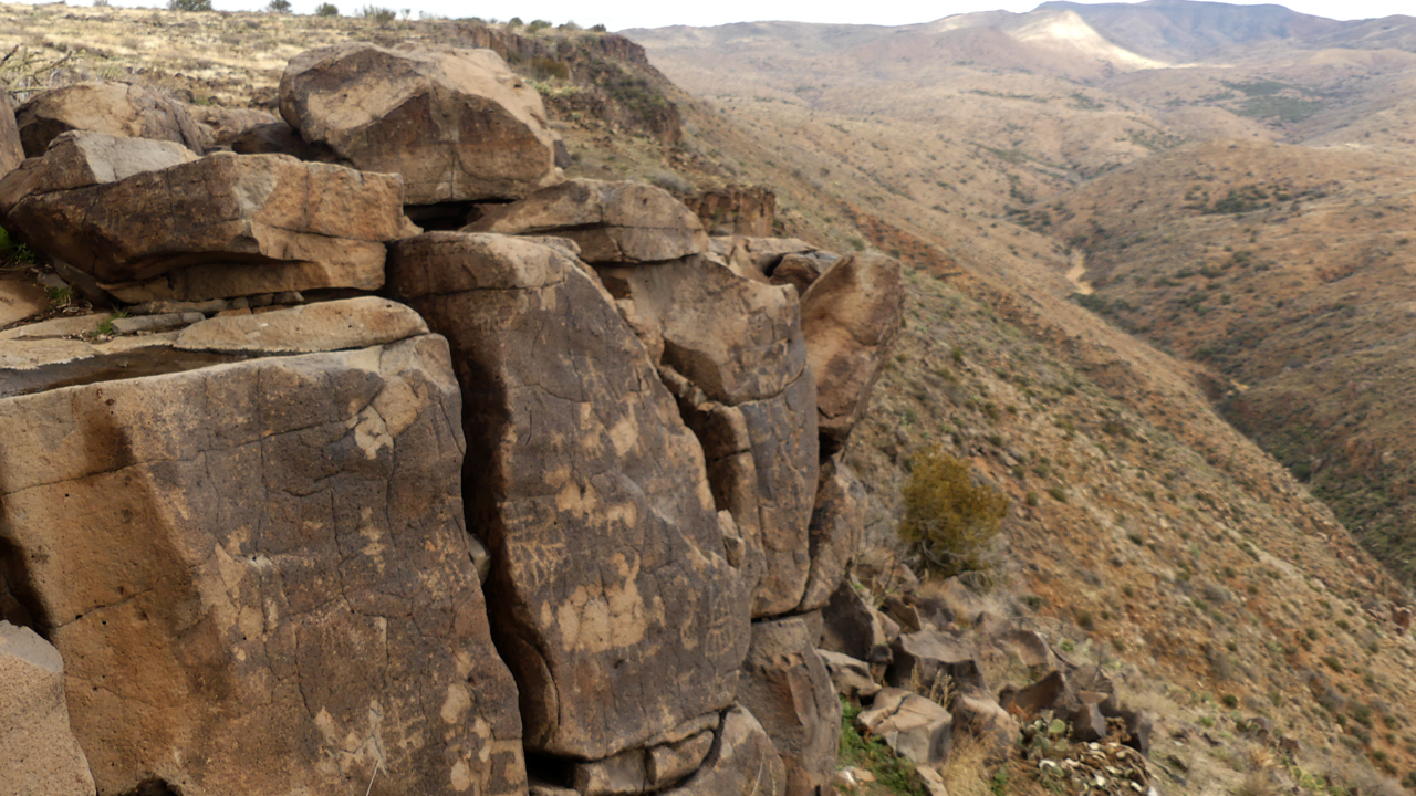
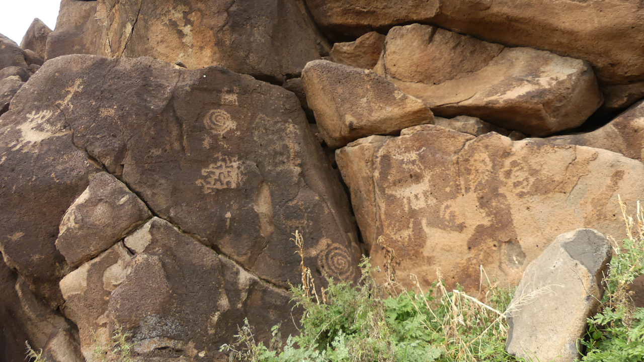
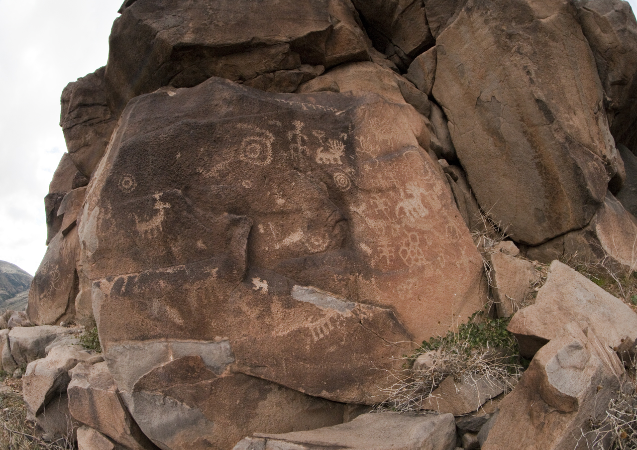
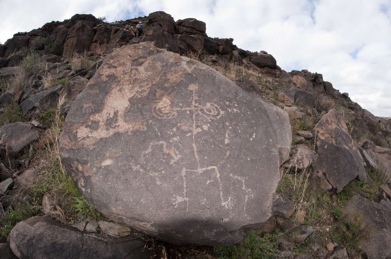
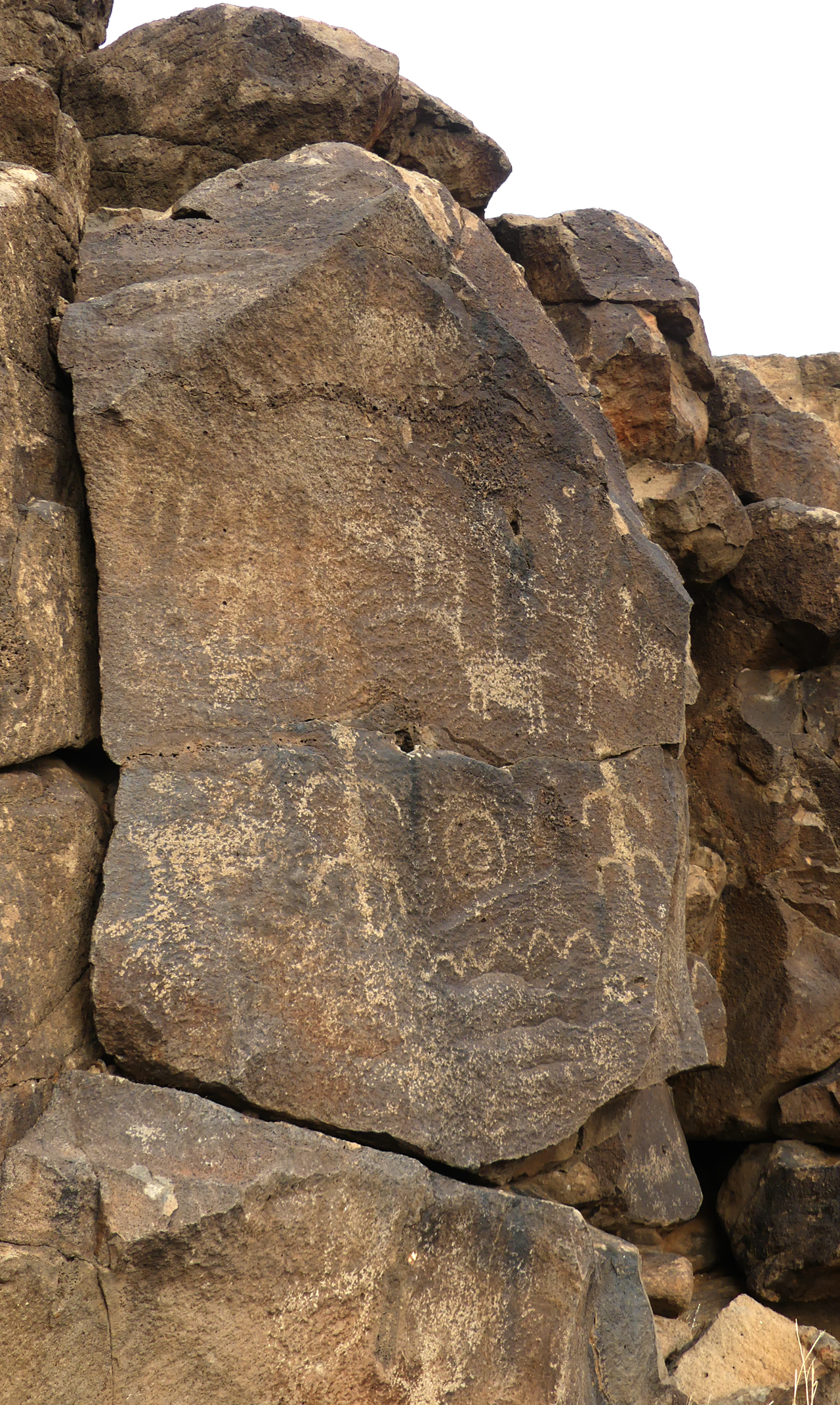
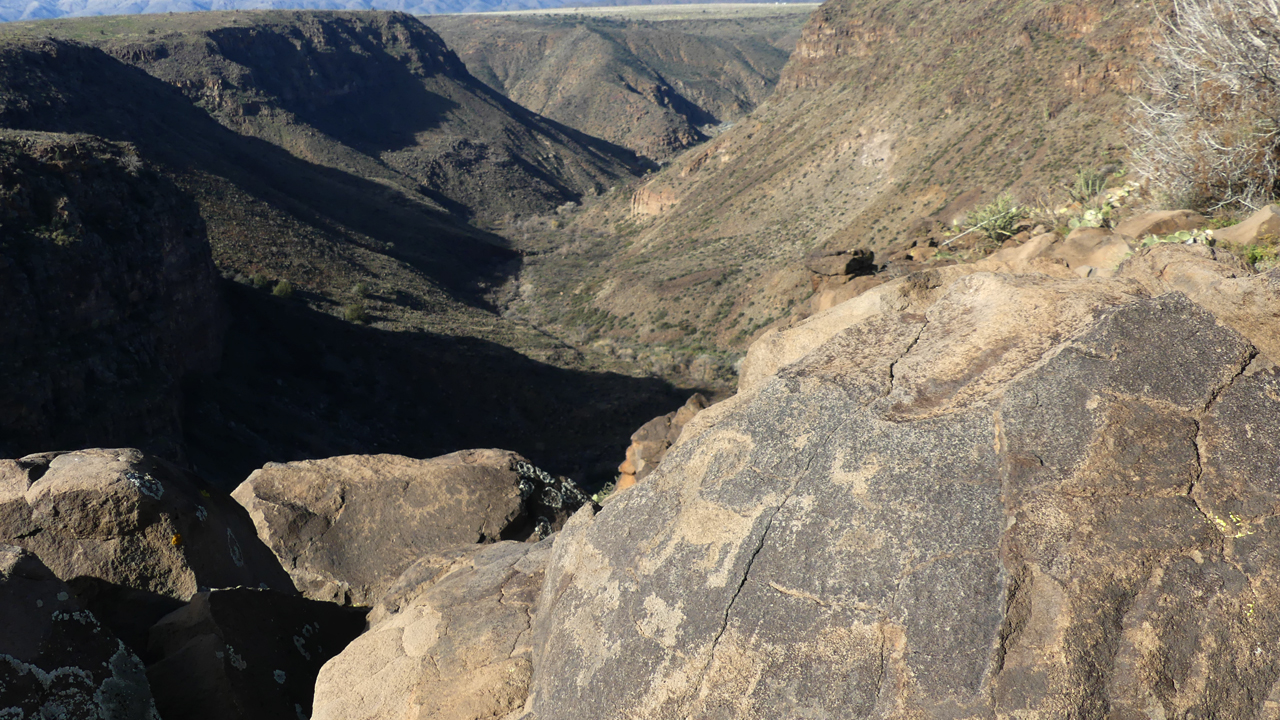
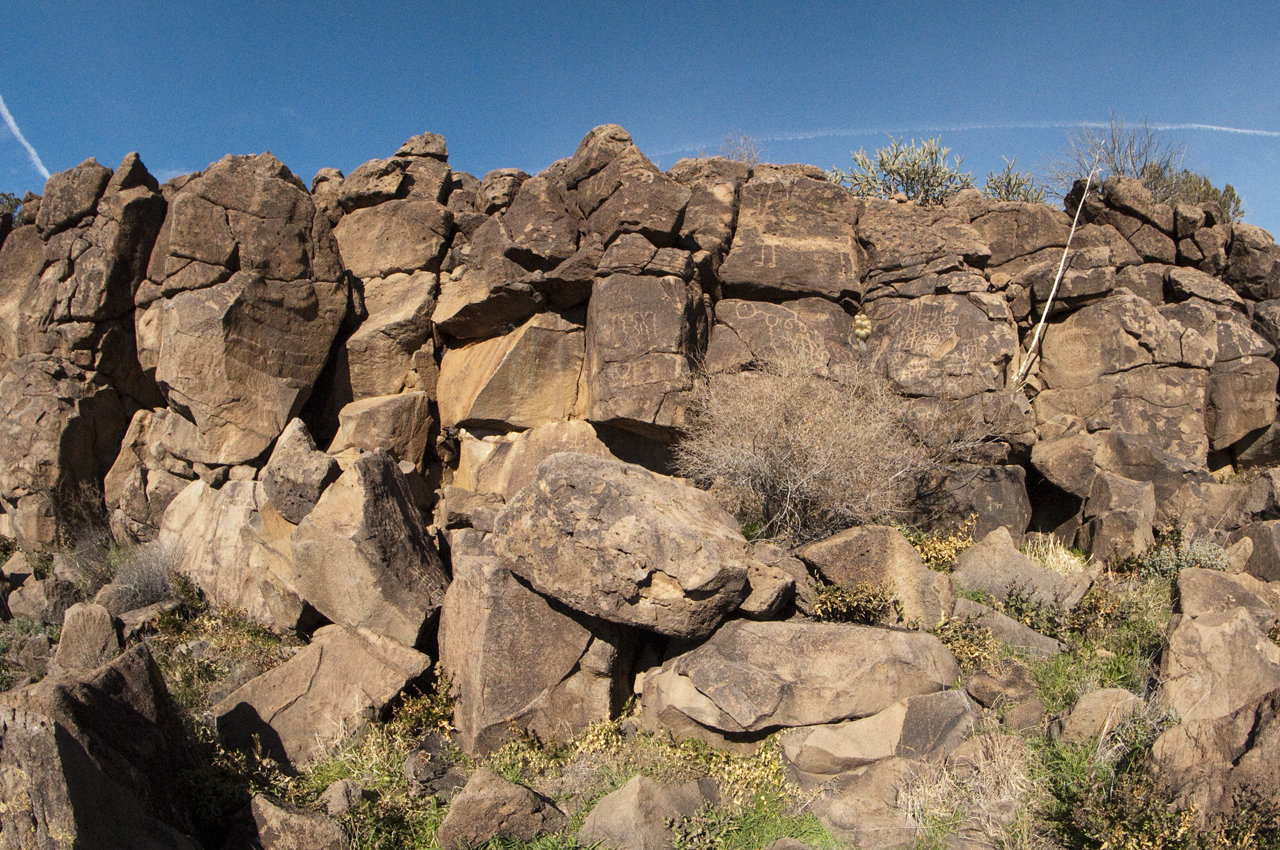
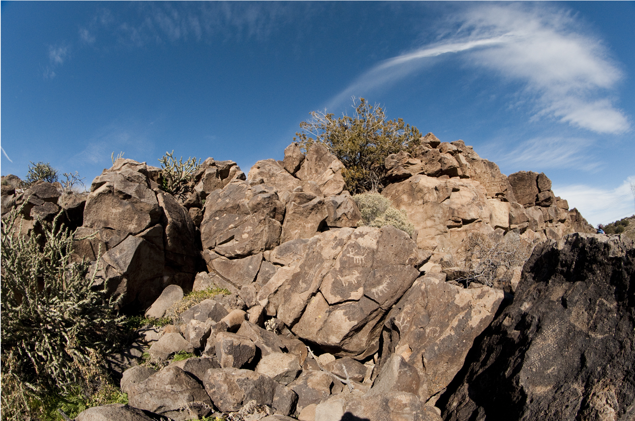
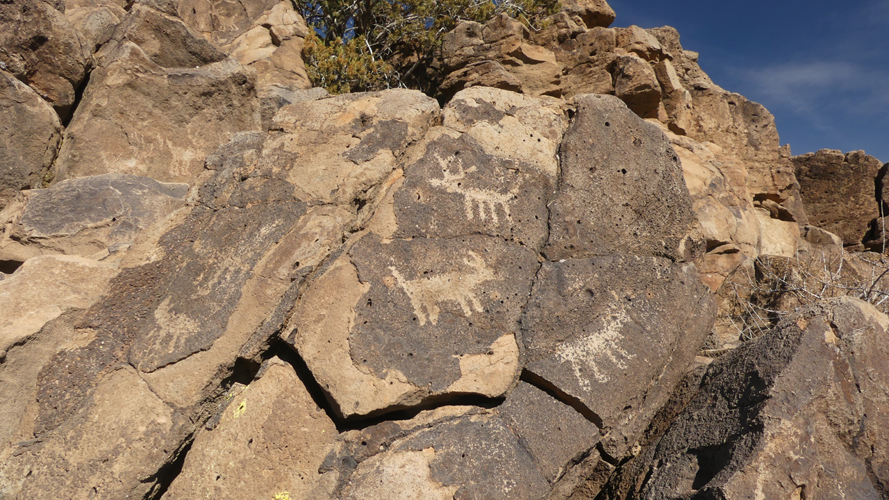
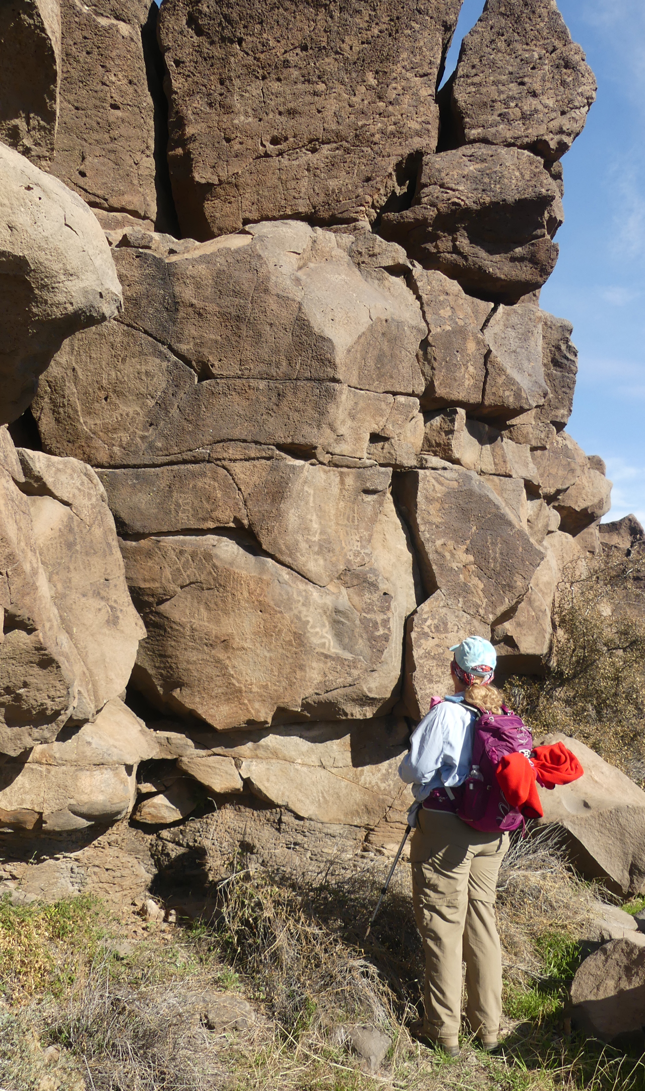
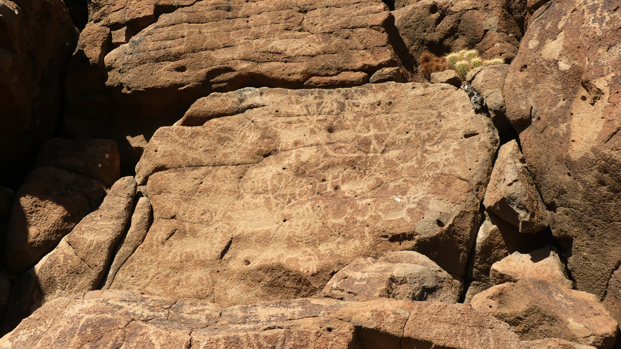
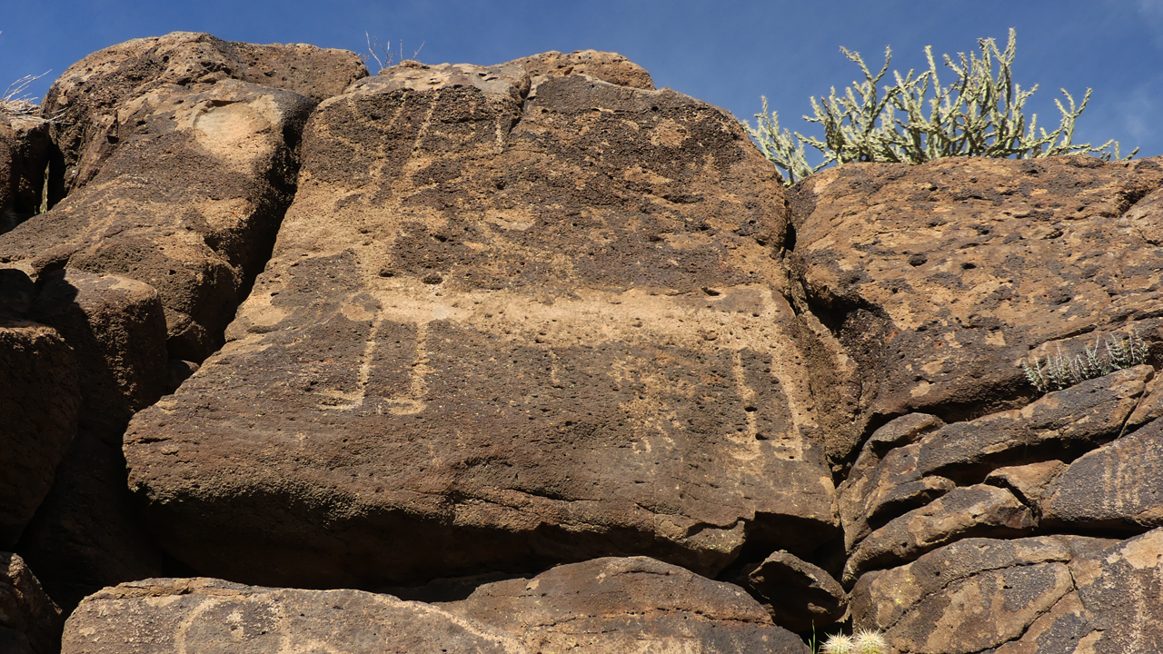
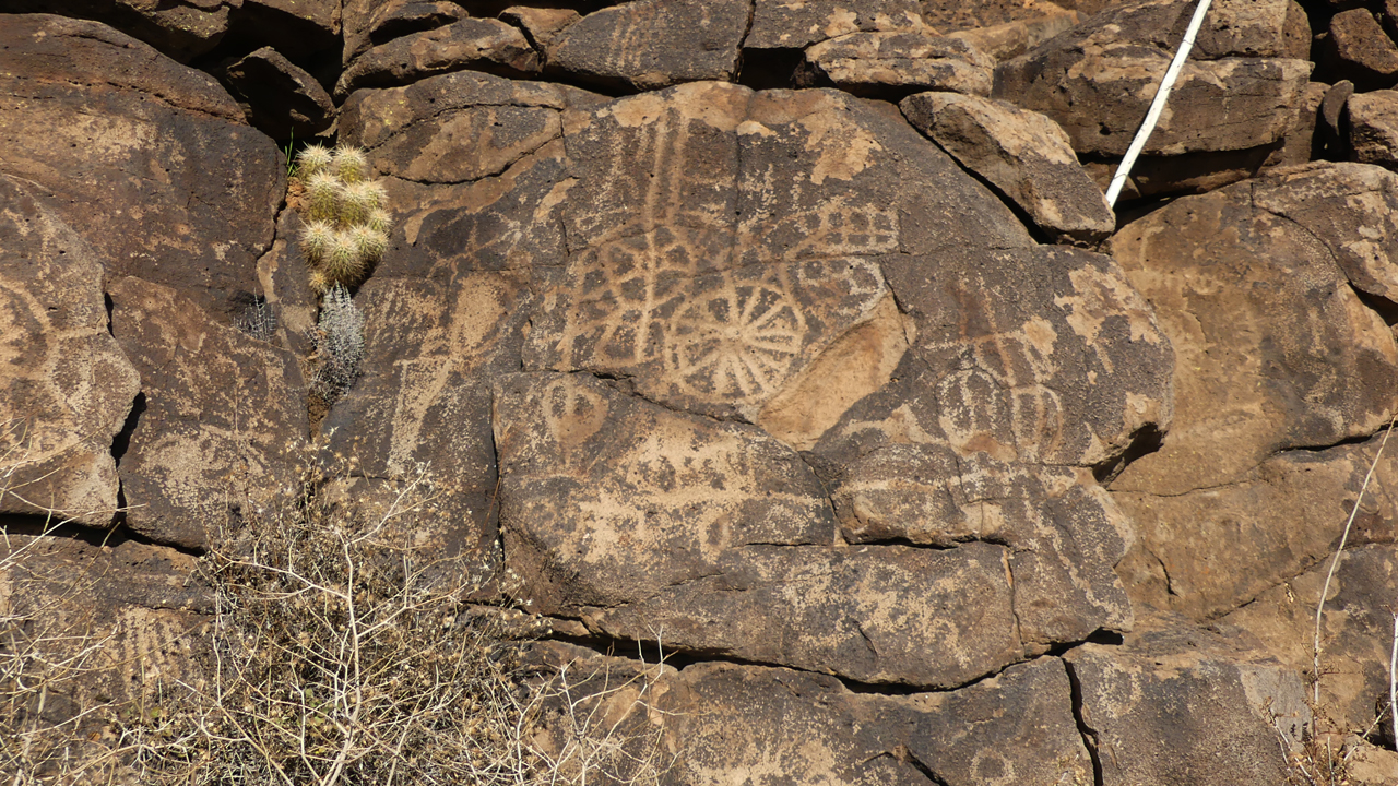
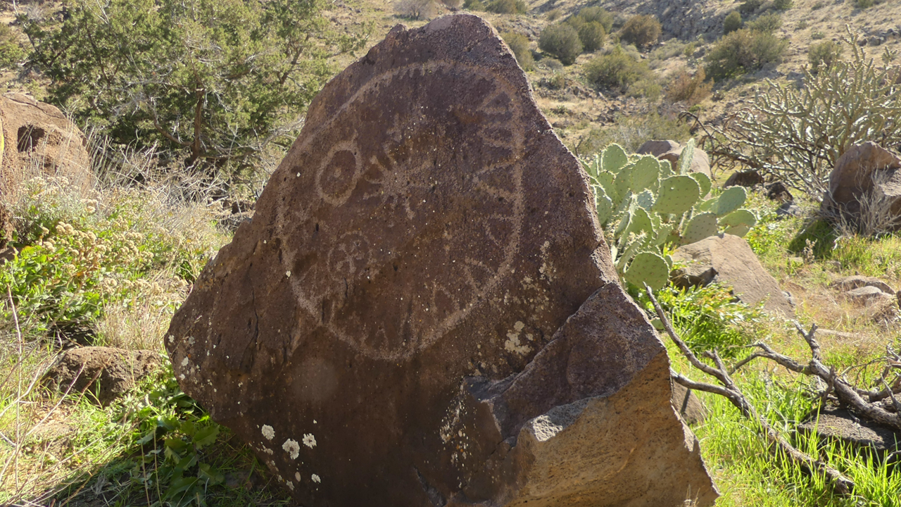
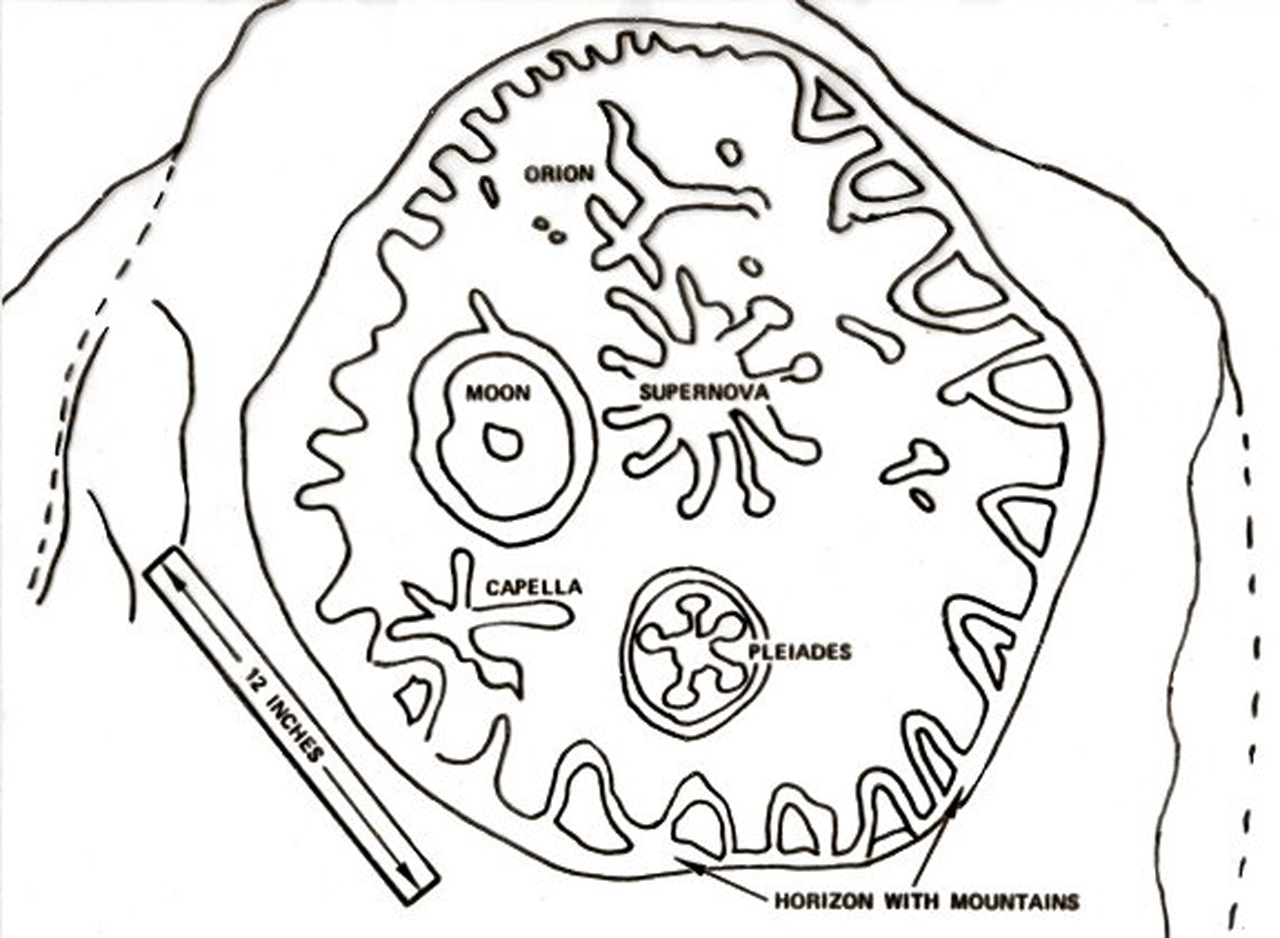
We became aware of this area in 2011, when we stumbled upon the impressive petroglyphs at V-Bar-V Ranch on a trip to Wet Beaver Creek. The caretaker told us that somewhere to the south in Agua Fria National Monument was a petroglyph depicting the Supernova of 1054, which was was about four times brighter than Venus and visible in daylight for 23 days, and for 653 days to the naked eye in the night sky. By piecing together various reports, we eventually zeroed in a several possible locations. We visited Agua Fria in November, 2012, and, after a day-and-a-half of bushwhacking, we made our way to an impressive wall of petroglyphs including at least one that appears to represent the Supernova of 1054.
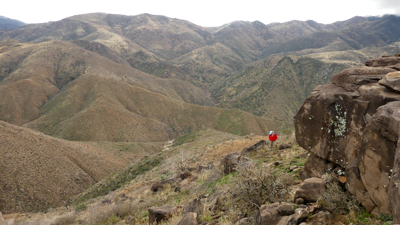
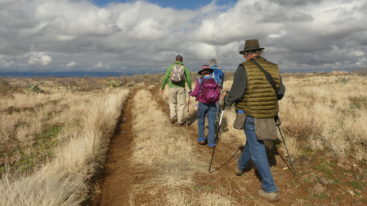
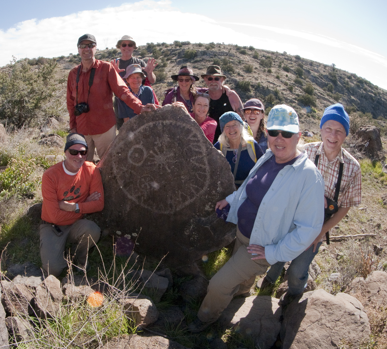
We returned in January, 2019, hoping to revisit that area and also explore the sites of some of the major pueblos. We were startled to see how badly the roads had deteriorated since our first visit seven years ago. Our GPS track from 2012 was useless, since two of the roads are now closed. The last five miles were as harrowing as a basically flat dirt road can be, with tire-swallowing ruts and bony boulders. Miraculously, we all managed to find each other on the mesa, thanks in no small part to a solid cell phone signal and FRS radios.
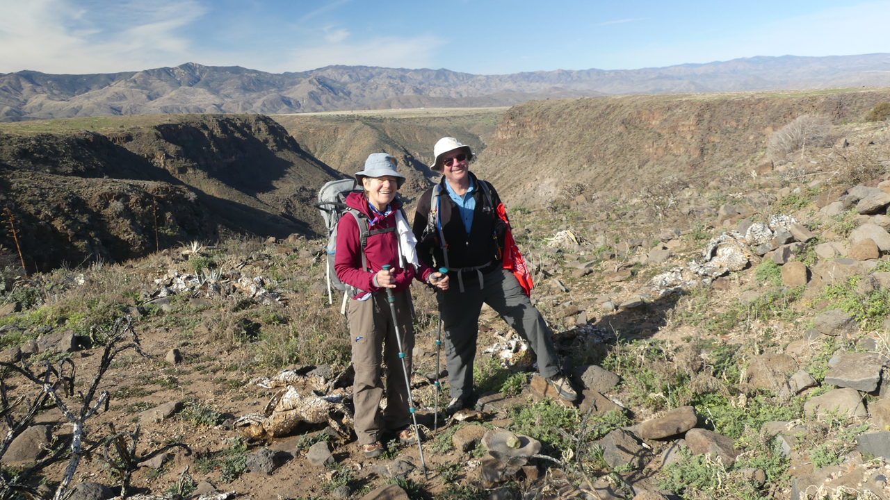
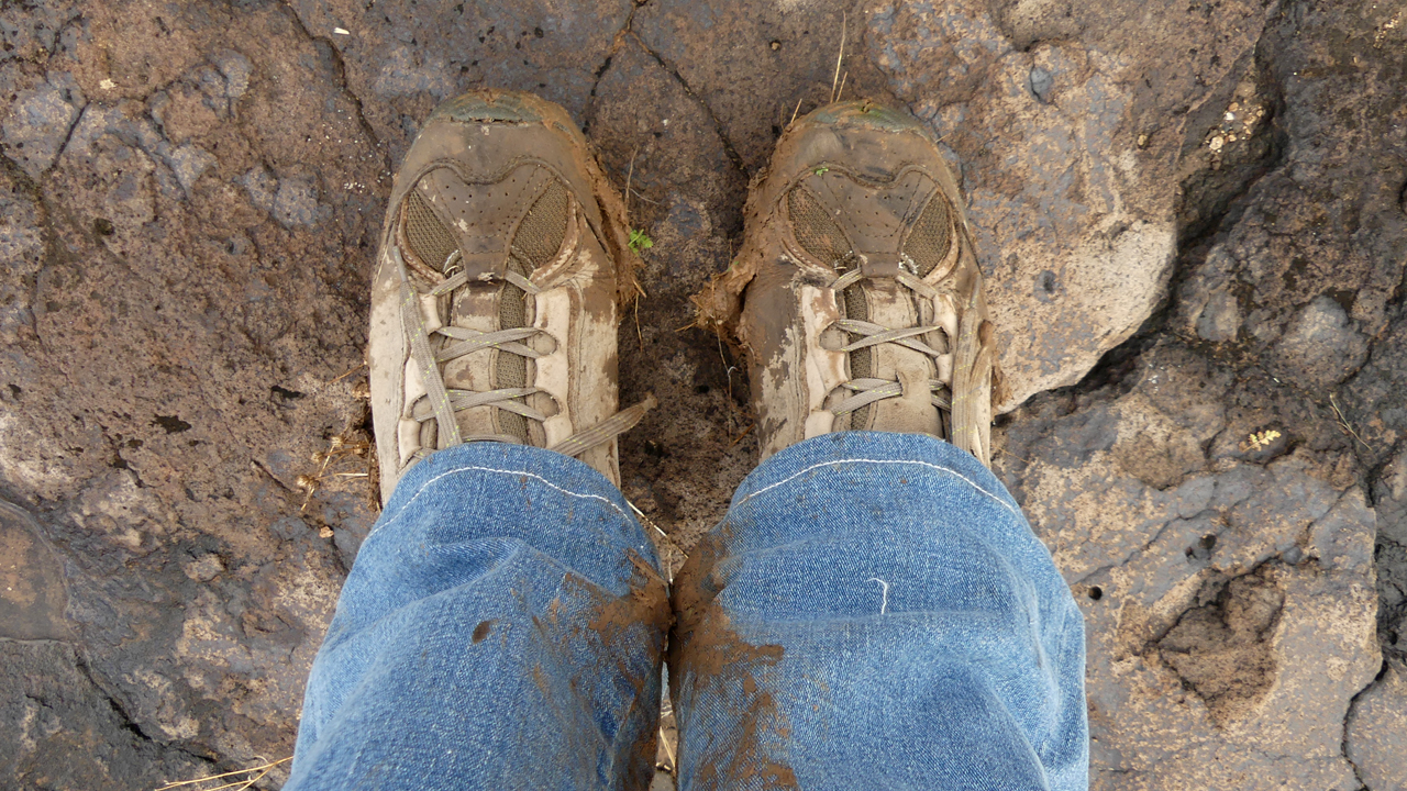
With possible rain showers in the forecast, we decided to move the camp to another location, past the spot where the road turned to crap. It was a wise choice, because it rained on and off all night long, and the next morning even the relatively good roads were a greasy mess. Under brooding skies, we headed to the next major community, one of the largest in the monument.